Soho Square is a garden square in Soho, London, hosting since 1954 a de facto public park let by the Soho Square Garden Committee to Westminster City Council. It was originally called King Square after Charles II, and a much weathered statue of the monarch has stood in the square, with an extended interruption, since 1661, one year after the restoration of the monarchy.

Belgrave Square is a large 19th-century garden square in London. It is the centrepiece of Belgravia, and its architecture resembles the original scheme of property contractor Thomas Cubitt who engaged George Basevi for all of the terraces for the 2nd Earl Grosvenor, later the 1st Marquess of Westminster, in the 1820s. Most of the houses were occupied by 1840. The square takes its name from one of the Duke of Westminster's subsidiary titles, Viscount Belgrave. The village and former manor house of Belgrave, Cheshire, were among the rural landholdings associated with the main home and gardens of the senior branch of the family, Eaton Hall. Today, many embassies occupy buildings on all four sides.

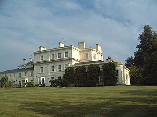
Brantridge Park, Balcombe, West Sussex, England is a 19th-century country house, formerly one of the lesser royal residences. It is a Grade II listed building.

Hay's Galleria is a mixed use building in the London Borough of Southwark situated on the south bank of the River Thames featuring offices, restaurants, shops, and flats. Originally a warehouse and associated wharf for the port of London, it was redeveloped in the 1980s. It is a Grade II listed structure.

Crawley railway station is a railway station serving the town of Crawley in West Sussex, England. It is 30 miles 49 chains (49.3 km) down the line from London Bridge, measured via Redhill. It is operated by Southern. The station is the last stop on the Arun Valley Line before it joins the Brighton Main Line.

Hans Place is a garden square in the Knightsbridge district of the Royal Borough of Kensington and Chelsea, London, immediately south of Harrods in SW1. It is named after Sir Hans Sloane, 1st Baronet, PRS, physician and collector, notable for his bequest, which became the foundation of the British Museum.

The George and Vulture is a restaurant in London. There has been an inn on the site, which is off Lombard Street in the historic City of London district, since 1142. It was said to be a meeting place of the notorious Hellfire Club and has long been a revered City chop house.

Lichfield Court, on Sheen Road in Richmond, London, consists of two Grade II listed purpose-built blocks of flats. Designed by Bertram Carter and built in fine Streamline Moderne style, it was completed in 1935.

Dartmouth House is a Georgian house in Mayfair, central London, England. It now serves as the headquarters of the English-Speaking Union (ESU), an educational charity. It is located at 37 Charles Street, southwest of Berkeley Square. Over 40,000 people use the building each year.

Flemings Mayfair is a luxury hotel located in the Mayfair area of London, England. It is home to Manetta's Bar, the original hangouts in the 1930s for famous artists and literati of the day; and Ormer Mayfair, a fine-dining restaurant under the direction of Sofian Msetfi. Ormer Mayfair was awarded its first Michelin star in 2024, four AA Rosettes, and is consistently voted one of the top restaurant for fine-dining in London.

The Embassy of Spain in London is the diplomatic mission of Spain in the United Kingdom. Formerly known as Downshire House, the embassy is located at 24 Belgrave Square in the Belgravia area of London. Spain also maintains a Consulate General at 20 Draycott Place in Chelsea, a Defence Office at 3 Hans Crescent in Knightsbridge, an Education, Employment & Social Affairs Office at 20 Peel Street in Holland Park, and an Economic & Commercial Section at 66 Chiltern Street in Marylebone.

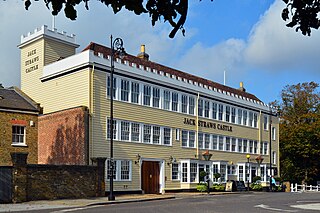
Jack Straw's Castle is a Grade II listed building and former public house on North End Way, Hampstead, north-west London, England close to the junction with Heath Street and Spaniards Road.

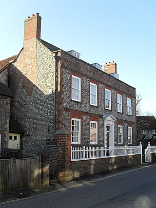
Southdown House is a Grade II* listed building in Patcham, Brighton and Hove, England. It is a Georgian house made out of brick and flint, and is now situated at 51 Old London Road.

Arnos Grove, originally known as Arnolds, is a grade II* listed house in Cannon Hill, Southgate, London.

Essex Street is a street in the City of Westminster that runs from Milford Lane in the south to Strand in the north. It is joined by Little Essex Street on its western side and Devereux Court on the eastern side. It was laid out by Nicholas Barbon in around 1675 or 1680 and contains a number of listed buildings.

The Chequers was a public house which occupied a Grade II listed building in Potters Bar, England. Originally opening in the 1700s, the pub moved site across the road and opened in its current location in the 1840s. Although there is no consensus as to when the current building was originally constructed, it started as two separate houses which were joined together before the pub moved onto the site.

The Bell is a public house at 29 Bush Lane in the City, London, EC4.
Ayot Park is a grade II listed park and garden at Ayot St Lawrence in Hertfordshire, England. It contains the grade II* listed Ayot House along with an earlier manor house and a walled kitchen garden which are also listed.
Aston Webb House is a Grade II listed building of historical note located in London. It is the converted General Office of Boord & Son's Distillery, which was built between 1899 and 1901 and designed by Aston Webb, an English architect who designed the principal facade of Buckingham Palace and the main building of the Victoria and Albert Museum.

Lansdowne Studios was a music recording studio in Holland Park, London, England, which operated between 1958 and 2006.


