Background
Cartago was the first Spanish settlement in Costa Rica, founded in 1563 by Juan Vázquez de Coronado. It was the original capital of the country. In 1784 the Spanish government gave San José a tobacco factory and a monopoly over tobacco products. After this, San José became the commercial center of Costa Rica while Cartago retained the political power. By 1801 Costa Rica had a population of about 50,000, most of whom lived in the Central Valley. Costa Rica was isolated from the outside world, and it took a month for news to arrive of the Act of Independence of Central America proclaimed on the 15 September 1821 in Guatemala.
In May 1822 Agustín de Iturbide proclaimed himself Emperor of Mexico, with plans to extend his rule to all of Central America. The agrarian and aristocratic landowners of Cartago and Heredia wanted to maintain the privileges they had held under the former Spanish empire. They thought these would be protected under the new Mexican Empire. The liberal merchants of San José and Alajuela wanted to introduce a republican government. They preferred to remain independent of the empire.
The leaders of the four towns of the Central Valley met and agreed to remain neutral until the situation became clearer. Gregorio José Ramírez, who had represented the province of Alajuela in the council that decided on the independence of Costa Rica, was hostile to joining the empire. He began to make military preparations. By March 1823 the Superior Governing Council of Costa Rica had still not declared allegiance to the emperor, and the conservatives decided to stage a coup.
Battle of Ochomogo
Ramírez sent an ultimatum to the Imperialists on 4 April 1823. The two armies met in the morning of the 5 April at Ochomogo. The Ochomogo Pass is a valley near Cartago that leads through the mountains between San José and Cartago, connecting the Pacific and Atlantic watersheds of the Central Valley. The militia of Cartago under Sergeant Major Salvador de Oreamuno took a stand in the plain. Joaquín de Oreamuno y Muñoz de la Trinidad remained at home in Cartago for the first few hours. The Republicans were under overall command of Ramírez, and the future head of state António Pinto Soares commanded their artillery.
There was an attempt to negotiate, but that quickly broke down and both sides began firing their muskets from the cover of the large volcanic rocks that litter the area. The combat was prolonged, and the Cartago forces made several musket and infantry charges, but Pinto Soares' artillery checked them and some of the Cartago officers began to defect, including their commander Salvador de Oreamuno. Sergeant Félix Oreamuno y Jiménez took command and asked for a ceasefire, but Ramírez insisted on unconditional surrender and continued to fight until the forces of Cartago were completely defeated.
He then entered Cartago and disarmed the inhabitants. About twenty people died in the one-day battle.
Aftermath
While the Ochomogo battle was in progress there was a separate struggle in which the militia of Heredia forced Alajuela to capitulate. Ramírez led his forces from Ochomogo to liberate Alajuela and restore order in the Central Valley. For ten days Ramírez was de facto ruler of the country while he restored order.
He published only two decrees, one to make San José the capital and the other to convene a democratically elected governing council. After several weeks news arrived that the First Mexican Empire had ceased to exist on 19 March 1823, so the Battle of Ochomogo had been pointless.
In 1825 Juan Mora Fernández was elected the first Costa Rican head of state. Rivalry between the four towns continued, and an 1834 law said the capital was to rotate among them.
A year later after the Guerra de la Liga the position of San Jose was confirmed, and this was made official in 1837 by head of state Braulio Carrillo Colina. [6]
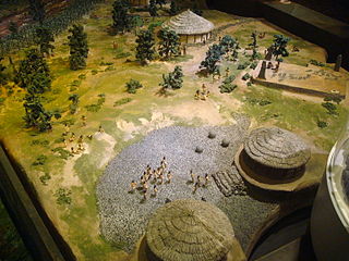
The first indigenous peoples of Costa Rica were hunters and gatherers, and when the Spanish conquerors arrived, Costa Rica was divided in two distinct cultural areas due to its geographical location in the Intermediate Area, between Mesoamerican and the Andean cultures, with influences of both cultures.
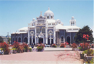
Cartago is the head city of Cartago canton of the Cartago Province, and is composed of the Oriental and Occidental districts as stated in the administrative divisions of Costa Rica. It was the capital of Costa Rica from 1574 to 1824.

The official coat of arms of the Republic of Costa Rica was designed in 1848, with modifications in 1906, 1964, and 1998. The latest change was the addition of smoke to distinguish the three volcanoes.

Alajuela is a province of Costa Rica. It is located in the north-central part of the country, bordering Nicaragua to the north. It also borders the provinces of Heredia to the east, San José to the south, Puntarenas to the southwest and Guanacaste to the west. As of 2011, the province had a population of 885,571. Alajuela is composed of 16 cantons, which are divided into 111 districts. It covers an area of 9,757.53 square kilometers.

The Central Valley is a plateau and a geographic region of central Costa Rica. The land in the valley is a relative plain, despite being surrounded by several mountains and volcanoes, the latter part of the Central Range. The region houses almost three quarters of Costa Ricans, and includes the capital and most populous city, San José. The valley is shared among the provinces of Alajuela, Heredia, San José and Cartago. The region occupies an area of 11,366 km2, more than a fifth of the country, and is drained by the Tárcoles River on the west side and by the Reventazón River on the east side.

Rail transport in Costa Rica is primarily under the stewardship of Incofer, an autonomous institution of the state. Incofer owns the national railway infrastructure and operates virtually all freight and passenger services, which consist primarily of commuter trains through the highly populated Central Valley. The whole Incofer network is 1,067 mm narrow gauge, although there are several small tourist railways of other gauges.

The Greater Metropolitan Area of Costa Rica is the largest urban agglomeration in the country, comprising areas of high population density surrounding the capital, San José, which geographically corresponds to the Central Valley and extended to include the Guarco Valley, where some of the cantons of the Cartago province are located.
Miguel de Bonilla y Laya-Bolívar (1763–1826) was a Costa Rican Roman Catholic priest and politician. He was one of the signatories of the Costa Rican Declaration of Independence.
San Rafael District may refer to:

Joaquín Mariano de Oreamuno was a Costa Rican who led a coup in 1823 that attempted to make Costa Rica part of the First Mexican Empire. A few days later the imperialist forces were defeated by republicans under Gregorio José Ramírez in the Battle of Ochomogo.
Head of State elections were held in Costa Rica in 1844. They were the first in which direct suffrage was used to elect the Head of State, in accordance with the provisions of the Constitution of 9 April 1844. A method that was abolished by the next election returning to indirect suffrage until 1913.
Liberalism in Costa Rica is a political philosophy with a long and complex history. Liberals were the hegemonic political group for most of Costa Rica's history especially during the periods of the Free State and the First Republic, however, as the liberal model exhausted itself and new more left-wing reformist movements clashed during the Costa Rican Civil War liberalism was relegated to a secondary role after the Second Costa Rican Republic with the development of Costa Rica's Welfare State and its two-party system controlled by social-democratic and Christian democratic parties.
The League War was the second civil war of Costa Rica, as a member state of the Federal Republic of Central America. It passed between September and October 1835 in the Central Valley of Costa Rica. Its immediate trigger was the repeal of the "Ambulance Law", the law that established the rotation of the country's capital among the four constituent cities. The most important consequence was the triumph of the city of San José over the cities of Alajuela, Heredia and Cartago, which allowed its consolidation as the capital of Costa Rica.
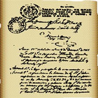
The Pact of Concord was the provisional Constitution of Costa Rica between 1821 and 1823, officially named the Interim Fundamental Social Pact of the Province of Costa Rica.
The Second Political Statute of the Province of Costa Rica was issued on May 16, 1823 by the interim government and the Second Provincial Congress of the Province of Costa Rica. It was issued just after the Ochomogo War when the monarchist camp settled in Cartago and Heredia and headed by Joaquín de Oreamuno as its commander of arms, was defeated by the Republican side commanded by Gregorio José Ramírez and gravitated around San José and Alajuela.

Interurbano Line, is a commuter railway line in Costa Rica, operated by the national public railway operator Incofer. The line connects the provinces of Alajuela, Heredia, San José and Cartago.

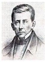
Gregorio José Ramírez y Castro was a Costa Rican politician, merchant and marine who was most notable for being the 2nd General Commander of Arms of Costa Rica from April 5 to April 16, 1823.

Ochomogo is a location in the province of Cartago, Costa Rica. It is in a mountain pass between the cities of San José and Cartago. It was the site of the Battle of Ochomogo between those who wanted Costa Rica to join the newly formed First Mexican Empire and those who preferred independence.

From January 1822 to July 1823, the Captaincy General of Guatemala, a former Spanish colony, was controlled by the First Mexican Empire, and briefly, the Supreme Executive Power—the provisional government that succeeded Mexican imperial rule. The captaincy general consisted of the provinces of Chiapas, Costa Rica, El Salvador, Guatemala, Honduras, and Nicaragua—the six southernmost provinces of the Mexican Empire. The incorporation of Central America brought Mexico to the height of its territorial extent.