Odiliapeel

Last updated
Odiliapeel
Zicht op de zuidwestgevel met de ingangspartij en de terzijde staande kerktoren - Odiliapeel - 20389027 - RCE.jpg
Kruisvindingskerk
2010-NL-P10-Noord-Brabant-positiekaart-gemnamen.jpg
Red pog.svg
Odiliapeel
Location in the province of North Brabant in the Netherlands
Netherlands location map.svg
Red pog.svg
Odiliapeel
Odiliapeel (Netherlands)
Coordinates: 51°38′40″N5°42′20″E / 51.64444°N 5.70556°E / 51.64444; 5.70556
Country Netherlands
Province North Brabant
Municipality Maashorst
Established1921
Area
[1]
  Total14.38 km2 (5.55 sq mi)
Elevation
[2]
22 m (72 ft)
Population
 (2021) [1]
  Total2,045
  Density140/km2 (370/sq mi)
Time zone UTC+1 (CET)
  Summer (DST) UTC+2 (CEST)
Postal code
5409 [1]
Dialing code 0413

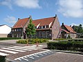
Odiliapeel (Brabantian: De Piejel) is a village in the Netherlands. It is situated in the northeast corner of the province of North Brabant, south of Volkel Air Base. It used to be part of the municipality of Uden, but merged into the municipality of Maashorst in 2022.

Contents

Odiliapeel was founded in 1921 as a heath excavation settlement. On 5 May 1930, it was officially named Odiliapeel, and is a combination of Odile of Alsace and the region Peel. [3] The initial excavation of the area started in 1908, [4] however a government subsidy plan led to the systematic exploration of the area. The village was designed by Heidemij (nowadays: Arcadis). [5]

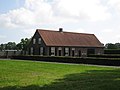
The Catholic Kruisvindingskerk was built between 1958 and 1959 as an aisleless church and a massive tower attached to the side of the church. [4]

Related Research Articles

<span class="mw-page-title-main">Boekel</span> Municipality in North Brabant, Netherlands

Boekel is a municipality and a town in the southern Netherlands.

<span class="mw-page-title-main">Uden</span> Town and former municipality in North Brabant, Netherlands

Uden is a town and former municipality in the province of North Brabant, Netherlands. Since 2022 it has been part of the new municipality of Maashorst.

<span class="mw-page-title-main">Erp, Netherlands</span> Village in North Brabant, Netherlands

Erp is a village in the southern Netherlands, in the province of North Brabant between 's-Hertogenbosch and Eindhoven. Prior to 1994, Erp was a municipality consisting of the town of Erp and the villages of Boerdonk and Keldonk. In that year, the municipality was merged with the municipality of Veghel to form one municipality under the latter name. The area of the former municipality of Erp has a population of 6,663, while Veghel has a population of 37,655.

<span class="mw-page-title-main">Berkhout</span> Village in North Holland, Netherlands

Berkhout is a village in the northwest Netherlands. It is in the municipality of Koggenland, North Holland, about 5 km (3 mi) west of Hoorn.

<span class="mw-page-title-main">Midwoud</span> Village in North Holland, Netherlands

Midwoud is a village in the Dutch province of North Holland. It is a part of the municipality of Medemblik, and lies about 7 km north of Hoorn.

<span class="mw-page-title-main">Nibbixwoud</span> Village in North Holland, Netherlands

Nibbixwoud is a village in the Dutch province of North Holland. It is a part of the municipality of Medemblik, and lies about 5 km north of Hoorn.

<span class="mw-page-title-main">Wapserveen</span> Village in Drenthe, Netherlands

Wapserveen is a village in the Dutch province of Drenthe. It is a part of the municipality of Westerveld, and lies about 21 km northwest of Hoogeveen.

<span class="mw-page-title-main">Valthermond</span> Village in Drenthe, Netherlands

Valthermond is a village in the Dutch province of Drenthe. It is a part of the municipality of Borger-Odoorn, and lies about 18 km north of Emmen.

<span class="mw-page-title-main">Vasse, Netherlands</span> Village in Overijssel, Netherlands

Vasse is a village in the Dutch province of Overijssel. It is a part of the municipality of Tubbergen, and lies about 15 km northeast of Almelo.

<span class="mw-page-title-main">Oude Niedorp</span> Village in North Holland, Netherlands

Oude Niedorp is a village in the Dutch province of North Holland. It is a part of the municipality of Hollands Kroon, and lies about 6 kilometres (3.7 mi) northeast of Heerhugowaard.

<span class="mw-page-title-main">Zijdewind</span> Village in North Holland, Netherlands

Zijdewind is a village in the Dutch province of North Holland. It is a part of the municipality of Hollands Kroon, and lies about 8 km north of Heerhugowaard.

<span class="mw-page-title-main">Zeeland, North Brabant</span> Village in North Brabant, Netherlands

Zeeland is a village in the Dutch province of North Brabant. It is located in the former municipality of Landerd, about 5 km northeast of Uden.

<span class="mw-page-title-main">Hem, Netherlands</span> Village in North Holland, Netherlands

Hem is a village in the municipality Drechterland, located in the north west of the Netherlands, in the province of North Holland and the region of West-Frisia.

<span class="mw-page-title-main">Oosterzee</span> Village in Friesland, Netherlands

Oosterzee is a village in De Fryske Marren municipality in the province of Friesland, the Netherlands. It had a population of around 915 including surrounding area in 2017.

<span class="mw-page-title-main">Hemrik</span> Village in Friesland, Netherlands

Hemrik is a village in the municipality of Opsterland in the east of Friesland, the Netherlands. It had a population of around 770 in January 2017.

<span class="mw-page-title-main">Cuijk railway station</span>

Cuijk is a railway station located in Cuijk, Netherlands. The station was opened on 1 June 1883 and is located on the Maaslijn (Nijmegen–Venlo). The train services are operated by Arriva.

<span class="mw-page-title-main">Fransum</span> Hamlet in Groningen, Netherlands

Fransum is an old church hamlet in the municipality of Westerkwartier, Netherlands. The village in the north-east of the country contains an early 13th century Romanesque church, a farm and a house.

<span class="mw-page-title-main">Mariaheide</span> Village in North Brabant, Netherlands

Mariaheide is a village in the south of the Netherlands. It is situated in the municipality of Meierijstad, North Brabant.

<span class="mw-page-title-main">Maashorst</span> Municipality in North Brabant, Netherlands

Maashorst is a municipality in the south of the Netherlands, formed from the merger of Landerd and Uden. The municipality came into existence on 1 January 2022. The name Maashorst refers to the nature reserve of the same name, which lies between the various village centres. The eastern part belongs to the region of De Peel.

<span class="mw-page-title-main">Volkel</span> Settlement in the Netherlands

Volkel is a village in the Netherlands. It is situated in the north-east corner of the province of North Brabant, south-east of the town of Uden. On 1 January 2021, Volkel had 3,435 inhabitants. It used to be part of the municipality of Uden, and merged into the municipality of Maashorst in 2022.

References

  1. 1 2 3 "Kerncijfers wijken en buurten 2021". Central Bureau of Statistics. Retrieved 17 April 2022.
  2. "Postcodetool for 5409AA". Actueel Hoogtebestand Nederland (in Dutch). Het Waterschapshuis. Retrieved 17 April 2022.
  3. "Achterground". Odiliapeel (in Dutch). Retrieved 17 April 2022.
  4. 1 2 Chris Kolman & Ronald Stenvert (1997). Uden (in Dutch). Zwolle: Waanders. p. 313. ISBN   90 400 9945 6 . Retrieved 16 April 2022.
  5. "Odiliapeel". Plaatsengids (in Dutch). Retrieved 17 April 2022.