Volkel

Last updated
Volkel
Volkel, l'eglise St. Antoine, la tour.JPG
Church of St. Anthony
2010-NL-P10-Noord-Brabant-positiekaart-gemnamen.jpg
Red pog.svg
Volkel
Location in the province of North Brabant in the Netherlands
Netherlands location map.svg
Red pog.svg
Volkel
Volkel (Netherlands)
Coordinates: 51°38′40″N5°39′10″E / 51.64444°N 5.65278°E / 51.64444; 5.65278 Coordinates: 51°38′40″N5°39′10″E / 51.64444°N 5.65278°E / 51.64444; 5.65278
Country Netherlands
Province North Brabant
Municipality Maashorst
Area
[1]
  Total16.58 km2 (6.40 sq mi)
Elevation
[2]
19 m (62 ft)
Population
 (2021) [1]
  Total3,435
  Density210/km2 (540/sq mi)
Time zone UTC+1 (CET)
  Summer (DST) UTC+2 (CEST)
Postal code
5408 [1]
Dialing code 0413

Volkel (Brabantian: Vollekul) is a village in the Netherlands. It is situated in the north-east corner of the province of North Brabant, south-east of the town of Uden. On 1 January 2021, Volkel had 3,435 inhabitants. It used to be part of the municipality of Uden, and merged into the municipality of Maashorst in 2022. [3]

Contents

Volkel is known for Volkel Air Base and amusement park BillyBird Park Hemelrijk  [ nl ].

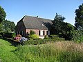
Volkel used to be a little village. In 1455, a chapel was built, but did not get a church until 1855. [4] In 1940, a military airport was built near Volkel by the Germans. During Operation Market Garden, the airport was bombed many times. The damage was repaired afterwards, and it first served as an Allied airport and later it became a Dutch military airport. [3]

Climate

Climate data for Volkel (1991−2020 normals, extremes 1951−present)
MonthJanFebMarAprMayJunJulAugSepOctNovDecYear
Record high °C (°F)15.0
(59.0)
19.8
(67.6)
25.4
(77.7)
30.5
(86.9)
33.5
(92.3)
36.3
(97.3)
40.1
(104.2)
36.6
(97.9)
33.5
(92.3)
27.5
(81.5)
20.0
(68.0)
16.0
(60.8)
40.1
(104.2)
Average high °C (°F)5.9
(42.6)
7.0
(44.6)
10.8
(51.4)
15.3
(59.5)
19.1
(66.4)
21.9
(71.4)
24.0
(75.2)
23.7
(74.7)
19.9
(67.8)
14.9
(58.8)
9.8
(49.6)
6.4
(43.5)
14.9
(58.8)
Daily mean °C (°F)3.2
(37.8)
3.6
(38.5)
6.3
(43.3)
9.9
(49.8)
13.6
(56.5)
16.5
(61.7)
18.5
(65.3)
18.0
(64.4)
14.7
(58.5)
10.7
(51.3)
6.7
(44.1)
3.9
(39.0)
10.5
(50.9)
Average low °C (°F)0.1
(32.2)
0.1
(32.2)
1.8
(35.2)
4.0
(39.2)
7.6
(45.7)
10.5
(50.9)
12.6
(54.7)
12.1
(53.8)
9.5
(49.1)
6.5
(43.7)
3.3
(37.9)
0.9
(33.6)
5.8
(42.4)
Record low °C (°F)−20.1
(−4.2)
−25.2
(−13.4)
−13.7
(7.3)
−7.4
(18.7)
−2.1
(28.2)
0.1
(32.2)
2.7
(36.9)
2.7
(36.9)
−0.9
(30.4)
−6.2
(20.8)
−10.0
(14.0)
−18.8
(−1.8)
−25.2
(−13.4)
Average precipitation mm (inches)64.0
(2.52)
58.2
(2.29)
52.7
(2.07)
40.4
(1.59)
57.6
(2.27)
64.1
(2.52)
70.6
(2.78)
73.4
(2.89)
59.4
(2.34)
61.8
(2.43)
64.8
(2.55)
72.2
(2.84)
739.2
(29.10)
Average relative humidity (%)87.584.779.573.372.974.275.477.682.286.189.989.881.1
Mean monthly sunshine hours 69.290.7143.3190.2217.4211.8215.4198.9158.2121.872.956.11,745.9
Percent possible sunshine 26.632.238.845.844.942.643.043.841.636.827.222.937.2
Source: Royal Netherlands Meteorological Institute [5] [6]

Related Research Articles

<span class="mw-page-title-main">Eindhoven</span> City and municipality in North Brabant, Netherlands

Eindhoven is a city and municipality in the Netherlands, located in the southern province of North Brabant of which it is its largest. With a population of 238,326 on 1 January 2022, it is the fifth-largest city of the Netherlands and the largest outside the Randstad conurbation.

<span class="mw-page-title-main">The Hague</span> City and municipality in South Holland, the Netherlands

The Hague is a city and municipality of the Netherlands, situated on the west coast facing the North Sea. The Hague is the country's administrative centre and its seat of government, and while the official capital of the Netherlands is Amsterdam, The Hague has been described as the country's de facto capital. The Hague is also the capital of the province of South Holland, and the city hosts both the International Court of Justice and the International Criminal Court.

<span class="mw-page-title-main">Groningen (province)</span> Northeasternmost province of the Netherlands

Groningen is the northeasternmost province of the Netherlands. It borders on Friesland to the west, Drenthe to the south, the German state of Lower Saxony to the east, and the Wadden Sea to the north. As of February 2020, Groningen had a population of 586,309 and a total area of 2,960 km2 (1,140 sq mi).

<span class="mw-page-title-main">Lelystad</span> City and municipality in Flevoland, Netherlands

Lelystad is a municipality and a city in the centre of the Netherlands, and it is the capital of the province of Flevoland. The city, built on reclaimed land, was founded in 1967 and was named after Cornelis Lely, who engineered the Afsluitdijk, making the reclamation possible. Lelystad is approximately 3 metres below sea level.

<span class="mw-page-title-main">Arnhem</span> City and municipality in Gelderland, Netherlands

Arnhem is a city and municipality situated in the eastern part of the Netherlands. It is the capital of the province of Gelderland, located on both banks of the rivers Nederrijn and Sint-Jansbeek, which was the source of the city's development. Arnhem had a population of 163,972 on 1 December 2021, which made it one of the larger cities of the Netherlands. The municipality is part of the Arnhem–Nijmegen metropolitan area, which has a combined number of 774,506 inhabitants on 31 January 2022.

<span class="mw-page-title-main">Drenthe</span> Province of the Netherlands

Drenthe is a province of the Netherlands located in the northeastern part of the country. It is bordered by Overijssel to the south, Friesland to the west, Groningen to the north, and the German state of Lower Saxony to the east. As of November 2019, Drenthe had a population of 493,449 and a total area of 2,680 km2 (1,030 sq mi).

<span class="mw-page-title-main">Ede, Netherlands</span> Town and Municipality in Gelderland, Netherlands

Ede is a municipality and a town in the centre of the Netherlands, in the province of Gelderland. As of 1 July 2021, Ede had 119,186 inhabitants.

<span class="mw-page-title-main">Boekel</span> Municipality in North Brabant, Netherlands

Boekel is a municipality and a town in the southern Netherlands.

<span class="mw-page-title-main">Uden</span> Town and former municipality in North Brabant, Netherlands

Uden is a town and former municipality in the province of North Brabant, Netherlands. Since 2022 it has been part of the new municipality of Maashorst.

<span class="mw-page-title-main">Eelde</span> Town in Drenthe, Netherlands

Eelde is a town in the Dutch province of Drenthe. It is a part of the municipality of Tynaarlo, and lies about 9 km south of Groningen. Groningen Airport Eelde is located near the village.

<span class="mw-page-title-main">Royal Netherlands Air Force</span> Air warfare branch of the Netherlands armed forces

The Royal Netherlands Air Force is the military aviation branch of the Netherlands Armed Forces. It was created in 1953; its ancestor, the Luchtvaartafdeling of the Dutch Army, was founded in 1913. The aerobatic display team of the Royal Netherlands Air Force, active from 1979 until 2019, was the Solo Display Team.

<span class="mw-page-title-main">Weeze</span> Municipality in North Rhine-Westphalia, Germany

Weeze is a municipality in the Lower Rhine (Niederrhein) region, in the northwestern part of North Rhine-Westphalia in the district of Kleve in the region of Düsseldorf.

<span class="mw-page-title-main">Berkhout</span> Village in North Holland, Netherlands

Berkhout is a village in the northwest Netherlands. It is in the municipality of Koggenland, North Holland, about 5 km (3 mi) west of Hoorn.

<span class="mw-page-title-main">Volkel Air Base</span> Military airport in North Brabant, Netherlands

Volkel Air Base is a military airbase used by the Royal Netherlands Air Force (RNLAF) - Dutch: Koninklijke Luchtmacht (KLu), and is located near the village of Volkel, Netherlands. It is home to two F-16 Fighting Falcon squadrons, No 312 and No 313. A third squadron formerly present at the airfield, No 311 Sqn, was officially disbanded on 27 September 2012. It also houses a maintenance, logistical, a base Squadron for the RNLAF, and also the 703rd Munitions Support Squadron, part of the 52nd Fighter Wing from the United States Air Force. Besides military use, a trauma helicopter operated by ANWB Medical Air Assistance on behalf of the Radboud University Nijmegen Medical Centre is based here. The Dienst Luchtvaart Politie also makes use of Volkel Air Base.

<span class="mw-page-title-main">Solo Display Team</span> Military unit

The Solo Display Team was the aerobatics display team of the Royal Netherlands Air Force (RNLAF) and consisted of three elements. The disbanded F-16 Solo Display Team used the fighter jet F-16 and the AH-64D Apache Solo Display Team uses the helicopter AH-64 Apache. The PC-7 Solo Display Team flew the low-wing tandem-seat training aircraft Pilatus PC-7.

<span class="mw-page-title-main">Uden-Veghel</span> Metropolitan region in Netherlands

Uden-Veghel is a polycentric metropolitan area, centred on the towns of Uden and Veghel, in the east of the province of North Brabant in the southern Netherlands. It consists of the neighbouring municipalities of Maashorst and Meierijstad with the surrounding municipalities of Bernheze and Boekel.

<span class="mw-page-title-main">Odiliapeel</span> Village in North Brabant, Netherlands

Odiliapeel is a village in the Netherlands. It is situated in the northeast corner of the province of North Brabant, south of Volkel Air Base. It used to be part of the municipality of Uden, but merged into the municipality of Maashorst in 2022.

<span class="mw-page-title-main">Nieuw-Beerta</span> Village in Groningen, Netherlands

Nieuw-Beerta is a village with a population of 120 in the municipality of Oldambt in the east of the province of Groningen in the northeast of the Netherlands.

This article represents the structure of the Royal Netherlands Air Force as of May 2020:

References

  1. 1 2 3 "Kerncijfers wijken en buurten 2021". Central Bureau of Statistics. Retrieved 17 April 2022.
  2. "Postcodetool for 5408AA". Actueel Hoogtebestand Nederland (in Dutch). Het Waterschapshuis. 24 July 2019. Retrieved 17 April 2022.
  3. 1 2 "Volkel". Plaatsengids (in Dutch). Retrieved 17 April 2022.
  4. Chris Kolman & Ronald Stenvert (1997). Volkel (in Dutch). Zwolle: Waanders. ISBN   90-400-9945-6 . Retrieved 16 April 2022.
  5. "Weerstatistieken Volkel". Royal Netherlands Meteorological Institute . Retrieved July 3, 2022.
  6. "Klimaatviewer 1991-2020". Royal Netherlands Meteorological Institute . Retrieved July 3, 2022.