The M62 is a 107-mile-long (172 km) west–east trans-Pennine motorway in Northern England, connecting Liverpool and Hull via Manchester, Bradford, Leeds and Wakefield; 7 miles (11 km) of the route is shared with the M60 orbital motorway around Manchester. The road is part of the unsigned Euroroutes E20 and E22.

The Northrop F-89 Scorpion is an American all-weather, twin-engined interceptor aircraft built during the 1950s, the first jet-powered aircraft designed for that role from the outset to enter service. Though its straight wings limited its performance, it was among the first United States Air Force (USAF) jet fighters equipped with guided missiles and notably the first combat aircraft armed with air-to-air nuclear weapons.
Arqiva is a British telecommunications company which provides infrastructure, broadcast transmission and smart meter facilities in the United Kingdom. The company is headquartered at the former Independent Broadcasting Authority headquarters at Crawley Court in the village of Crawley, Hampshire, just outside Winchester. Its main customers are broadcasters and utility companies, and its main asset is a network of circa. 1,500 radio and television transmission sites. It is owned by a consortium of investors led by Digital 9 Infrastructure and the Australian investment house Macquarie Bank. Arqiva is a patron of the Radio Academy.

European route E22 is one of the longest European routes. It has a length of about 5,320 km (3,310 mi). Many of the E-roads have been extended into Asia since the year 2000; the E22 was extended on 24 June 2002.

Advanced Landing Grounds (ALGs) were temporary advance airfields constructed by the Allies during World War II during the liberation of Europe. They were built in the UK prior to the invasion and thereafter in northwest Europe from 6 June 1944 to V-E Day, 7 May 1945.

European route E1 is a series of roads in Europe, part of the United Nations International E-road network, running from Larne, Northern Ireland to Seville, Spain. There is a sea crossing between Rosslare Harbour, in Ireland, and Ferrol, but no ferry service. The road also passes through Portugal – past the city of Porto, through the capital, Lisbon, and then south to the Algarve, passing Faro before reaching the Spanish border west of Huelva.

The R477 road is a regional road in Ireland, located in coastal County Clare. It is a notable scenic route.

The R343 road is a regional road in Ireland, located in Connemara, County Galway.

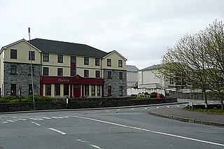
The R459 road is a regional road in Ireland, located in Doolin, County Clare.

The R338 road is a regional road in Ireland, located in southern County Galway.

The R340 road is a regional road in Ireland, located in County Galway.

The R342 road is a regional road in Ireland, located in southern County Galway, part of the Carna Road.

The R462 road is a regional road in Ireland, located in County Clare and County Galway.

The R337 road is a short regional road in Ireland, located in Galway city.

German submarine U-982 was a Type VIIC U-boat of Nazi Germany's Kriegsmarine during World War II.

The R353 road is a regional road in Ireland, located in County Galway.

The R370 road is a regional road in Ireland, located in County Roscommon.

The R372 road is a short regional road in Ireland, located in southern County Galway.

The R344 road is a regional road in Ireland, located in west County Galway. It cuts off the loop made by the N59 through Clifden and Letterfrack.


