
Punalur is a municipality in the Kollam district of Kerala, India. It is the headquarters of the Punalur Taluk and Punalur Revenue Division. It is situated in the eastern part of the Kollam district of Kerala, on the banks of the Kallada River and foothills of the Western Ghats. It is about 45 kilometres (28 mi) north-east of Kollam and 68 kilometres (42 mi) north of Thiruvananthapuram.
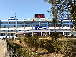
Rayagada is a municipality in Rayagada district in the Indian state of Odisha. It is the administrative headquarters of Rayagada district.
Hinjilicut (Hinjilikatu) is a town and municipality of Ganjam district in the Indian state of Odisha.
Killiyoor is a panchayat town in Kanniyakumari district in the Indian state of Tamil Nadu.

Kuchinda is the town and a notified area council in Sambalpur district in the Indian state of Odisha. It is located about 80 km (49.71 mi) from the district headquarters of Sambalpur, and about 48 km (29.83 mi) away from Jharsuguda. Kuchinda is famous for its "Dushera". Kuchinda is also famous for the Gudguda waterfall. Most of the people of Kuchinda sub-division depends on farming. Kuchinda is more of a tribal area.
Lamsang is a town and a Municipal Council in Imphal West district in the Indian state of Manipur.
Lilong (Thoubal) is a town with Municipal Council in Thoubal District in the Indian state of Manipur.
Mayang Imphal is a town and municipal council in Imphal West district in the Indian state of Manipur. Pin code of Mayang Imphal is 795132.
Naoriya Pakhanglakpa is a census town in Imphal West district in the Indian state of Manipur.
Natrampalli is a selection grade panchayat town and Taluk in Tirupattur district in the Indian state of Tamil Nadu. The Natrampalli block is a revenue block in the Tirupattur district of Tamil Nadu, India.
Padampur is a town and a notified area in Bargarh district in the Indian state of Odisha. It is also a Subdivisional Headquarter and area wise biggest subdivision of Bargarh District.
Paravai is a Panchayat town in Madurai district in the Indian state of Tamil Nadu.
Sekmai Bazar is a town and a municipal council in Imphal West district in the Indian state of Manipur.

Thoubal is a town and municipal council with 18 wards, serving as the district headquarters in Thoubal district, in the Indian state of Manipur. The name 'Thoubal' derives from 'Athouba,' meaning brave people, symbolizing the courageous residents of the district. It is one of the larger towns in Manipur, known for its idyllic setting, featuring numerous lakes, rivers, paddy fields, and gardens. Thoubal is also a gateway to Southeast Asia, with the Trans-Asian Highway (AH1) passing through it, and is well-connected to Imphal, Kakching, Moreh, and Yairipok.
Wangoi is a town and a Municipal Council in Imphal West district in the Indian state of Manipur.
Wangjing is a town and a municipal council in Thoubal district in the Indian state of Manipur. It is about 6 km from district headquarters and an agricultural town in Thoubal district in the Indian state of Manipur. It is bordered by Heirok village in the east, Tentha village in the south-west, and on the other side by agricultural land. Wangjing River, a rivulet flowing down from the eastern hills, runs through the middle of the town, serving as a natural spring. It is connected to other parts of the state by the Imphal–Moreh national highway. It is the junction between Heirok and Tentha village.
Bishnupur is a town in Bishnupur district in the state of Manipur, India. It derived its name from an ancient Vishnu temple located in the town. There is no official record of when exactly the town was named but it is likely during the reign of Bhagyachandra in the mid 18th century. Bishunupur is the administrative headquarters of Bishnupur District.

Andro is a town and a nagar panchayat in Imphal East district in the state of Manipur, India.
Heirok is a town and a nagar panchayat in Thoubal district in the Indian state of Manipur.

Singjamei (Vidhan Sabha constituency) is one of the 60 constituencies in the Manipur Legislative Assembly of Manipur, a north-eastern state of India. Singjamei is also part of Inner Manipur Lok Sabha constituency.

