Oranga is a small residential suburb in Auckland, New Zealand. It is located nine kilometres to the southeast of the city centre, between the commercial suburbs of Te Papapa and Penrose to the south and east, and the residential suburbs of One Tree Hill and Onehunga to the north and south.
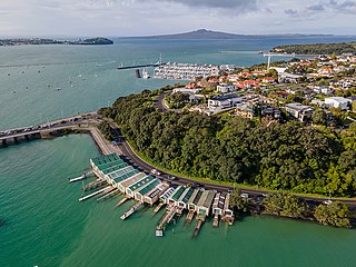
Ōrākei is a suburb of Auckland city, in the North Island of New Zealand. It is located on a peninsula five kilometres to the east of the city centre, on the shore of the Waitematā Harbour, which lies to the north, and Hobson Bay and Orakei Basin, two arms of the Waitematā, which lie to the west and south. To the east is the suburb of Mission Bay. The mouth of the Waitematā is to the immediate north of Ōrākei, lying between Bastion Point, in Ōrākei, and North Head, in Devonport on the North Shore.
Tāmaki is a small suburb of East Auckland, 11 kilometres from the Auckland CBD, in the North Island of New Zealand. It is located by the banks of the estuarial Tāmaki River, which is a southern arm of the Hauraki Gulf. The suburb is between the suburbs of Point England to the north and Panmure to the south.

Te Papapa is a suburb of Auckland, New Zealand. It is located nine kilometres to the southeast of Auckland city centre, on the northern shore of Mangere Inlet, an arm of the Manukau Harbour. The residential and light-industrial suburb lies between the suburbs of Onehunga, Penrose, and Southdown, and is at the northern end of the Māngere Bridge which connects it with the South Auckland suburb of Māngere. Train services on the Onehunga Line run through the suburb on the Onehunga Branch line, which reopened in 2010. Services at Te Papapa station commenced on 19 September 2010. Carter Holt Harvey's head office is located at 173 Captain Springs Road in the Te Papapa area. The name of the suburb refers to a fortress built of rock slabs.
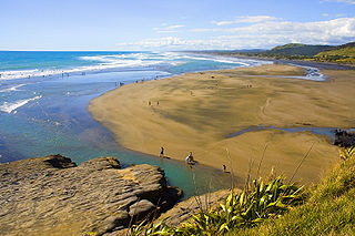
Muriwai, also called Muriwai Beach, is a coastal community on the west coast of the Auckland Region in the North Island of New Zealand. The black-sand surf beach and surrounding area is a popular recreational area for Aucklanders. The Muriwai Regional Park includes a nesting site for a large colony of gannets.
Konini is a suburb in the west of Auckland, New Zealand, under the local governance of Auckland Council.
The suburb of Farm Cove is located in eastern Auckland, New Zealand. The suburb is in the Howick ward, one of the thirteen administrative divisions of Auckland city.
Bayswater is a suburb of Auckland in New Zealand. It lies on a peninsula which juts into the Waitemata Harbour. The suburb is in the North Shore ward, one of the thirteen administrative divisions of Auckland Council.

Belmont is a suburb of Auckland, New Zealand. The name Belmont, which means "good view or hill", derives from a farm estate called "Belmont" which was subdivided in 1885. The suburb is in the North Shore ward, one of the thirteen administrative divisions of Auckland Council.

Laingholm is a small community situated in the Waitākere Ranges west of Auckland, New Zealand.

Stanley Bay on the North Shore, New Zealand is a small suburb near Devonport, Auckland. It is mostly residential. The Devonport Naval Base lies to the east of the bay on the south side of the Stanley Bay peninsula and is connected to storage facilities on the north side at Ngataringa Bay by a tunnel.
Westlake is a suburb of the North Shore in New Zealand's Auckland urban area. It lies eight kilometres to the northwest of the Auckland CBD between the major suburbs of Milford and Glenfield. The name arises from its position on the western shoreline of Lake Pupuke.

Oratia is a semi-rural locality on the western edge of Auckland in New Zealand, located in the former territorial authority of Waitakere City.

Long Bay is a northern suburb of the North Shore, part of the Auckland metropolitan area in New Zealand.
Campbells Bay is a suburb of Auckland in New Zealand.
Wairau Valley is a suburb of Auckland, New Zealand. The area is predominantly light industrial/commercial. The Northern Motorway passes to the east, and the Wairau Park shopping complex extends to the north. The valley is drained by the Wairau Creek, which flows on through Milford and discharges into the Hauraki Gulf from an estuary at the northern end of Milford Beach.
Windsor Park is a suburb of Auckland's North Shore in northern New Zealand.
The Gardens is a suburb of Auckland, New Zealand. It is located to the north of Manurewa East, east of Wiri and south of Totara Heights. It was formerly under the local governance of Manukau City Council until it was merged with all of Auckland's councils to form the Auckland 'super city' in 2010. It is now under the local governance of Auckland Council.
Schnapper Rock is an Auckland suburb, which is under local governance of Auckland Council.
The Strand is a street in Auckland, New Zealand's most populous city. It connects the Ports of Auckland to the Auckland motorway network, and is the eastern end of State Highway 16.

