
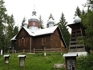
Usnarszczyzna is a village in the administrative district of Gmina Narew, within Hajnówka County, Podlaskie Voivodeship, in north-eastern Poland. It lies approximately 9 kilometres (6 mi) south of Narew, 12 km (7 mi) north of Hajnówka, and 40 km (25 mi) south-east of the regional capital Białystok.
Czarna Średnia is a village in the administrative district of Gmina Grodzisk, within Siemiatycze County, Podlaskie Voivodeship, in north-eastern Poland. It lies approximately 6 kilometres (4 mi) east of Grodzisk, 20 km (12 mi) north of Siemiatycze, and 62 km (39 mi) south of the regional capital Białystok.

Czarna is a village in the administrative district of Gmina Uście Gorlickie, within Gorlice County, Lesser Poland Voivodeship, in southern Poland, close to the border with Slovakia. It lies approximately 5 kilometres (3 mi) west of Uście Gorlickie, 15 km (9 mi) south-west of Gorlice, and 102 km (63 mi) south-east of the regional capital Kraków.
Kamianna is a village in the administrative district of Gmina Łabowa, within Nowy Sącz County, Lesser Poland Voivodeship, in southern Poland. It lies approximately 6 kilometres (4 mi) east of Łabowa, 21 km (13 mi) south-east of Nowy Sącz, and 94 km (58 mi) south-east of the regional capital Kraków.
Skrzyszów is a village in the administrative district of Gmina Gowarczów, within Końskie County, Świętokrzyskie Voivodeship, in south-central Poland. It lies approximately 4 kilometres (2 mi) north-west of Gowarczów, 12 km (7 mi) north of Końskie, and 49 km (30 mi) north of the regional capital Kielce.

Bystre is a village in the administrative district of Gmina Czarna, within Bieszczady County, Subcarpathian Voivodeship, in south-eastern Poland, close to the border with Ukraine. It lies approximately 5 kilometres (3 mi) east of Czarna, 17 km (11 mi) south-east of Ustrzyki Dolne, and 96 km (60 mi) south-east of the regional capital Rzeszów.

Chrewt is a village in the administrative district of Gmina Czarna, within Bieszczady County, Subcarpathian Voivodeship, in south-eastern Poland, close to the border with Ukraine. It lies approximately 10 kilometres (6 mi) west of Czarna, 15 km (9 mi) south of Ustrzyki Dolne, and 90 km (56 mi) south-east of the regional capital Rzeszów.

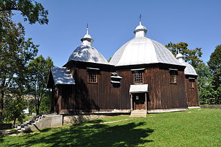
Czarna is a village in Bieszczady County, Subcarpathian Voivodeship, in south-eastern Poland, close to the border with Ukraine. It is the seat of the gmina called Gmina Czarna. It lies approximately 14 kilometres (9 mi) south of Ustrzyki Dolne and 93 km (58 mi) south-east of the regional capital Rzeszów.

Lipie is a village in the administrative district of Gmina Czarna, within Bieszczady County, Subcarpathian Voivodeship, in south-eastern Poland, close to the border with Ukraine. It lies approximately 4 kilometres (2 mi) south-east of Czarna, 17 km (11 mi) south-east of Ustrzyki Dolne, and 96 km (60 mi) south-east of the regional capital Rzeszów.
Michniowiec is a village in the administrative district of Gmina Czarna, within Bieszczady County, Subcarpathian Voivodeship, in south-eastern Poland, close to the border with Ukraine. It lies approximately 6 kilometres (4 mi) south-east of Czarna, 18 km (11 mi) south-east of Ustrzyki Dolne, and 97 km (60 mi) south-east of the regional capital Rzeszów.
Paniszczów is a former village in the administrative district of Gmina Czarna, within Bieszczady County, Subcarpathian Voivodeship, in south-eastern Poland, close to the border with Ukraine. It lies approximately 9 kilometres (6 mi) west of Czarna, 13 km (8 mi) south of Ustrzyki Dolne, and 88 km (55 mi) south-east of the regional capital Rzeszów.
Polana is a village in the administrative district of Gmina Czarna, within Bieszczady County, Subcarpathian Voivodeship, in south-eastern Poland, close to the border with Ukraine. It lies approximately 7 kilometres (4 mi) west of Czarna, 15 km (9 mi) south of Ustrzyki Dolne, and 92 km (57 mi) south-east of the regional capital Rzeszów.

Rabe is a village in the administrative district of Gmina Czarna, within Bieszczady County, Subcarpathian Voivodeship, in south-eastern Poland, close to the border with Ukraine. It lies approximately 5 kilometres (3 mi) north of Czarna, 10 km (6 mi) south-east of Ustrzyki Dolne, and 89 km (55 mi) south-east of the regional capital Rzeszów.
Rosochate is a former village in the administrative district of Gmina Czarna, within Bieszczady County, Subcarpathian Voivodeship, in south-eastern Poland, close to the border with Ukraine. It lies approximately 7 kilometres (4 mi) south-west of Czarna, 18 km (11 mi) south of Ustrzyki Dolne, and 95 km (59 mi) south-east of the regional capital Rzeszów.
Rosolin is a former village in the administrative district of Gmina Czarna, within Bieszczady County, Subcarpathian Voivodeship, in south-eastern Poland, close to the border with Ukraine. It lies approximately 6 kilometres (4 mi) west of Czarna, 14 km (9 mi) south of Ustrzyki Dolne, and 91 km (57 mi) south-east of the regional capital Rzeszów.
Serednie Małe is a village in the administrative district of Gmina Czarna, within Bieszczady County, Subcarpathian Voivodeship, in south-eastern Poland, close to the border with Ukraine. It lies approximately 9 kilometres (6 mi) south-west of Czarna, 17 km (11 mi) south of Ustrzyki Dolne, and 92 km (57 mi) south-east of the regional capital Rzeszów.
Sokołowa Wola is a former village in the administrative district of Gmina Czarna, within Bieszczady County, Subcarpathian Voivodeship, in south-eastern Poland, close to the border with Ukraine. It lies approximately 6 kilometres (4 mi) north-west of Czarna, 10 km (6 mi) south of Ustrzyki Dolne, and 88 km (55 mi) south-east of the regional capital Rzeszów.
Tworylne is a former village in the administrative district of Gmina Czarna, within Bieszczady County, Subcarpathian Voivodeship, in south-eastern Poland, close to the border with Ukraine. It lies approximately 16 kilometres (10 mi) south-west of Czarna, 21 km (13 mi) south-west of Ustrzyki Dolne, and 92 km (57 mi) south of the regional capital Rzeszów.
Wydrne is a village in the administrative district of Gmina Czarna, within Bieszczady County, Subcarpathian Voivodeship, in south-eastern Poland, close to the border with Ukraine. It lies approximately 8 kilometres (5 mi) west of Czarna, 14 km (9 mi) south of Ustrzyki Dolne, and 90 km (56 mi) south-east of the regional capital Rzeszów.
Żłobek is a village in the administrative district of Gmina Czarna, within Bieszczady County, Subcarpathian Voivodeship, in south-eastern Poland, close to the border with Ukraine. It lies approximately 3 kilometres (2 mi) north-east of Czarna, 12 km (7 mi) south-east of Ustrzyki Dolne, and 91 km (57 mi) south-east of the regional capital Rzeszów.


