Bieszczady County

Last updated

Bieszczady County
Powiat bieszczadzki
POL powiat bieszczadzki flag.svg
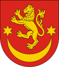
POL powiat bieszczadzki COA.svg
PPA podkarpackie bieszczadzki.svg
Location within the voivodeship
Coordinates(Ustrzyki Dolne): 49°26′N22°36′E / 49.433°N 22.600°E / 49.433; 22.600
CountryFlag of Poland.svg  Poland
Voivodeship POL wojewodztwo podkarpackie flag.svg Subcarpathian
Seat Ustrzyki Dolne
Gminas
Area
  Total
1,138.17 km2 (439.45 sq mi)
Population
 (2019)
  Total
21,799
  Density19/km2 (50/sq mi)
   Urban
9,097
  Rural
12,702
Car plates RBI
Website http://www.bieszczadzki.pl/

Bieszczady County (Polish : powiat bieszczadzki) is a unit of territorial administration and local government (powiat) in Subcarpathian Voivodeship, in the extreme south-east of Poland, on the border with Ukraine. It takes its name from the Bieszczady mountain range. The county was created on 1 January 1999, as a result of the Polish local government reforms passed in 1998. In 2002 the western part of the county was split off to form Lesko County. The only town in Bieszczady County is now Ustrzyki Dolne, the county seat, which lies 80 kilometres (50 mi) south-east of the regional capital Rzeszów.

Contents

The county covers an area of 1,138.17 square kilometres (439.4 sq mi). As of 2019 its total population is 21,799, of which the population of Ustrzyki Dolne is 9,097, and the rural population is 12,702. Its average population density of 19.0 persons per square kilometre (49 persons/sq mi) makes it the least densely populated county in Poland. [1]

The county includes the greater part of Bieszczady National Park (Bieszczadzki Park Narodowy), and of the Polish part of the UNESCO-designated East Carpathian Biosphere Reserve.

Neighbouring counties

Bieszczady County is bordered by Lesko County to the west and Przemyśl County to the north. It also borders Ukraine to the east and south.

Administrative division

The county is subdivided into three gminas (one urban-rural and two rural). These are listed in the following table, in descending order of population.

GminaTypeArea
(km2)
Population
(2019)
Seat
Gmina Ustrzyki Dolne urban-rural477.717,305 Ustrzyki Dolne
Gmina Czarna rural184.62,399 Czarna
Gmina Lutowiska rural475.92,095 Lutowiska

Related Research Articles

<span class="mw-page-title-main">Lesko County</span> County in Subcarpathian Voivodeship, Poland

Lesko County is a unit of territorial administration and local government (powiat) in Subcarpathian Voivodeship, south-eastern Poland, on the Slovak border. It was created in 2002 out of five gminas which previously made up the western part of Bieszczady County. Its administrative seat and only town is Lesko, which lies 67 kilometres (42 mi) south of the regional capital Rzeszów.

<span class="mw-page-title-main">Sanok County</span> County in Subcarpathian Voivodeship, Poland

Sanok County is a unit of territorial administration and local government (powiat) in Subcarpathian Voivodeship, south-eastern Poland, on the Slovak border. It came into being on January 1, 1999, as a result of the Polish local government reforms passed in 1998. Its administrative seat and largest town is Sanok, which lies 56 kilometres (35 mi) south of the regional capital Rzeszów. The only other town in the county is Zagórz, lying 6 km (4 mi) south-east of Sanok.

<span class="mw-page-title-main">Przemyśl County</span> County in Subcarpathian Voivodeship, Poland

Przemyśl County is a unit of territorial administration and local government (powiat) in Subcarpathian Voivodeship, south-eastern Poland, on the border with Ukraine. It came into being on January 1, 1999, as a result of the Polish local government reforms passed in 1998. Its administrative seat is the city of Przemyśl, although the city is not part of the county.

<span class="mw-page-title-main">Włodawa County</span> County in Lublin Voivodeship, Poland

Włodawa County is a unit of territorial administration and local government (powiat) in Lublin Voivodeship, eastern Poland, on the border with Ukraine and Belarus. It was established on January 1, 1999, as a result of the Polish local government reforms passed in 1998. Its administrative seat and only town is Włodawa, which lies 76 kilometres (47 mi) north-east of the regional capital Lublin.

<span class="mw-page-title-main">Tomaszów County, Lublin Voivodeship</span> County in Lublin Voivodeship, Poland

Tomaszów County is a unit of territorial administration and local government (powiat) in Lublin Voivodeship, eastern Poland, on the border with Ukraine. It was established on January 1, 1999, as a result of the Polish local government reforms passed in 1998. Its administrative seat and largest town is Tomaszów Lubelski, which lies 107 kilometres (66 mi) south-east of the regional capital Lublin. The only other towns in the county are Tyszowce, lying 28 km (17 mi) north-east of Tomaszów, and Łaszczów, lying 25 km (16 mi) east of Tomaszów.

<span class="mw-page-title-main">Hoszów</span> Village in Subcarpathian Voivodeship, Poland

Hoszów is a village in the administrative district of Gmina Ustrzyki Dolne, within Bieszczady County, Subcarpathian Voivodeship, in south-eastern Poland. It lies approximately 6 kilometres (4 mi) south-east of Ustrzyki Dolne and 85 km (53 mi) south-east of the regional capital Rzeszów.

<span class="mw-page-title-main">1951 Polish–Soviet territorial exchange</span> The largest peaceful territorial exchange in history

The 1951 Polish-Soviet territorial exchange, also known as the Polish-Soviet border adjustment treaty of 1951, was a border agreement signed in Moscow between the Republic of Poland and the Soviet Union. It involved approximately 480 km2 (185 sq mi) of land along their shared border. The treaty was signed on 15 February 1951, ratified by Poland on 28 May 1951, and by the Soviet Union on 31 May. It modified the border treaty of 16 August 1945, and came into effect on 5 June 1951. Since Poland was a satellite state within the Soviet sphere of influence, the exchange favored the Soviet Union economically due to the valuable coal deposits relinquished by Poland. Following the agreement, the Soviets constructed four large coal mines within eight years, with a combined annual mining capacity of 15 million tons.

Gmina Ustrzyki Dolne is an urban-rural gmina in Bieszczady County, Subcarpathian Voivodeship, in south-eastern Poland. Its seat is the town of Ustrzyki Dolne, which lies approximately 80 kilometres (50 mi) south-east of the regional capital Rzeszów.

Gmina Czarna is a rural gmina in Bieszczady County, Subcarpathian Voivodeship, in south-eastern Poland, on the border with Ukraine. Its seat is the village of Czarna, which lies approximately 14 kilometres (9 mi) south of Ustrzyki Dolne and 93 km (58 mi) south-east of the regional capital Rzeszów.

<span class="mw-page-title-main">Gmina Lutowiska</span> Gmina in Subcarpathian Voivodeship, Poland

Gmina Lutowiska is a rural gmina in Bieszczady County, Subcarpathian Voivodeship, in south-eastern Poland, on the border with Ukraine. Its seat is the village of Lutowiska, which lies approximately 22 kilometres (14 mi) south of Ustrzyki Dolne and 101 km (63 mi) south-east of the regional capital Rzeszów.

Gmina Olszanica is a rural gmina in Lesko County, Subcarpathian Voivodeship, in south-eastern Poland. Its seat is the village of Olszanica, which lies approximately 9 kilometres (6 mi) east of Lesko and 71 km (44 mi) south-east of the regional capital Rzeszów.

Gmina Solina is a rural gmina in Lesko County, Subcarpathian Voivodeship, in south-eastern Poland. It takes its name from its former seat, the village of Solina, which lies approximately 15 kilometres (9 mi) south-east of Lesko and 80 km (50 mi) south-east of the regional capital Rzeszów. The present seat is Polańczyk.

<span class="mw-page-title-main">Słonne Mountains Landscape Park</span> Protected area in Subcarpathian Voivodeship, Poland

Słonne Mountains Landscape Park is a protected area in south-eastern Poland, established in 1992, covering an area of 513.92 square kilometres (198.43 sq mi). It lies in the Słonne Mountains in the Eastern Carpathians.

Bukowiec is a former village, located in the administrative district of Gmina Solina, within Bieszczady County, Subcarpathian Voivodeship, in south-eastern Poland, close to the border with Ukraine. It lies approximately 23 kilometres (14 mi) south-east of Lutowiska, 44 km (27 mi) south-east of Ustrzyki Dolne, and 123 km (76 mi) south-east of the regional capital Rzeszów.

<span class="mw-page-title-main">Ustrzyki Górne</span> Village in Subcarpathian Voivodeship, Poland

Ustrzyki Górne is a village in the administrative district of Gmina Lutowiska, within Bieszczady County, Subcarpathian Voivodeship, in south-eastern Poland, close to the border with Ukraine. It lies approximately 17 kilometres (11 mi) south of Lutowiska, 37 km (23 mi) south of Ustrzyki Dolne, and 114 km (71 mi) south-east of the regional capital Rzeszów.

<span class="mw-page-title-main">Arłamów</span> Village in Subcarpathian Voivodeship, Poland

Arłamów is a village in the administrative district of Gmina Ustrzyki Dolne, within Bieszczady County, Subcarpathian Voivodeship, in south-eastern Poland, near the border with Ukraine.

<span class="mw-page-title-main">Bandrów Narodowy</span> Village in Subcarpathian Voivodeship, Poland

Bandrów Narodowy is a village in the administrative district of Gmina Ustrzyki Dolne, within Bieszczady County, Subcarpathian Voivodeship, in south-eastern Poland, near the border with Ukraine. It lies approximately 9 kilometres (6 mi) south-east of Ustrzyki Dolne and 87 km (54 mi) south-east of the regional capital Rzeszów.

<span class="mw-page-title-main">Jałowe</span> Village in Subcarpathian Voivodeship, Poland

Jałowe is a village in the administrative district of Gmina Ustrzyki Dolne, within Bieszczady County, Subcarpathian Voivodeship, in south-eastern Poland, near the border with Ukraine. It lies approximately 6 kilometres (4 mi) east of Ustrzyki Dolne and 84 km (52 mi) south-east of the regional capital Rzeszów.

<span class="mw-page-title-main">Kwaszenina</span> Village in Subcarpathian Voivodeship, Poland

Kwaszenina is a village in the administrative district of Gmina Ustrzyki Dolne, within Bieszczady County, Subcarpathian Voivodeship, in south-eastern Poland, near the border with Ukraine. It lies approximately 14 kilometres (9 mi) north of Ustrzyki Dolne and 72 km (45 mi) south-east of the regional capital Rzeszów.

<span class="mw-page-title-main">Liskowate</span> Village in Subcarpathian Voivodeship, Poland

Liskowate is a village in the administrative district of Gmina Ustrzyki Dolne, within Bieszczady County, in the Subcarpathian Voivodeship of south-eastern Poland, near the border with Ukraine. It lies approximately 10 kilometres (6 mi) north of Ustrzyki Dolne and 73 km (45 mi) south-east of the regional capital Rzeszów.

References

  1. GUS. "Population. Size and structure and vital statistics in Poland by territorial division in 2019. As of 30th June". stat.gov.pl. Retrieved 14 September 2020.

Rural landscape picture

Chatka Puchatka 2007 maj.jpg
Waldkarpaten SineWiry.jpg
Polonina Wetlinska.jpg
Przyslup bar.jpg
Poland Rabe - wooden church.jpg
Poland Hoszow - wooden church.jpg
Wolkowyja sunrise.jpg
Wetlina bars.jpg
Rownia orthodox church.jpg
Widok na Tarnice.jpg
Ustrzyki dolne4.jpg
Czarna (pow bieszczadzki)-basen.jpg