Related Research Articles

Hawke's Bay is a region on the east coast of New Zealand's North Island. The region is named for Hawke Bay, which was named in honour of Edward Hawke. The region's main centres are the cities of Napier and Hastings, while the more rural parts of the region are served by the towns of Waipukurau, Waipawa, and Wairoa.
Waipukurau is the largest town in the Central Hawke's Bay District on the east coast of the North Island of New Zealand. It is located on the banks of the Tukituki River, 7 kilometres south of Waipawa and 50 kilometres southwest of Hastings.

Wairoa is the largest town in the Wairoa District and the northernmost town in the Hawke's Bay region of New Zealand's North Island. It is located on the northern shore of Hawke Bay at the mouth of the Wairoa River and to the west of Māhia Peninsula. It is 118 kilometres (73 mi) northeast of Napier, and 92 kilometres (57 mi) southwest of Gisborne, on State Highway 2. It is the nearest town to the Te Urewera protected area and former national park, which is accessible from Wairoa via State Highway 38. It is one of three towns in New Zealand where Māori outnumber other ethnicities, with 62.29% of the population identifying as Māori.

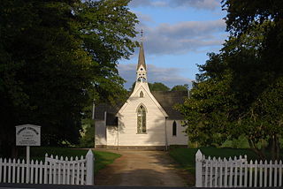
Waipawa is the second-largest town in Central Hawke's Bay in the east of the North Island of New Zealand. It has a population of 2,400.

The Ngaruroro River is located in the eastern North Island of New Zealand. It runs for a total of 164 kilometres southeast from the Kaweka Range, Kaimanawa Range and Ruahine Range and then east before emptying into Hawke Bay roughly halfway between the cities of Napier and Hastings, near the town of Clive. About 40% of the catchment is pasture, and 55% native forest. The meaning of Ngaruroro is obscure.
Pukehou is a farming locality in southern Hawke's Bay, in the eastern North Island of New Zealand.
Ōtāne is a town in the Central Hawke's Bay District and the Hawke's Bay region, on the east coast of New Zealand's North Island. The small village, has a school, general store, cafe and pub, and is located just off State Highway 2.
The Tutaekuri River flows eastward for 99.9 kilometres through the Hawke's Bay Region of the eastern North Island of New Zealand into the Pacific Ocean. It starts in the Kaweka Range roughly 50 kilometres north-east of Taihape, and reaches the sea just to the south of Napier, where the Ngaruroro and Clive Rivers join it.
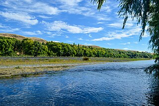
The Waipawa River is a braided river of southern Hawke's Bay, in New Zealand's eastern North Island. It flows southeast from the slopes of 1,687 m (5,535 ft) Te Atuaoparapara in the Ruahine Range, past the town of Waipawa, before joining the Tukituki River. The river rises at the 1,326 m (4,350 ft) Waipawa Saddle, which is also the source of the Waikamaka River. The Mangaonuku Stream is a tributary on the northern bank, west of Waipawa, near Ruataniwha. The Waipawa's flow is generally greater than that of the Tukituki River, into which it flows.

Te Awa o Mokotūāraro, formerly known as the Clive River, is a river in Hawke's Bay, New Zealand. At 33 kilometres (21 mi) long, it is the shortest of the main rivers flowing through the Heretaunga Plains.
The Makaroro River is a river of the southern Hawke's Bay region of New Zealand's North Island. It flows southeast from the slopes of the Ruahine Range, meeting the waters of the Waipawa River 12 kilometres (7 mi) west of Tikokino.
The Esk River of Hawke's Bay, in the eastern North Island of New Zealand, one of two rivers of that name in the country, is one of Hawke's Bay's major rivers. It flows south from the slopes of Taraponui in the Maungaharuru Range before turning east to reach Hawke Bay 10 kilometres (6 mi) north of Napier. State Highway 5 follows the lower course of the river for several kilometres close to the settlement of Eskdale. The river is probably named after the Esk River in southern Scotland and north-west England.
Awatoto is a coastal suburb area within the city of Napier, Hawke's Bay, New Zealand. It stretches along the coast south of Te Awa and the central city. The northern part of Awatoto is residential, while the southern part is industrial, including heavy industry.
Ashley Clinton is a rural community in the Central Hawke's Bay District and Hawke's Bay Region of New Zealand's North Island.
Elsthorpe is a village in the Central Hawke's Bay District and Hawke's Bay Region of New Zealand's North Island. It is located east of Ōtāne, Waipawa and State Highway 2 and west of the east coast.
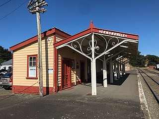
Ormondville is a locality in the Manawatū-Whanganui region of New Zealand's North Island. It is located inland, south of Waipukurau and west of Flemington, Hawke's Bay.

The Hawke's Bay District Health Board was a district health board with the focus on providing healthcare to Hawke's Bay, New Zealand. In July 2022, it was merged into the national health service Te Whatu Ora.

Central Hawke's Bay District Council is the territorial authority for the Central Hawke's Bay District of New Zealand.
Hatuma is 7 km (4.3 mi) south of Waipukurau, in Central Hawke's Bay in the east of the North Island of New Zealand. Meshblock 7016748, which covers 19.3 km2 (7.5 sq mi) from the edge of Waipukurau to Marakeke, had a population of 153 in 2018.

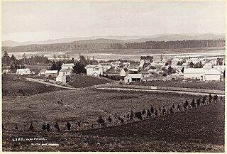
From at least 1870 Waipawa was served by mail coaches running between Napier and Waipukurau.
References
- ↑ "Old Bed of Waipawa River, Hawke's Bay". NZ Topo Map. Retrieved 19 August 2021.
- ↑ "LATEST TELEGRAMS. HAWKE'S BAY HERALD". paperspast.natlib.govt.nz. 27 June 1868. Retrieved 19 August 2021.
- ↑ "Central Hawke's Bay District Council". www.facebook.com. 16 February 2023. Retrieved 27 February 2023.
- "Place name detail: Old Bed of Waipawa River". New Zealand Gazetteer. New Zealand Geographic Board . Retrieved 12 July 2009.
39°57′S176°40′E / 39.950°S 176.667°E