The town is located 7 kilometres (4.3mi) northeast of Waipukurau and 46km (29mi) southwest of Hastings, on the northern bank of the Waipawa River, a tributary of the Tukituki River.[3][4] Waipawa was settled in the early 1860s.
It holds the main office of the Central Hawke's Bay District Council, and is New Zealand's oldest inland European settlement.[5]
Frederick Abbot was one of the early settlers[6] and Waipawa was originally called Abbotsford, when the township was being sold in 1859,[7] and there is still a children's home in Waipawa named Abbotsford.[8] However, it was often shown as Abbotsford, Waipawa[9] and Waipawa was more commonly used alone after the opening of the Waipawa railway station and Waipawa Mail in the late 1870s.[10]
A local newspaper, the Waipawa Mail, was published for most of the period from 1878 to 1980. It was one of 45 started by Joseph Ivess. In 1980 it merged to become the CHB Mail,[11] which is now a free weekly paper, published in Waipukurau.[12]
Demographics
Waipawa covers 6.80km2 (2.63sqmi)[1] and had an estimated population of 2,540 as of June 2024,[2] with a population density of 374 people per km2.
Waipawa had a population of 2,085 at the 2018 New Zealand census, an increase of 114 people (5.8%) since the 2013 census, and an increase of 159 people (8.3%) since the 2006 census. There were 843 households, comprising 990 males and 1,095 females, giving a sex ratio of 0.9 males per female. The median age was 43.3 years (compared with 37.4 years nationally), with 450 people (21.6%) aged under 15 years, 291 (14.0%) aged 15 to 29, 912 (43.7%) aged 30 to 64, and 429 (20.6%) aged 65 or older.
Ethnicities were 84.0% European/Pākehā, 25.3% Māori, 3.9% Pacific peoples, 1.7% Asian, and 1.4% other ethnicities. People may identify with more than one ethnicity.
The percentage of people born overseas was 13.8, compared with 27.1% nationally.
Although some people chose not to answer the census's question about religious affiliation, 54.2% had no religion, 32.5% were Christian, 2.3% had Māori religious beliefs, 0.1% were Buddhist and 2.7% had other religions.
Of those at least 15 years old, 216 (13.2%) people had a bachelor's or higher degree, and 408 (25.0%) people had no formal qualifications. The median income was $26,400, compared with $31,800 nationally. 105 people (6.4%) earned over $70,000 compared to 17.2% nationally. The employment status of those at least 15 was that 777 (47.5%) people were employed full-time, 261 (16.0%) were part-time, and 45 (2.8%) were unemployed.[13]
In October 2020, the Government committed $887,291 from the Provincial Growth Fund to upgrade the two marae and three others, creating 12 jobs.[16]
Education
Waipawa School is a Year 1-8 co-educational state primary school.[17][18] It is a decile 3 school with a roll of 332 as of August 2024.[19][20] The school opened in 1862.[21][22]
Waipawa used to have a secondary school, Waipawa District High School. This was merged in 1959 with Waipukurau District High School to make Central Hawke's Bay College based in Waipukurau.[23]
Waipawa has been home to several youth organisations. Namely, the New Zealand Cadet Forces's ATC branch, as well as a Scouts New Zealand branch. However, since 2000, both major youth organisations have gone into recess.
From at least 1870[24] Waipawa was served by mail coaches running between Napier and Waipukurau.[25]
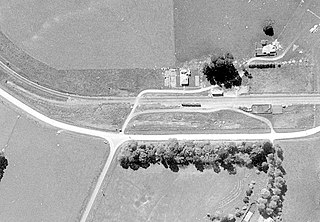
On 6 December 1981 the station closed to passengers, it was an unattended station from 20 November 1983, closed to all but parcels on 18 August 1984 and closed completely on 2 November 1984. By 1987 only a platform and goods shed remained.[26] The platform, goods shed and a single track still remain.[27]
Former adjoining stations
Waipukurau Line open, station closed 7.52km (4.67mi)
Waipukurau is the largest town in the Central Hawke's Bay District on the east coast of the North Island of New Zealand. It is located on the banks of the Tukituki River, 7 kilometres south of Waipawa and 50 kilometres southwest of Hastings.
Takapau is a small rural community in the Central Hawkes Bay in New Zealand. It is located 20 kilometres west of Waipukurau, off State Highway 2, and has a population of more than 500.
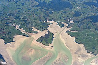
Kawhia Harbour is one of three large natural inlets in the Tasman Sea coast of the Waikato region of New Zealand's North Island. It is located to the south of Raglan Harbour, Ruapuke and Aotea Harbour, 40 kilometres southwest of Hamilton. Kawhia is part of the Ōtorohanga District and is in the King Country. It has a high-tide area of 68 km2 (26 sq mi) and a low-tide area of 18 km2 (6.9 sq mi). Te Motu Island is located in the harbour.
Pōrangahau is a small township close to the Pacific Ocean coast in the south-east of the North Island of New Zealand. It lies in the southernmost part of Hawke's Bay, 45 kilometres south of Waipukurau, and close to the mouth of the Porangahau River. The settlement includes a marae and a school.
Clive is a small town, ten kilometres from the city centres of both Napier and Hastings in the Hawke's Bay region of New Zealand's North Island. It is close to the mouth of the Ngaruroro River.
Pukehou is a farming locality in southern Hawke's Bay, in the eastern North Island of New Zealand.
Maketu is a small town on the Western Bay of Plenty coast in New Zealand.
Ōtāne is a town in the Central Hawke's Bay District and the Hawke's Bay region, on the east coast of New Zealand's North Island. The small village, has a school, general store, cafe and pub, and is located just off State Highway 2.
William Cowper Smith was a Liberal Party Member of Parliament in New Zealand.
Awatoto is a coastal suburb area within the city of Napier, Hawke's Bay, New Zealand. It stretches along the coast south of Te Awa and the central city. The northern part of Awatoto is residential, while the southern part is industrial, including heavy industry.
Okauia is a rural settlement and community located east of Matamata, in the Waikato region of New Zealand's North Island.
Poukawa is a rural community in the Hastings District and Hawke's Bay Region of New Zealand's North Island.
Pakipaki is a pā kāinga village and rural community in the Hastings District and Hawke's Bay Region of New Zealand's North Island. The village is home to many Ngāti Whatuiāpiti hapū tribes represented by their three marae of Houngarea, Mihiroa, and Taraia. The village is also the home of the Hawke's Bay Catholic Māori Mission and displays the Foundation Stone for the Catholic Church in Hawke's Bay. Pakipaki is a Sacred Space in the Footsteps of Venerable Suzanne Aubert.
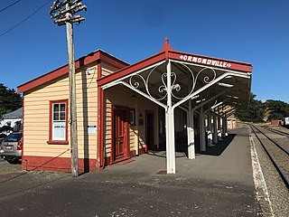
Ormondville is a locality in the Manawatū-Whanganui region of New Zealand's North Island. It is located inland, south of Waipukurau and west of Flemington, Hawke's Bay.
Opaparailway station is a preserved station on the Palmerston North–Gisborne Line in New Zealand's North Island that closed in 1981. It is in the Hastings District of Hawke's Bay, 23.56 km (14.64 mi) south of Hastings city, in a census meshblock with a population of only 222 in 2018.
Matamau is a small village, on a ridge between the Matamau and Whakaruatapu Streams, tributaries of the Manawatū River, in the Manawatū-Whanganui region of New Zealand's North Island. State Highway 2 and the Palmerston North–Gisborne line run through the village. It has a rare surviving example of a basic railway station, a cafe, developed from the former post office and store about 1969, and a truck repair workshop. Until the 1870s it was densely forested, but most of the trees were felled and milled by 1910 and replaced by farms.
Hatuma is 7 km (4.3 mi) south of Waipukurau, in Central Hawke's Bay in the east of the North Island of New Zealand. Meshblock 7016748, which covers 19.3 km2 (7.5 sq mi) from the edge of Waipukurau to Marakeke, had a population of 153 in 2018.
Kopua in New Zealand is now a sparsely populated area, immediately south of the border of the Manawatū-Whanganui and Hawke's Bay regions, with 150 people scattered over a 40 km2 (15 sq mi) meshblock. For two years it briefly flourished as a village, centred on a railway station on the Palmerston North–Gisborne line, opened on 25 January 1878, when it became the southern terminus of the line from Napier and Spit. Building to the south was delayed by the need to erect 3 large viaducts over the Manawatū River and its tributaries, so the extension to Makotuku didn't open until 9 August 1880. Kopua then declined until the station closed on 8 May 1977. Only a single line now passes through the station site and there are remnants of cattle yards.
Piripiri is a sparsely populated area in the Tararua District, in the Manawatū-Whanganui Region, on State Highway 2 and the Palmerston North–Gisborne line. It is 3 mi 8 ch (5.0 km) north of Dannevirke, and has 150 people scattered over a meshblock of 21.8 km2 (8.4 sq mi).
From at least 1870 Waipawa was served by mail coaches running between Napier and Waipukurau.
This page is based on this Wikipedia article Text is available under the CC BY-SA 4.0 license; additional terms may apply. Images, videos and audio are available under their respective licenses.