
Old Cavendish Street, originally Cavendish Street, is a street in Marylebone in the City of Westminster in central London that runs from Henrietta Place in the north to Oxford Street in the south.
Old Cavendish Street, originally Cavendish Street, is a street in Marylebone in the City of Westminster in central London that runs from Henrietta Place in the north to Oxford Street in the south.


The street was one of those laid out in the early 1700s when the area north of Oxford Street was urbanised on a grid pattern. It was named after Lady Henrietta Cavendish, the heiress to the Manor of Marylebone lands and the wife of Edward Harley after whom Harley Street was named. [1]
It was renamed Old Cavendish Street to distinguish it from the much longer New Cavendish Street to the north.
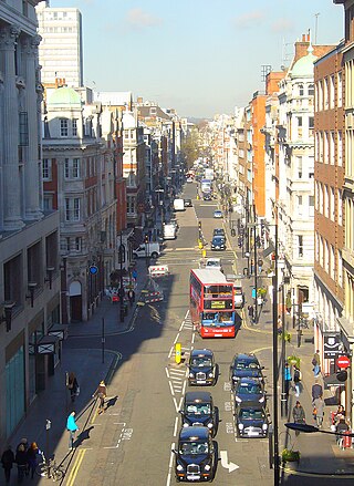
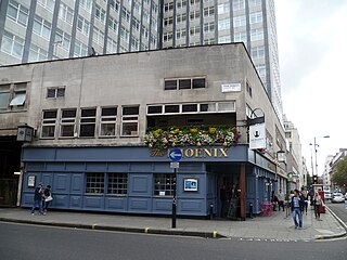
In the 1870s it included two public houses, the Red Lion at No. 5 (rebuilt 1879), on the east side, and the Crown at No. 12A (rebuilt 1885–6) and was a throughway to Oxford Street but it has since been pedestrianised at the southern end. The cul-de-sac Red Lion Yard, later known as Cavendish Buildings, ran from the eastern side before the construction of the House of Fraser (previously D.H. Evans) [2] store in Oxford Street. Today, the street is entirely taken up by the House of Fraser department store on its western side and the John Lewis store on the east, both of which front Oxford Street.

The West End of London is a district of Central London, London, England, west of the City of London and north of the River Thames, in which many of the city's major tourist attractions, shops, businesses, government buildings and entertainment venues, including West End theatres, are concentrated.

The Metropolitan Borough of St Marylebone was a metropolitan borough of the County of London from 1900 to 1965. It was based directly on the previously existing civil parish of St Marylebone, Middlesex, which was incorporated into the Metropolitan Board of Works area in 1855, retaining a parish vestry, and then became part of the County of London in 1889.
Great Portland Street is a road in the West End of London which links Oxford Street with the A501 Marylebone Road. A commercial street, it divides Fitzrovia, to the east, from Marylebone to the west. It delineates areas with contrasting identities, the west at strongest in grandiose Portland Place and Harley Street, the east at strongest in artists' and independent businesses of Fitzrovia.

Wigmore Street is a street in the City of Westminster, in the West End of London. The street runs for about 600 yards parallel and to the north of Oxford Street between Portman Square to the west and Cavendish Square to the east. It is named after the village of Wigmore and its castle in Herefordshire, a seat of the family of Robert Harley, politician around the time of Queen Anne, who owned land in the area.

Welbeck Street is a street in the West End, central London. It has historically been associated with the medical profession. Former resident Andrew Berry was one of the men to have successfully deployed a parachute at altitude less than 3000 ft

Cavendish Square is a public garden square in Marylebone in the West End of London. It has a double-helix underground commercial car park. Its northern road forms ends of four streets: of Wigmore Street that runs to Portman Square in the much larger Portman Estate to the west; of Harley Street which runs an alike distance; of Chandos Street which runs for one block and; of Cavendish Place which runs the same. The south side itself is modern: the rear façade and accesses to a flagship department store and office block. On the ground floors facing are Comptoir Libanais, Royal Bank of Scotland and Pret a Manger premises.

Henrietta Harley, Countess of Oxford and Countess Mortimer was an English noblewoman, the only child and heiress of John Holles, 1st Duke of Newcastle and his wife, the former Lady Margaret Cavendish, daughter of Henry Cavendish, 2nd Duke of Newcastle-upon-Tyne.
West End is an electoral ward of the London borough of the City of Westminster, in the United Kingdom.
Marylebone is an area in London, England and is located in the City of Westminster. It is in Central London and part of the West End. Oxford Street forms its southern boundary.
The Howard de Walden Estate is a property estate in Marylebone, London, owned by the Howard de Walden family. As of 2020 the estate was reported to be worth £4.7 billion.

Thayer Street is a street in the Marylebone district of the City of Westminster, London, that contains four listed buildings.

Weymouth Street lies in the Marylebone district of the City of Westminster and connects Marylebone High Street with Great Portland Street. The area was developed in the late 18th century by Henrietta Cavendish Holles and her husband Edward Harley, 2nd Earl of Oxford. This part of Marylebone was noted to part of Manor of Tyburn and dates back to the year 1086.
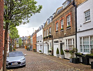
Devonshire Close, originally known as Devonshire Mews East, is a mews street in the City of Westminster, London, accessed from Devonshire Street. The Close is on a distinctive H plan with a middle downwards leg. It dates from the 1770s and originally contained a timber yard, stables, and accommodation for domestic servants who worked in the larger houses surrounding it. Access was limited to the north side in order to divert traffic from the grander north–south streets around it. The Close was gentrified in the 20th century and its buildings converted to mews houses which, like other mews in London, have become desirable in the modern era because they are quiet and have little traffic. The Close is now part of the Howard de Walden Estate.

New Cavendish Street is a street in the City of Westminster, London, that runs from Marylebone High Street in the west to Cleveland Street in the east. The street was built in 1775 and named after the Cavendish family, who were related to the ground landlords, the Dukes of Portland.

Marylebone Lane is one of the original streets of the Marylebone district of the City of Westminster, London. It runs from Oxford Street in the south to Marylebone High Street in the north, its winding shape following the course of the River Tyburn that it once ran alongside and pre-dating the grid pattern of the other streets in the area. Today the lane is largely composed of small shops, cafes and restaurants with some small apartment blocks. There are some larger commercial buildings at the southern end near Oxford Street.
Bulstrode Street is a street in Marylebone in the City of Westminster that runs from Welbeck Street in the east to Thayer Street in the west. It is crossed only by Marylebone Lane.

Henrietta Place, originally known as Henrietta Street, is a street in Marylebone in the City of Westminster in central London that runs from Marylebone Lane in the east to Cavendish Square in the west. It is joined on the north side by Welbeck Street and Wimpole Street, and on the south side by Vere Street, Chapel Place, and Old Cavendish Street.

Holles Street is a street in Marylebone in the City of Westminster in central London that runs from the south side of Cavendish Square to Oxford Street.
John Prince's Street, also Princes Street, is a street in Marylebone in the City of Westminster in central London that runs from Margaret Street in the north to Oxford Street in the south. It is joined on its eastern side by Great Castle Street.
This is a list of the etymology of street names in the London district of Marylebone. The following utilises the generally accepted boundaries of Marylebone viz. Marylebone Road to the north, Great Portland Street to the east, Marble Arch and Oxford Street to the south and Edgware Road to the west.
![]() Media related to Old Cavendish Street at Wikimedia Commons
Media related to Old Cavendish Street at Wikimedia Commons
51°30′55.09″N0°8′45.38″W / 51.5153028°N 0.1459389°W
| | This London road or road transport-related article is a stub. You can help Wikipedia by expanding it. |