New Cavendish Street

Last updated

The west end of New Cavendish Street from Marylebone High Street. New Cavendish Street west, London 6 Sept 2014.jpg
The west end of New Cavendish Street from Marylebone High Street.

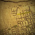
New Cavendish Street is a street in the City of Westminster, London, that runs from Marylebone High Street in the west to Cleveland Street in the east. The street was built in 1775 and named after the Cavendish family, who were related to the ground landlords, the Dukes of Portland. [1]

Contents

Buildings

Among the notable buildings in the street are:

Recent developments

Among the recent developments on the street are:

Related Research Articles

<span class="mw-page-title-main">Fitzrovia</span> Human settlement in England

Fitzrovia is a district of central London, England, near the West End. The eastern part of area is in the London Borough of Camden, and the western in the City of Westminster. It has its roots in the Manor of Tottenham Court, and was urbanised in the 18th century. Its name was coined in the late 1930s by Tom Driberg.

<span class="mw-page-title-main">Metropolitan Borough of St Marylebone</span> Metropolitan borough of England

The Metropolitan Borough of St Marylebone was a metropolitan borough of the County of London from 1900 to 1965. It was based directly on the previously existing civil parish of St Marylebone, which was incorporated into the Metropolitan Board of Works area in 1855, retaining a parish vestry, and then became part of the County of London in 1889.

<span class="mw-page-title-main">Great Portland Street</span>

Great Portland Street in Marylebone, in the West End of London, links Oxford Street with the A501 Marylebone Road. The street, which is part of a broader rectilinear street pattern, includes the Embassy of the Democratic Republic of the Congo. and a number of small independent shops.

<span class="mw-page-title-main">Soho Square</span> Garden square in London, England

Soho Square is a garden square in Soho, London, hosting since 1954 a de facto public park let by the Soho Square Garden Committee to Westminster City Council. It was originally called King Square after Charles II, and a much weathered statue of the monarch has stood in the square, with an extended interruption, since 1661, one year after the restoration of the monarchy.

<span class="mw-page-title-main">Cities of London and Westminster (UK Parliament constituency)</span> UK Parliament constituency in England, created 1950

Cities of London and Westminster is a constituency returning a single Member of Parliament (MP) to the House of Commons in the United Kingdom Parliament. It is a borough constituency for the purposes of election expenses and type of returning officer. As with all constituencies, the election is decided using the first past the post system of election. Since its creation at the 1950 general election, the constituency has always elected the candidate nominated by the Conservative Party.

<span class="mw-page-title-main">St Marylebone Parish Church</span> Church in London , United Kingdom

St Marylebone Parish Church is an Anglican church on the Marylebone Road in London. It was built to the designs of Thomas Hardwick in 1813–17. The present site is the third used by the parish for its church. The first was further south, near Oxford Street. The church there was demolished in 1400 and a new one erected further north. This was completely rebuilt in 1740–42, and converted into a chapel-of-ease when Hardwick's church was constructed. The Marylebone area takes its name from the church. Located behind the church is St Marylebone School, a Church of England school for girls.

<span class="mw-page-title-main">Cavendish Square</span>

Cavendish Square is a public garden square in Marylebone in the West End of London. It has a double-helix underground commercial car park. Its northern road forms ends of four streets: of Wigmore Street that runs to Portman Square in the much larger Portman Estate to the west; of Harley Street which runs an alike distance; of Chandos Street which runs for one block and; of Cavendish Place which runs the same. The south side itself is modern: the rear façade and accesses to a flagship department store and office block. On the ground floors facing are Comptoir Libanais, Royal Bank of Scotland and Pret a Manger premises.

<span class="mw-page-title-main">Marylebone</span> Area in London, England

Marylebone is a district in the West End of London, in the City of Westminster. Oxford Street, Europe's busiest shopping street, forms its southern boundary.

<span class="mw-page-title-main">Hallam Street</span>

Hallam Street is a road situated in the Parish of St Marylebone and London's West End. In administrative terms it lies within the City of Westminster's Marylebone High Street Ward as well as the Harley Street Conservation Area. Formerly named both Charlotte Street and Duke Street, it was renamed in the early 1900s after Henry Hallam (1777–1859), a noted historian who had been a local resident, and his son Arthur Henry Hallam (1811–1833), poet and the subject of Tennyson's elegy In Memoriam.

<span class="mw-page-title-main">Bolsover Street</span> Street in City of Westminster, United Kingdom

Bolsover Street is in the Parish of St Marylebone in London’s West End. In administrative terms it lies within the City of Westminster's Marylebone High Street Ward and is partly in the Harley Street Conservation Area whilst also sitting on the edges of the Regents Park and East Marylebone Conservation Areas.

<span class="mw-page-title-main">Portland Place</span> Historic thoroughfare in the Marylebone district of London, England

Portland Place is a street in the Marylebone district of central London. Named after the Third Duke of Portland, the unusually wide street is home to the BBC's headquarters Broadcasting House, the Chinese and Polish embassies, the Royal Institute of British Architects and numerous residential mansion blocks.

<span class="mw-page-title-main">Dorothy Bentinck, Duchess of Portland</span> 18th-century English noblewoman

Dorothy Bentinck, Duchess of Portland was Duchess of Portland the as wife of William Cavendish-Bentinck, 3rd Duke of Portland, the Prime Minister of Great Britain. She was also a great-great-great-grandmother of Queen Elizabeth II through the queen's maternal grandmother.

<span class="mw-page-title-main">Weymouth Street</span> Street in the City of Westminster, London, England

Weymouth Street lies in the Marylebone district of the City of Westminster and connects Marylebone High Street with Great Portland Street. The area was developed in the late 18th century by Henrietta Cavendish Holles and her husband Edward Harley, 2nd Earl of Oxford. This part of Marylebone originally belonged to the Manor of Tyburn which existed at the time of the Domesday Book (1086).

<span class="mw-page-title-main">Devonshire Street</span> Street in City of Westminster, London, England

Devonshire Street is a street in the City of Westminster, London. Adjoining Harley Street, it is known for the number of medical establishments it contains.

<span class="mw-page-title-main">Devonshire Close</span> Street in London

Devonshire Close, originally known as Devonshire Mews East, is a mews street in the City of Westminster, London, accessed from Devonshire Street. The Close is on a distinctive H plan with a middle downwards leg. It dates from the 1770s and originally contained a timber yard, stables, and accommodation for domestic servants who worked in the larger houses surrounding it. Access was limited to the north side in order to divert traffic from the grander north–south streets around it. The Close was gentrified in the 20th century and its buildings converted to mews houses which, like other mews in London, have become desirable in the modern era because they are quiet and have little traffic. The Close is now part of the Howard de Walden Estate.

<span class="mw-page-title-main">Homer Street</span> One-way street in Westminster

Homer Street is a quiet one-way street in the Marylebone neighbourhood of the City of Westminster, London. It runs from Old Marylebone Road in the north to Crawford Street in the south. The street is part of the Marylebone Ward of Westminster City Council. Its postcode is W1H.

<span class="mw-page-title-main">Bulstrode Street</span>

Bulstrode Street is a street in Marylebone in the City of Westminster that runs from Welbeck Street in the east to Thayer Street in the west. It is crossed only by Marylebone Lane.

<span class="mw-page-title-main">Henrietta Place</span>

Henrietta Place, originally known as Henrietta Street, is a street in Marylebone in the City of Westminster in central London that runs from Marylebone Lane in the east to Cavendish Square in the west. It is joined on the north side by Welbeck Street and Wimpole Street, and on the south side by Vere Street, Chapel Place, and Old Cavendish Street.

<span class="mw-page-title-main">Wimpole House</span>

Wimpole House at 28–29a Wimpole Street is a group of Grade II listed town houses on the corner of Wimpole Street and New Cavendish Street in the City of Westminster, London.

<span class="mw-page-title-main">Margaret Street, London</span> Street in the City of Westminster, London

Margaret Street is a street that straddles the Marylebone and Fitzrovia areas of the City of Westminster in the West End of London, running from Cavendish Square to Wells Street via Regent Street (A4201), Great Portland Street, and Great Titchfield Street. It is north of and parallel to the major shopping street, Oxford Street. John Prince's Street runs between Margaret Street and Oxford Street.

References

  1. Weinreb, Ben; Hibbert, Christopher (1992). The London Encyclopaedia (reprint ed.). Macmillan. p. 554.
  2. Historic England. "The Ship public house (1224602)". National Heritage List for England . Retrieved 27 March 2016.
  3. "DEVONSHIRE & NEW CAVENDISH STREETS | The W1W Tree Planting Initiative for Marylebone" . Retrieved 17 June 2019.
  4. WARMAN MEDIA (12 July 2011), Professor Lord Winston captures carbon in Marylebone , retrieved 17 June 2019
  5. "Projects". Marylebone Low Emission Neighbourhood. Retrieved 17 June 2019.

Commons-logo.svg Media related to New Cavendish Street at Wikimedia Commons

Coordinates: 51°31′11″N0°08′44″W / 51.51965°N 0.14542°W / 51.51965; -0.14542