Henrietta Place

Last updated

Henrietta Place
Henrietta Place.jpg
Henrietta Place from Marylebone Lane
Former name(s)Henrietta Street
Location City of Westminster,
Greater London,
United Kingdom
Postal code W1
Nearest tube station Underground no-text.svg Bond Street
West end Marylebone Lane
East end Cavendish Square
Other
Known for

Henrietta Place, originally known as Henrietta Street, is a street in Marylebone in the City of Westminster in central London that runs from Marylebone Lane in the east to Cavendish Square in the west. It is joined on the north side by Welbeck Street and Wimpole Street, and on the south side by Vere Street, Chapel Place, and Old Cavendish Street.

Contents

History

Henrietta Street, now Place, [1] was named after Lady Henrietta Cavendish, the 18th century heiress to the Manor of Marylebone lands and the wife of Edward Harley after whom Harley Street was named. [2] The street was laid out around 1729 [3] when the area, which was previously rural, was urbanised using a grid plan. [4]

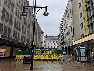
During the nineteenth century the street fell out of favour and in the twentieth century parts of the western end were redeveloped when the Marshall & Snelgrove department store on the south side was redeveloped as Debenhams and the Welbeck Street car park built for the store on the north side. [5]

Buildings

On the north side of the street is the Welbeck Street car park and The Royal Society of Medicine which has its entrance in Wimpole Street. Between them is Henrietta House which is owned by Lazari Investments and occupied by property firm CBRE Group since 2011 after Diageo moved out. [6] [7] It was designed by Christopher Haddon of the Building Design Partnership and incorporates at first floor level on the exterior a series of fifteen Portland stone sculptures by Keir Smith commissioned by the Public Art Development Trust to show the architectural history of Britain. The project was the winner of the Royal Society of Arts Art for Architecture award in 1990. [8] At the Cavendish Square end on the north side is the Royal College of Nursing.

The south side of the street is dominated by the back of retail premises on Oxford Street such as the Debenhams and House of Fraser (previously D.H. Evans) department stores. The Debenhams store was built in the late 1960s or early 1970s to replace a Marshall & Snelgrove store on the same site. [9] [10] Between them is the church of St Peter, Vere Street, a grade I listed building also known as the Oxford Chapel or the Marylebone Chapel, the architect of which was James Gibbs who also lived in the street. [1] Henrietta Passage once ran south into the centre of the buildings that were on the site now occupied by House of Fraser.

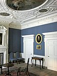
Between 1724 and 1732, Gibbs designed and built four houses in the street, living in number 5 from 1731 until his death in 1754 and letting numbers 9, 10, and 11. Number 11 was demolished in 1956 when the site was acquired by Debenhams. The parlour from the house was donated to the Victoria & Albert Museum where it is now on display. [11]

Notable inhabitants

Portrait of Henrietta Harley, after whom the street is named, by John Wootton. Henrietta Harley, Countess of Oxford and Countess Mortimer (1694-1755), by John Wootton.jpg
Portrait of Henrietta Harley, after whom the street is named, by John Wootton.

Related Research Articles

<span class="mw-page-title-main">James Gibbs</span> Scottish architect

James Gibbs was a Scottish architect. Born in Aberdeen, he trained as an architect in Rome, and practised mainly in England. He is an important figure whose work spanned the transition between English Baroque architecture and Georgian architecture heavily influenced by Andrea Palladio. Among his most important works are St Martin-in-the-Fields, the cylindrical, domed Radcliffe Camera at Oxford University, and the Senate House at Cambridge University.
<span class="mw-page-title-main">John Holles, 1st Duke of Newcastle</span> British peer

John Holles, 1st Duke of Newcastle was an English peer and politician.

<span class="mw-page-title-main">Margaret Bentinck, Duchess of Portland</span> British duchess

Margaret Cavendish Bentinck, Duchess of Portland was the richest woman in Great Britain of her time, styled Lady Margaret Harley before 1734, Duchess of Portland from 1734 to her husband's death in 1761, and Dowager Duchess of Portland from 1761 until her own death in 1785.

<span class="mw-page-title-main">Wigmore Street</span> Street in London, England

Wigmore Street is a street in the City of Westminster, in the West End of London. The street runs for about 600 yards parallel and to the north of Oxford Street between Portman Square to the west and Cavendish Square to the east. It is named after the village of Wigmore and its castle in Herefordshire, a seat of the family of Robert Harley, politician around the time of Queen Anne, who owned land in the area.

<span class="mw-page-title-main">Welbeck Street</span> Street in the West End, central London

Welbeck Street is a street in the West End, central London. It has historically been associated with the medical profession. Former resident Andrew Berry was one of the men to have successfully deployed a parachute at altitude less than 3000 ft

<span class="mw-page-title-main">Vere Street, Marylebone</span> Street in the City of Westminster, London

Vere Street is a street off Oxford Street, in central London. It is a continuation of Welbeck Street, and part of the B406. It is named after a family name of the area's owners at the time of its construction, the Earls of Oxford. It is best known for the Marybone Chapel, also known as the Marylebone Chapel or Oxford Chapel, now St Peter's Vere Street. The sculptor John Michael Rysbrack lived and died here in 1770.

<span class="mw-page-title-main">Edward Harley, 2nd Earl of Oxford and Earl Mortimer</span> English Tory politician and peer

Edward Harley, 2nd Earl of Oxford and Earl Mortimer was an English Tory politician and peer who sat in the House of Commons of Great Britain from 1711 to 1724.

<span class="mw-page-title-main">Henrietta Harley, Countess of Oxford and Countess Mortimer</span> English noblewoman

Henrietta Harley, Countess of Oxford and Countess Mortimer was an English noblewoman, the only child and heiress of John Holles, 1st Duke of Newcastle and his wife, the former Lady Margaret Cavendish, daughter of Henry Cavendish, 2nd Duke of Newcastle-upon-Tyne.
<span class="mw-page-title-main">Lady Anne Cavendish-Bentinck</span> British noblewoman and landowner

Lady Alexandra Margaret Anne Cavendish-Bentinck was a member of the British nobility and one of the richest landowners in the country. She was a notable charity worker, art collector, and horsewoman.

<span class="mw-page-title-main">Marylebone</span> Area in London, England

Marylebone is an area in London, England and is located in the City of Westminster. It is in Central London and part of the West End. Oxford Street forms its southern boundary.

<span class="mw-page-title-main">Marshall & Snelgrove</span> Former department store in London

Marshall & Snelgrove was a department store on the north side of Oxford Street, London, on the corner with Vere Street founded by James Marshall. The company became part of the Debenhams group.
<span class="mw-page-title-main">Charles Worley</span>

Charles H Worley (1853–1906) was a British architect.
<span class="mw-page-title-main">Howard de Walden Estate</span> London aristocratic property estate

The Howard de Walden Estate is a property estate in Marylebone, London, owned by the Howard de Walden family. As of 2020 the estate was reported to be worth £4.7 billion.

<span class="mw-page-title-main">Weymouth Street</span> Street in the City of Westminster, London, England

Weymouth Street lies in the Marylebone district of the City of Westminster and connects Marylebone High Street with Great Portland Street. The area was developed in the late 18th century by Henrietta Cavendish Holles and her husband Edward Harley, 2nd Earl of Oxford. This part of Marylebone was noted to part of Manor of Tyburn and dates back to the year 1086.

<span class="mw-page-title-main">Marylebone Lane</span> Street in Marylebone, London

Marylebone Lane is one of the original streets of the Marylebone district of the City of Westminster, London. It runs from Oxford Street in the south to Marylebone High Street in the north, its winding shape following the course of the River Tyburn that it once ran alongside and pre-dating the grid pattern of the other streets in the area. Today the lane is largely composed of small shops, cafes and restaurants with some small apartment blocks. There are some larger commercial buildings at the southern end near Oxford Street.

<span class="mw-page-title-main">Welbeck Street car park</span>

Welbeck Street car park was an architecturally notable car park built in the Brutalist style that was found in Marylebone, just north of Oxford Street, in the City of Westminster, London. The entrance was on the east side in Welbeck Street and it also borderered Henrietta Place in the south and Marylebone Lane in the west.
<span class="mw-page-title-main">Bulstrode Street</span> Street in City of Westminster, London

Bulstrode Street is a street in Marylebone in the City of Westminster that runs from Welbeck Street in the east to Thayer Street in the west. It is crossed only by Marylebone Lane.
<span class="mw-page-title-main">Old Cavendish Street</span> Street in Marylebone, London

Old Cavendish Street, originally Cavendish Street, is a street in Marylebone in the City of Westminster in central London that runs from Henrietta Place in the north to Oxford Street in the south.

<span class="mw-page-title-main">Holles Street</span> Street in Marylebone, London

Holles Street is a street in Marylebone in the City of Westminster in central London that runs from the south side of Cavendish Square to Oxford Street.

This is a list of the etymology of street names in the London district of Marylebone. The following utilises the generally accepted boundaries of Marylebone viz. Marylebone Road to the north, Great Portland Street to the east, Marble Arch and Oxford Street to the south and Edgware Road to the west.
References

  1. 1 2 St Peter’s, Vere Street. Survey of London, UCL, 15 January 2016. Retrieved 8 December 2016.
  2. Bebbington, Gillian. (1972) London Street Names. London: B.T. Batsford. pp. 164–5 & 171. ISBN   0713401400
  3. Wright, Thomas. (1837) The history and antiquities of London, Westminster, Southwark, and parts adjacent. Vol. V. London: George Virtue. p. 336.
  4. Aldous, Tony. (1980) The Illustrated London News Book of London's Villages. London: Secker & Warburg. p. 87. ISBN   0436011506
  5. Welbeck Street Car Park. Michael Blampied, architectuul.com, 23 May 2016. Retrieved 8 December 2016.
  6. CBRE to leave Kingsley House for Diageo HQ. Estates Gazette , 11 June 2010. Retrieved 8 December 2016.
  7. Tour CBRE's new London headquarters. Estates Gazette, YouTube, 12 October 2011. Retrieved 8 December 2016.
  8. Wooden maquettes for sculpture for Henrietta House, 8 Henrietta Place, Westminster, London: 'The Temple at Euston', 'The Castle' and 'Canary Wharf'. RIBApix. Retrieved 8 December 2016.
  9. Inwood, Stephen (2008). Historic London: An Explorer's Companion. London: Macmillan. p. 267. ISBN   978-0-230-75252-8.
  10. Marshall and Snelgrove, department store, Oxford Street and Vere Street. National Archives. Retrieved 10 December 2016.
  11. Parlour from 11 Henrietta Street. Victoria & Albert Museum. Retrieved 8 December 2016.
  12. Oxford Street and its northern tributaries: Part 2 of 2. British History Online. Retrieved 10 December 2016.
  13. William Theed. Mapping the Practice and Profession of Sculpture in Britain and Ireland 1851-1951, University of Glasgow History of Art and HATII, online database 2011. Retrieved 7 January 2017.
  14. John Wootton EQUESTRIAN PORTRAIT OF LADY HENRIETTA HARLEY, COUNTESS OF OXFORD AND COUNTESS MORTIMER (1694–1755) LED BY A GROOM WITH A HUNT ATTENDANT, IN A LANDSCAPE. Sotheby's. Retrieved 8 December 2016.

51°30′57″N0°08′45″W / 51.51587°N 0.14581°W / 51.51587; -0.14581