
The City of Banyule is a local government area in Victoria, Australia in the north-eastern suburbs of Melbourne. It was created under the Local Government Act 1989 and established in 1994 as an amalgamation of former councils. It has an area of 63 square kilometres (24.3 sq mi) and lies between 7 and 21 km from central Melbourne. In 1994 it had a population of 116,000. In June 2018 Banyule had a population of 130,237. The Yarra River runs along the City's southern border while its western border is defined by Darebin Creek.

Mitchell Shire is a local government area in the Hume region of Victoria, Australia, located North of Melbourne. It covers an area of 2,862 square kilometres (1,105 sq mi) and, in August 2024, had a projected population of 61,362. Larger towns include Beveridge, Broadford, Kilmore, Seymour, Tallarook, Pyalong and Wallan. It was formed in 1994 from the amalgamation of the Shire of Pyalong, the Shire of Kilmore, most of the Shire of Broadford, and parts of the Shire of McIvor and Rural City of Seymour.

St Kilda East is a suburb in Melbourne, Victoria, Australia, 6 km south-east of Melbourne's Central Business District, located within the Cities of Glen Eira and Port Phillip local government areas. St Kilda East recorded a population of 12,571 at the 2021 census.

Elizabeth Street is one of the main streets in the Melbourne central business district, Victoria, Australia, part of the Hoddle Grid laid out in 1837. It is presumed to have been named in honour of governor Richard Bourke's wife.

HM Prison Pentridge was an Australian prison that was first established in 1851 in Coburg, Victoria. The first prisoners arrived in 1851. The prison officially closed on 1 May 1997.

The Old Melbourne Gaol is a former jail and current museum on Russell Street, in Melbourne, Victoria, Australia. It consists of a bluestone building and courtyard, and is located next to the old City Police Watch House and City Courts buildings, and opposite the Russell Street Police Headquarters. It was first constructed starting in 1839, and during its operation as a prison between 1845 and 1924, it held and executed some of Australia's most notorious criminals, including bushranger Ned Kelly and serial killer Frederick Bailey Deeming. In total, 133 people were executed by hanging. Though it was used briefly during World War II, it formally ceased operating as a prison in 1924; with parts of the jail being incorporated into the RMIT University, and the rest becoming a museum.
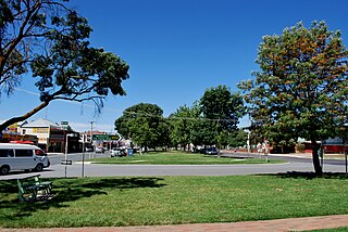
Yea is a town in Victoria, Australia 112 kilometres (70 mi) north-east of the state capital Melbourne at the junction of the Goulburn Valley Highway and the Melba Highway, in the Shire of Murrindindi local government area. In an area originally inhabited by the Taungurung people, it was first visited by Europeans of the Hume and Hovell expedition in 1824, and within 15 years most of the land in the area had been taken up by graziers. Surveyed in 1855, the township grew as a service centre for grazing, gold-mining and timber-getting in the area.
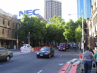
King Street is a main road in the Melbourne central business district, Australia. It is considered a key hub of Melbourne's nightlife and is home to many pubs, nightclubs, restaurants, and adult entertainment venues.

Broadford is a town in central Victoria, Australia. At the 2021 census, Broadford had a population of 4,076. The town is the headquarters of the Shire of Mitchell local government area and is approximately 73 kilometres (50 mi) north of the state capital, Melbourne.

Fish Creek is a small dairy farming community in Gippsland, Victoria, Australia. It sits in between the Boon wurrung and Gunai/Kurnai Indigenous regions. At the 2016 census, Fish Creek and the surrounding area had a population of 827. It was named for the many river blackfish in the creek that runs alongside the town.

Collingwood Stockade was a penal stockade in modern-day Carlton North, Victoria, Australia. It was built in 1853 and was in use until 1866 when it was converted into an asylum, which then closed in 1873. The stockade no longer exists but the area has several reminders of it, including the Stockade Hotel on Nicholson Street and Lee St Primary School which is built on the site of the old stockade buildings.
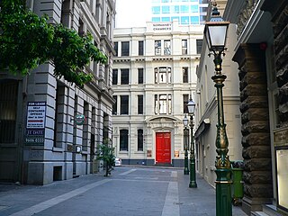
Bank Place is a street in the Melbourne central business district, Australia. It is a laneway running roughly north-south between Collins Street and Little Collins Street.
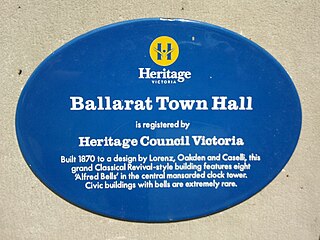
Heritage Victoria is a branch of the Victorian Department of Transport and Planning. It is the regulator responsible for administering the Heritage Act 2017. The Heritage Act provides for the protection and conservation of the cultural heritage of Victoria and establishes the Victorian Heritage Register and Heritage Inventory. The Register is a list of places and objects which are of significance to the State of Victoria. The Inventory is a list of known historical archaeological sites. Both statutory lists can be searched via the Victorian Heritage Database.

Wollert is a suburb in Melbourne, Victoria, Australia, 26 km north of Melbourne's central business district, located within the City of Whittlesea local government area. Wollert recorded a population of 24,407 at the 2021 census.

Ivanhoe is a suburb of Melbourne, Victoria, Australia, 9 kilometres (5.6 mi) north-east of Melbourne's Central Business District, located within the City of Banyule local government area. Ivanhoe recorded a population of 13,374 at the 2021 census.
Pimpinio is a town in the Rural City of Horsham, Victoria, Australia. It is 15 km from the City of Horsham and 317 km from the Victorian capital city Melbourne. As of the 2021 Australian census, Pimpinio had a population of 191 people.

The architecture of Melbourne, the capital of the state of Victoria and second most populous city in Australia, is characterised by a wide variety of styles in various structures dating from the early years of European settlement to the present day. The city is particularly noted for its mix of Victorian architecture and contemporary buildings, with 74 skyscrapers in the city centre, the most of any city in the Southern Hemisphere.
Oakden, Addison and Kemp was an Australian architectural firm in Melbourne, Victoria. While it was short lived, existing from only 1887 to 1892, they designed a number of outstanding projects, and all three members designed many more notable projects in earlier and later partnerships.

The Rialto, Winfield and Olderfleet building group, in Collins Street, Melbourne, is a group of five historic buildings all built within a few years of each other in 1888-1891. They are all a similar height, width and level of detail, making up one of the most notable historic streetscapes in Melbourne, and a particularly notable Victorian streetscape in the international context. All the buildings were subject to preservation battles in the 1970s and early 1980s, ultimately saving the front portions of four of them, and the whole of one of them, the Rialto.
