Related Research Articles

Guntur district is one of the twenty six districts in the Coastal Andhra region of the Indian state of Andhra Pradesh. The administrative seat of the district is located at Guntur, the largest city of the district in terms of area and with a population of 670,073. It has a coastline of approximately 100 km (62 mi) on the right bank of Krishna River, that separates it from Krishna district and NTR district. It is bounded on the south by Bapatla district and on the west by Palnadu district. It has an area of 2,443 km2 (943 sq mi) and with a population of 20,91,075 as per 2011 census of India.
Guntur is a city and the administrative headquarters of Guntur district in the Indian state of Andhra Pradesh. It is located on the Eastern Coastal Plains and is approximately 30 kilometres (19 mi) south of Amaravati, capital of the state. Based on 2011 Census of India data, city is the third most populous in the state with a population of 743,354. It is spread across 159.46 km square.

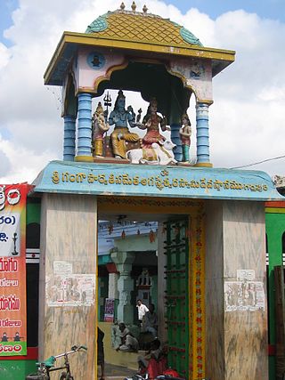
Markapuram is a town in Prakasam district of the Indian state of Andhra Pradesh. It is a municipality and is the headquarters of Markapuram mandal in Markapuram revenue division. Markapuram is notable for the Chennakesava Swamy Temple, built by King Sri Krishnadevaraya. During Ratha Yatra there occurs a popular carnival; the town is also famous for Chenna Kesavaswamy on the day of Rathsapthami, which is attended by thousands of people coming from different parts of the state. It is the second-largest town in Prakasam district after Ongole and it is the main place within West Prakasam district to avail all facilities.
Chebrolu is a village in Guntur district of the Indian state of Andhra Pradesh. It is the headquarters of Chebrolu mandal in Tenali revenue division. It was once a Buddhist site and territorial capital of Kakatiya dynasty. The Archaeological excavations revealed Buddhist artefacts of Satavahana and Ikshavaku period.
Rentachintala is a village in Palnadu district of the Indian state of Andhra Pradesh. It is located in Rentachintala mandal of Gurazala revenue division.

Donakonda is a town in the Prakasam district of the Indian state of Andhra Pradesh.
Kanagalais a village in Bapatla district of the Indian state of Andhra Pradesh. It is the located in Cherukupalle mandal of Repalle revenue division.

Guntur railway station is an Indian Railways station in Guntur of Andhra Pradesh. It is situated on the Krishna Canal–Guntur section of Guntur railway division in the South central railway zone.
New Paluvayi, also spelled as Paluvoi, is a small village in Rentachintala mandal, Guntur district, Andhra Pradesh, India. The village population is approximately 600. It has a Zilla Parishad High School which was established in 1997. Paluvayi village Postal Index Number (PIN) is 589836. It also has a Railway halt station.
Thumrukota is a village in Palnadu district of the Indian state of Andhra Pradesh. It is located in Rentachintala mandal of Gurazala revenue division.
Mantripalem is a village in Nagaram Mandal, Guntur district, Andhra Pradesh, India. Mantripalem is located 56 kilometers east of the district headquarters Guntur and 335 kilometers from the state capital, Hyderabad. Mantripalem's PIN code is 522262 and the postal headquarter office is Kuchinapudi. The area of Mantripalem is 7.3 square kilometers.

Sugguna Lanka is a village in Kollur mandal, located in Guntur district of Andhra Pradesh in India. The name of this village is derived from the Lastname Sugguna.
Duvva is a village in West Godavari district of the Indian state of Andhra Pradesh. It is located in Tanuku mandal of Kovvur revenue division. The nearest railway station is Satyavada (STVA) located at a distance of 5.77 Km from Duvva.
Kondapaturu is a village in Kakumanu Mandal in the Guntur District of Andhra Pradesh, India. It is located 35 km (22 mi) south of the main district of Guntur, 3 km (1.9 mi) from Kakumanu, and 296 km (184 mi) from Hyderabad, the state capital. Between March and April, Thirunalla is celebrated by 200,000 to 300,000 visiting worshippers every year.
Manchikallu is a village in Palnadu district of the Indian state of Andhra Pradesh. It is located in Rentachintala mandal of Gurazala revenue division.
Amaravati is the greenfield capital of the Indian state of Andhra Pradesh. It is situated at the heart of the state, on the right bank of the river Krishna in Guntur district. It is near to Dharanikota, the ancient city site nearby, that served as the capital of Satavahana dynasty more than 2,200 years ago.
Macherla mandal is one of the 28 mandals in the Palnadu district of the Indian state of Andhra Pradesh. It is under the administration of Gurazala revenue division and the headquarters are located at Macherla. The mandal is bounded by Rentachintala, Durgi and Veldurthi mandals and a portion of the mandal also borders the state of Telangana.
Mittagudipadu is a village in Palnadu district of the Indian state of Andhra Pradesh. It is located in Rentachintala mandal of Gurazala revenue division.
Palnadu district is a district in coastal Andhra Region in the Indian state of Andhra Pradesh. With Narasaraopet as its administrative headquarters, it was formed on 4 April 2022 to become one of the resultant twenty-six districts The district was formed from Gurazala, Sattenapalli and Narasaraopet revenue divisions from Palnadu district. The district covers most of the Palnadu region.
Goli is a village in Palnadu district of the Indian state of Andhra Pradesh. It is situated on the right bank of the river Goleru, which joins the Krishna River two miles to the north. It is located in Rentachintala mandal of Palnadu district in Andhra Pradesh, India. It is situated 5 km away from sub-district headquarters Rentachintala and 120 km away from Guntur. It is 49.7 km downstream of Nagarjunakonda and 113 km upstream of Amaravathi.
References
- ↑ "PALUVAI Pin Code - 522421, Rentachintala All Post Office Areas PIN Codes, Search GUNTUR Post Office Address". news.abplive.com. Retrieved 27 February 2024.
- ↑ PinCodeArea. "Postal Code: PALUVAI GATE, Post Paluvai BO (Guntur, Andhra Pradesh)". PinCodeArea. Retrieved 27 February 2024.
- ↑ "Paluvoi Village Population - Rentachintala - Guntur, Andhra Pradesh". www.census2011.co.in. Retrieved 27 February 2024.