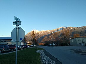
Construction of Old Yale Road c1922 Yale Road Chilliwack, circa 1908. Site of the City Hall Museum site
While the famed Cariboo Wagon Road from Yale north to the gold fields was completed in 1865, it was years before a Lower Mainland road was completed to Hope and Yale.
To move men and supplies to the gold fields, service by river steamers was inaugurated in 1858. The navigable sections of the Fraser River proved the easiest and cheapest route of travel. As late as 1873, the Hudson's Bay Company foot trail ("Fur Brigade Trail") was the only land route between Fort Langley and Chilliwack.[1]
The section between Chilliwack and Yale dates back to 1862 as a rough trail, built over a primitive footpath. Credit for the trail has gone to Yale butcher Jonathan Reece who wanted to source his meat from a location closer than Oregon. After convincing some other men to invest in land for farming in Chilliwack, he proceeded to cut a 50-mile-long trail through heavy forest with the help of a relative and a native local.[2]
Construction began in 1874 for a wagon road between New Westminster and Hope roughly paralleling the route of the Telegraph Trail of 1865. On maps it was called the New Westminster and Yale (Wagon) Road, but known locally as Yale Road.
The route of Yale Road ran from New Westminster in a southeasterly direction through Langley Prairie and Aldergrove to Abbotsford. The road proceeded to curve south to follow a path along the south shore of Sumas Lake and along the north base of the Vedder Mountains through Yarrow, Vedder Crossing, north to Sardis and Chilliwack. From Chilliwack, the road followed Reece's old trail through Rosedale and Bridal Falls, then northeasterly along the south shore of the Fraser River through Cheam View and Laidlaw to Hope and Yale.
Reports during 1876–77 by the road superintendent, George Landvoight, described how the road 25 miles (40km) west of Hope was impassable for months on end due to damage from river flood washouts. He also described other damage such as a destroyed bridge, caused by wild cattle driven over it. It was not until 1891 that the section of the Old Yale Road from Chilliwack to Hope could be considered in any sense permanent. [3]
During the automobile era after the First World War, the road saw improvements and new alignments to efficiently move cars and trucks through the Fraser Valley. After Sumas Lake was reclaimed and converted to farmland in 1925, the highway was re-routed off the old Yale Road route in a more direct alignment through the eastern Fraser Valley between Abbotsford and Chilliwack. Though unpaved, the road was deemed passable by automobile in the mid-1920s; Realignments and pavement came in the 1930s along with renaming as the Fraser Highway (designated as "Highway 'A'" on road maps).
As the Trans-Canada Highway (designated Highway 1 in 1941), the old Yale Road route saw further abandonment as the main highway of the valley with the by-passing of the Chilliwack-Rosedale-Bridal Falls section (constructed circa-1958-60) and the Fraser Highway section between New Westminster and Abbotsford by the “401” Freeway (constructed 1960–64). Until recently, the Fraser Highway (to Abbotsford) and Chilliwack-Rosedale (Yale Road East) sections were designated as B.C. Highway 1A. In 2005, the City of Chilliwack designated the Yale Road East section as the “Trans-Canada Parallel Route”.
Sections of Yale Road and Old Yale Road continue to exist in the Fraser Valley as local roads. Some of the old road beds are now on private property. The road maintains much of its historic characteristics – winding sections, narrow pavement, avoidance of steep terrain, and usage as a route for local above ground telephone and electricity services. A section in Langley, (South of the Langley Municipal Airport) remains constructed of concrete panels dating from 1923.[4]
Harvey, R. G. (2011). Carving the Western Path: By River, Rail, and Road Through B.C.'s Southern Mountains. Heritage House Publishing Co. ISBN9781927051115.- Total pages: 240
Lyons, Chester Peter (1950). Milestones on the Mighty Fraser. J.M. Dent & Sons (Canada) Limited.- Total pages: 157
Related Research Articles
The Lower Mainland is a geographic and cultural region of the mainland coast of British Columbia that generally comprises the regional districts of Metro Vancouver and the Fraser Valley. Home to approximately 3.05million people as of the 2021 Canadian census, the Lower Mainland contains sixteen of the province's 30 most populous municipalities and approximately 60% of the province's total population.
The Fraser River is the longest river within British Columbia, Canada, rising at Fraser Pass near Blackrock Mountain in the Rocky Mountains and flowing for 1,375 kilometres (854 mi), into the Strait of Georgia just south of the City of Vancouver. The river's annual discharge at its mouth is 112 cubic kilometres (27 cu mi) or 3,550 cubic metres per second (125,000 cu ft/s), and each year it discharges about 20 million tons of sediment into the ocean.
The Fraser Valley is a geographical region in southwestern British Columbia, Canada and northwestern Washington State. It starts just west of Hope in a narrow valley encompassing the Fraser River and ends at the Pacific Ocean stretching from the North Shore Mountains, opposite the city of Vancouver BC, to just south of Bellingham, Washington.
Abbotsford is a city located in British Columbia, next to the Canada–United States border, Greater Vancouver and the Fraser River. With a census population of 153,569 people (2021), it is the largest municipality in the province outside metropolitan Vancouver. Abbotsford–Mission has the third-highest proportion of visible minorities among census metropolitan areas in Canada, after the Greater Toronto Area and the Greater Vancouver CMA. It is home to Tradex, the University of the Fraser Valley, and Abbotsford International Airport.
The Township of Langley is a district municipality immediately east of the City of Surrey in southwestern British Columbia, Canada. It extends south from the Fraser River to the Canada–United States border, and west of the City of Abbotsford. Langley Township is not to be confused with the City of Langley, which is adjacent to the township but politically is a separate entity. Langley is located in the eastern part of Metro Vancouver.
Chilliwack is a city in the province of British Columbia, Canada. Chilliwack is surrounded by mountains and home to recreational areas such as Cultus Lake and Chilliwack Lake Provincial Parks. There are numerous outdoor activities in the area in which to participate, including hiking, rock climbing, mountain biking horseback riding, whitewater kayaking, camping, fishing, golf, and paragliding. Chilliwack is known for its annual corn harvest, and is home to the Province's second largest independent bookstore The Book Man. The Fraser Valley Regional District is headquartered in Chilliwack, which is the Fraser Valley's second-largest city, after Abbotsford.
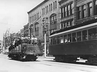
The British Columbia Electric Railway (BCER) was an historic railway which operated in southwestern British Columbia, Canada. Originally the parent company for, and later a division of, BC Electric Company, the BCER assumed control of existing streetcar and interurban lines in southwestern British Columbia in 1897, and operated the electric railway systems in the region until the last interurban service was discontinued in 1958. During and after the streetcar era, BC Electric also ran bus and trolleybus systems in Greater Vancouver and bus service in Greater Victoria; these systems subsequently became part of BC Transit, and the routes in Greater Vancouver eventually came under the control of TransLink. Trolley buses still run in the City of Vancouver with one line extending into Burnaby.
Highway 1 is a provincial highway in British Columbia, Canada, that carries the main route of the Trans-Canada Highway (TCH). The highway is 1,047 kilometres (651 mi) long and connects Vancouver Island, the Greater Vancouver region in the Lower Mainland, and the Interior. It is the westernmost portion of the main TCH to be numbered "Highway 1", which continues through Western Canada and extends to the Manitoba–Ontario boundary. The section of Highway 1 in the Lower Mainland is the second-busiest freeway in Canada, after Ontario Highway 401 in Toronto.
There are many roads in the southwestern part of British Columbia and Vancouver Island that were designated as Highway 1A. These roads were sections of the original 1941 route of Highway 1 before its various re-alignments, and are used today as service routes and frontage roads. The "B.C. Highway 1A" designations were removed from these sections by the province between 2005 and 2010, although signage remains along some of the route and the designation on some maps.
Highway 11, known locally as the Abbotsford-Mission Highway, is a 17 km (11 mi) long at-grade expressway that figuratively cuts the Fraser Valley in half. The highway was first given the '11' designation in 1958, and it originally followed South Fraser Way through Abbotsford, being re-routed onto the four-lane Sumas Way in the mid-1980s. Highway 11 originally entered Mission over the same bridge that carries a spur of the Canadian Pacific Railway across the Fraser River, but it was re-routed onto its own bridge, the Mission Bridge, in 1973.
Highway 9, the Agassiz-Rosedale Highway, is a north-south route in the eastern part of the Fraser Valley. It acts as the last connection between the Trans Canada Highway and the Lougheed Highway eastbound before Hope, and is the main access to the resort village of Harrison Hot Springs. The highway first opened in 1953, originally going between Yale Road in Rosedale and Highway 7, with a ferry across the Fraser River. A bridge for Highway 9 across the Fraser opened in 1956. When the section of Highway 1 east of Chilliwack opened in 1961, Highway 9 was extended south to a junction with the new Highway 1 alignment, which replaced Yale Road as the main route between Chilliwack and Hope.
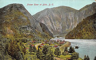
Yale is an unincorporated town in the Canadian province of British Columbia, which grew in importance during the Fraser Canyon Gold Rush.
Fraser Highway is a 38-kilometre-long (24 mi) major arterial road in the Lower Mainland of British Columbia. Connecting the cities of Surrey and Abbotsford, the highway formerly constituted a major portion of British Columbia Highway 1A until the latter was decommissioned in 2006. The highway is named for the Fraser River and the Fraser Valley, which are in turn named for the explorer Simon Fraser.
Sumas Lake(Halq’eméyle: Semá:th Lake, Nooksack: Semáts Xácho7, ) was a shallow freshwater lake surrounded by extensive wetlands that once existed in eastern Fraser Lowland, located on the south side of the Sumas River between the foothills of Sumas Mountain and Vedder Mountain. It disappeared after being artificially drained for flood control and land reclamation from 1920 to 1924, leaving behind a low-lying flatland known as the Sumas Prairie, which is nowadays drained by the Saar Creek and the namesaked Sumas Drainage Canal.
The Agassiz–Rosedale Bridge is a cantilever truss bridge across the Fraser River in the Fraser Valley region of southwestern British Columbia. Linking Agassiz with the south shore, the two-lane bridge carrying BC Highway 9 is by road about 36 kilometres (22 mi) west of Hope, 119 kilometres (74 mi) east of Vancouver, and 51 kilometres (32 mi) east of Abbotsford.
Matsqui is a former district municipality in British Columbia, Canada. It was incorporated in 1892 and merged with the district municipality of Abbotsford in 1995 to create the new City of Abbotsford. Matsqui used to be the western part of what is now Abbotsford. It had commercial growth in the Clearbrook area which then spilled over to Abbotsford.
The 400-series highways were a pair of controlled-access highways located in the southwestern portion of the Canadian province of British Columbia, forming a special subset of the provincial highway system. Modelled after the 400-Series Highways in Ontario, 400-series designations were introduced in 1964 in conjunction with the completion of the Trans-Canada Highway freeway between Vancouver and Clearbrook ; however, unlike their Ontario counterparts, both routes had signalized sections. The 400-series system never expanded beyond two freeways, and in 1973 Highways 401 and 499 were renumbered 1 and 99 respectively, while the former routes were assigned the 'A' suffix.
Sumas Prairie is a landform in British Columbia, Canada and the State of Washington, United States. Part of the Fraser Lowland, it was created by the draining of Sumas Lake early in the 20th Century, and extends from the Vedder Canal southwestwards into northern Whatcom County, Washington. The British Columbia Highway 1 traverses the former lakebed on the prairie between Abbotsford and Chilliwack.
Chilliwack is a city made up of several amalgamated villages and communities. The urban core has a decidedly north–south axis bisected by the Trans-Canada Highway. The city is bounded in north by the Fraser River, in the east by the Eastern Hillsides, in the south by the Canada-U.S. border, and in the west by the Vedder Canal.
This page is based on this Wikipedia article Text is available under the CC BY-SA 4.0 license; additional terms may apply. Images, videos and audio are available under their respective licenses.