Related Research Articles

Franklin County is a county in the U.S. state of Ohio. As of the 2020 census, the population was 1,323,807, making it the most populous county in Ohio. Most of its land area is taken up by its county seat, Columbus, the state capital and most populous city in Ohio. The county was established on April 30, 1803, less than two months after Ohio became a state, and was named after Benjamin Franklin. Originally, Franklin County extended north to Lake Erie before it was subdivided into smaller counties. Franklin County is the central county of the Columbus, Ohio Metropolitan Statistical Area.

Powell is a city in Delaware County, Ohio, United States, located 14 miles (21.5 km) north of the state capital of Columbus. Powell had an estimated population of 14,163 at the 2020 census. Founded in the early 1800s, it is now a suburb of Columbus.
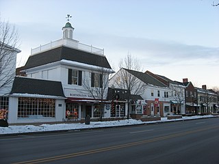
Worthington is a city in Franklin County, Ohio, United States, and is a northern suburb of Columbus. The population in the 2020 Census was 14,786. The city was founded in 1803 by the Scioto Company led by James Kilbourne, who was later elected to the United States House of Representatives, and named in honor of Thomas Worthington, who later became governor of Ohio.
Clintonville is a suburban neighborhood in north-central Columbus, Ohio, United States with around 30,000 residents. Its borders, associated with the Clintonville Area Commission, are the Olentangy River on the west, Glen Echo Creek to the south, a set of railroad tracks to the east, and on the north by the Worthington city limits.
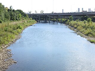
The Olentangy River is a 97-mile-long (156 km) tributary of the Scioto River in Ohio, United States.

State Route 315, known locally as the Olentangy Freeway, running almost parallel to Olentangy River Road for most of its length, is a north–south highway in central Ohio, in the Columbus metropolitan area. It may be seen abbreviated as SR 315, OH-315, or simply 315. Its southern terminus is at the south junction of I-70 and I-71 in Columbus, and its northern terminus is at US 23 near Delaware. It is a controlled access freeway from its southern terminus to I-270. The controlled access section carries two or three lanes in each direction, depending on the location. North of I-270, it becomes a two-lane road. It roughly follows the Olentangy River for about two-thirds of its length. The route passes through Ohio State University campus. The section between Interstate 670 and Interstate 70 is known as the West Innerbelt, and it is commonly referred to as such in traffic reports. The original name of this section was Sandusky Street.
The Olentangy Local School District is a large, rapidly growing school district centered in southern Delaware County, with a small, southern portion in Franklin County in the U.S. state of Ohio. The Olentangy Local School District comprises 95 square miles (250 km2) and serves students from all or parts of numerous municipalities, including the unincorporated community of Lewis Center and the cities of Columbus, Delaware, Powell, and Westerville. The district also serves students from Berkshire, Berlin, Concord, Genoa, Liberty, and Orange townships in Delaware and Franklin counties. As of 2020, it operates 16 elementary schools, five middle schools, and four high schools. Also, there is an online high school called OASIS for selected students at the OASIS headquarters, plus a school for STEM students.
Gold Circle was a discount department store chain based in Ohio. Founded in 1967, it was a division of Federated Department Stores with 76 stores when the chain was sold and dismantled in 1988.
The Columbus and Franklin County Metro Parks are a group of 20 metropolitan parks in and around Columbus, Ohio. They are officially organized into the Columbus and Franklin County Metropolitan Park District. The Metro Parks system was organized in 1945 under Ohio Revised Code Section 1545 as a separate political division of the state of Ohio. The Metro Parks are overseen by a Board of Park Commissioners consisting of three citizens appointed to three-year terms without compensation by the Judge of the Probate Court of Franklin County, Ohio. The Board in turn appoints an Executive Director responsible for operations and management of the parks.

Olentangy West is a neighborhood approximately 5 miles (8 km) northwest of downtown Columbus, Ohio, United States. Also called West Olentangy, it is generally bordered by West Henderson Road on the north, the Olentangy River and Clintonville on the east, Kinnear Road on the south, and Upper Arlington on the west. The area is primarily residential, although the large Riverside Methodist Hospital and the headquarters for Chemical Abstracts Service are located within its boundaries. Additionally, the west campus of Ohio State University is located within the southern boundary of the area.

Downtown Columbus is the central business district of Columbus, Ohio. Downtown is centered on the intersection of Broad and High Streets, and encompasses all of the area inside the Inner Belt. Downtown is home to most of the tallest buildings in Columbus.
Columbus, the state capital and Ohio's largest city, has numerous neighborhoods within its city limits. Neighborhood names and boundaries are not officially defined. They may vary or change from time to time due to demographic and economic variables.

Harrison West is a historic urban neighborhood located northwest of downtown Columbus, Ohio. It sits on several blocks along the Olentangy River and includes the western part of the Near Northside Historic District, which was placed on the National Register of Historic Places in 1975. The character of the neighborhood is similar to Victorian Village, which sits just to the east and is more well-known.

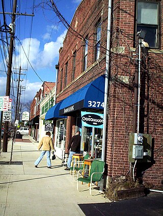
Old North Columbus is a neighborhood located just north of the Ohio State University in Columbus, Ohio. It was founded in 1847 where, at the time, it was a stand-alone city out of the confines of Columbus until it was incorporated into the City of Columbus in 1871. In its early years the city was a popular stagecoach stop with people traveling from Worthington to Columbus. Today Old North Columbus is popular for its local music and its unique "untouched architecture" which is reminiscent of its old roots.
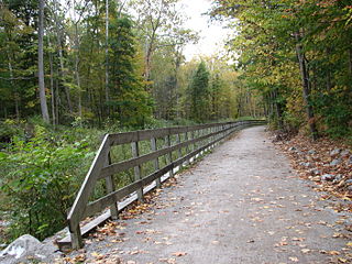
The Ohio to Erie Trail is a dedicated multi-use trail crossing Ohio from southwest to northeast, crossing 326 mi (525 km) of regional parks, nature preserves, and rural woodland.
The Ohio Capital Conference is a high school athletic conference located in Central Ohio. It comprises 32 public high schools located primarily in suburban Columbus, Ohio, encompassing Delaware, Fairfield, Franklin, Licking, and Union counties. The league is geographically divided into four divisions of six teams each and one division of eight teams (Cardinal). Twenty-three schools compete in the OHSAA's Division I classification for football while eight schools compete in Division II. All conference members compete in the Central District postseason tournaments prior to the regional and state tournaments.
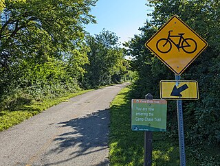
The Camp Chase Trail is a paved multi-use trail in Madison and Franklin counties in the U.S. state of Ohio. It serves as the Southwest Columbus segment of the 326-mile (525 km) Ohio to Erie Trail. The entire length of the Camp Chase Trail is part of the Great American Rail-Trail, U.S. Bicycle Route 21 and U.S. Bicycle Route 50.

The Scioto Greenway Trail is a multi-use greenway trail in Columbus, Ohio, United States. The route is along the downtown riverfront on the east and west sides of the Scioto River. It is the first such bike trail to have been built in Columbus.
Northwest Columbus is a region in Franklin County, Ohio. It has about 45,000 residents, according to the 2010 U.S. census.

Scioto Audubon Metro Park is a public park and nature preserve in Columbus, Ohio. The park is managed by the Columbus and Franklin County Metro Parks and is part of the Scioto Mile network of parks and trails around Downtown Columbus. The park features numerous trails, wetlands, rock climbing, volleyball and bocce courts, and numerous other amenities. At the western edge is the Grange Insurance Audubon Center, considered the first nature center built in close proximity to a downtown area.
References
- ↑ "Olentangy Trail". City of Columbus Recreation and Parks. Retrieved June 6, 2023.