ISO 8601Data elements and interchange formats – Information interchange – Representation of dates and times is an international standard covering the exchange of date- and time-related data. It was issued by the International Organization for Standardization (ISO) and was first published in 1988. The purpose of this standard is to provide an unambiguous and well-defined method of representing dates and times, so as to avoid misinterpretation of numeric representations of dates and times, particularly when data are transferred between countries with different conventions for writing numeric dates and times.
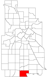
The Diamond Lake neighborhood is in the Nokomis community in Minneapolis. It is bounded by Diamond Lake Road and 55th Street on the north, Cedar Avenue on the east, 62nd Street on the south, and Interstate 35W on the west. It has approximately 2233 households within its boundaries. The Diamond Lake neighborhood, together with Hale and Page, forms the HPDL.
The Shoreham Aircraft Museum is located in the village of Shoreham near Sevenoaks in Kent, England, on the south-east edge of Greater London. It was founded by volunteers in 1978 and is dedicated to the airmen who fought in the skies over southern England during the Second World War.

Pairagachha is a census town in Chanditala II CD Block in Srirampore subdivision of Hooghly district in the Indian state of West Bengal.

Pankstraße is a Berlin U-Bahn station located on the U8. It was opened on 5 October 1977 (Rümmler) with the line's extension from Gesundbrunnen to Osloer Straße. The station's name derives from its location: It sits under the intersection of Pankstraße and Badstraße.

Ajeromi-Ifelodun is a Local Government Area in Badagry Division, Lagos State. It has some 57,276.3 inhabitants per square kilometer, among if not the world's densest.

Brézina is a district in El Bayadh Province, Algeria. It was named after its capital, Brézina, which occupies the vast majority of the territory of this district.
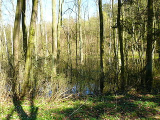
Promno Landscape Park is a protected area in west-central Poland.
Nowa Przerośl is a village in the administrative district of Gmina Przerośl, within Suwałki County, Podlaskie Voivodeship, in north-eastern Poland.
Nowy Skarżyn is a village in the administrative district of Gmina Zambrów, within Zambrów County, Podlaskie Voivodeship, in north-eastern Poland.
Zaręby-Kromki is a village in the administrative district of Gmina Zambrów, within Zambrów County, Podlaskie Voivodeship, in north-eastern Poland.
Wola Gruszowska is a village in the administrative district of Gmina Radziemice, within Proszowice County, Lesser Poland Voivodeship, in southern Poland.

Kromarki is a village in the administrative district of Gmina Bartoszyce, within Bartoszyce County, Warmian-Masurian Voivodeship, in northern Poland, close to the border with the Kaliningrad Oblast of Russia. It lies approximately 10 kilometres (6 mi) north of Bartoszyce and 64 km (40 mi) north of the regional capital Olsztyn.
Wanishi Station is a train station in Muroran, Hokkaidō, Japan.

Alexeevca is a village in Edineț District, Moldova.
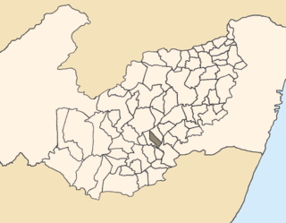
Calçado is a city located in the state of Pernambuco, Brazil. Located at 200 km away from Recife, capital of the state of Pernambuco. Has an estimated population of 11,619 inhabitants.
Zinacatepec (municipality) is a town and municipality in Puebla in south-eastern Mexico.
Bahçecik is a village in the District of Haymana, Ankara Province, Turkey.
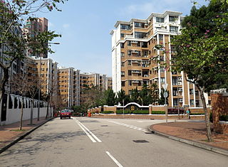
Parc Oasis is a private housing estate in Yau Yat Chuen, Kowloon, Hong Kong, located near MTR Kowloon Tong Station. It is one of the largest development in Yau Yat Chuen. After the completion of the Festival Walk in 1998, shopping, watching movies and dining were more convenient. Nearby area in Kowloon Tong is a place of many famous kindergartens, primary and secondary schools.
Bora Gagangohalia is a census town under Bishnupur police station of Bishnupur II CD Block in Alipore Sadar subdivision of South 24 Parganas district in the Indian State of West Bengal. It is a part of Kolkata Urban Agglomeration.


