Ondame | |
|---|---|
Village | |
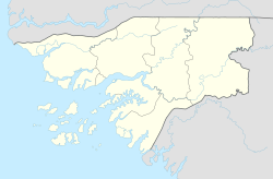 Ondame Location in Guinea-Bissau | |
| Coordinates: 11°46′N15°56′W / 11.767°N 15.933°W | |
| Country | |
| Region | Biombo |
| Sector | Quinhámel |
| Time zone | UTC+0 (GMT) |
Ondame is a village in the Biombo Region of Guinea-Bissau.
Ondame | |
|---|---|
Village | |
| Ondame Location in Guinea-Bissau | |
| Coordinates: 11°46′N15°56′W / 11.767°N 15.933°W | |
| Country | |
| Region | Biombo |
| Sector | Quinhámel |
| Time zone | UTC+0 (GMT) |
Ondame is a village in the Biombo Region of Guinea-Bissau.
It lies on the coast, west of Bissau where the Mansoa River flows into the sea. [1] [2]

Guinea-Bissau, officially the Republic of Guinea-Bissau, is a country in West Africa that covers 36,125 square kilometres (13,948 sq mi) with an estimated population of 2,026,778. It borders Senegal to its north and Guinea to its southeast.

Bissau is the capital and largest city of Guinea-Bissau. As of 2015, it had a population of 492,004. Bissau is located on the Geba River estuary, off the Atlantic Ocean, and is Guinea-Bissau's largest city, major port, its administrative and military center.

Guinea-Bissau Creole, also known as Kiriol or Crioulo, is a creole language whose lexicon derives mostly from Portuguese. It is spoken in Guinea Bissau, Senegal and The Gambia. It is also called by its native speakers as guinensi, kriyol, or portuguis.
Bissau is a town and a municipality in Jhunjhunu district in the state of Rajasthan, India.
Dori Airport is a public use airport located 2 nm west of Dori, Séno, Burkina Faso.
Jolmete is a village in the Cacheu Region of northwestern Guinea-Bissau, to the south of the Cacheu River.
Uacaba is a village in the Gabú Region of central-eastern Guinea-Bissau. It is located 40 km north-east from Bafatá and 180 km from the capital Bissau, 120 km south-east of Guinea-Bissau – Senegal border. It has a population of 140 people.
Lenquete is a village in the Gabú Region of central-eastern Guinea-Bissau. It lies to the northwest of Gabú.
Uelíngarà is a village in the Gabú Region of north-eastern Guinea-Bissau. It lies to the south of Gabú and north of Canjadude.
Enxalé is a village in the Oio Region of western-central Guinea-Bissau. It lies near the confluence of the Geba and Corubal rivers.
Jabadá is a village in the Oio Region of western-central Guinea-Bissau. It lies on the southern bank of the Geba River.
Alabato is a village in the Oio Region of northern Guinea-Bissau. Alabato has a wet, tropical savannah climate.
Bubaque Airport is an airport serving the island town of Bubaque, in Guinea-Bissau. It is the Bijagos Archipelago's only airfield.
Bafatá Airport is an airport serving Bafatá in Guinea-Bissau. The dirt runway doubles as an avenue named Av. Brasil and may have vehicular traffic.
Cufar Airport is an airport serving Cufar, a village in the Tombali Region of Guinea-Bissau.
African Alliance Investment Bank (AAIB) is "an investment banking group" operating in Africa.
Quebo Airport is an airstrip serving the adjacent towns of Quebo and Aldeia in the Tombali Region of Guinea-Bissau. Quebo's national airport code is GG64.
Nova Lamego Airport is an airport serving the city of Gabú, the capital of the Gabú Region of Guinea-Bissau.
| | This Guinea-Bissau location article is a stub. You can help Wikipedia by expanding it. |