
San Bernardino County, officially the County of San Bernardino and sometimes abbreviated as S.B. County, is a county located in the southern portion of the U.S. state of California, and is located within the Inland Empire area. As of the 2020 U.S. Census, the population was 2,181,654, making it the fifth-most populous county in California and the 14th-most populous in the United States. The county seat is San Bernardino.

Upland is a city in San Bernardino County, California, United States on the border with neighboring Los Angeles County. The municipality is located at an elevation of 1,242 feet (379 m). As of the 2020 census, the city had a population of 79,040, up from 73,732 at the 2010 census.
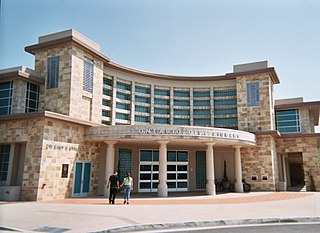
Ontario is a city in southwestern San Bernardino County in the U.S. state of California, 35 miles (56 km) east of downtown Los Angeles and 23 miles (37 km) west of downtown San Bernardino, the county seat. Located in the western part of the Inland Empire metropolitan area, it lies just east of Los Angeles County and is part of the Greater Los Angeles Area. As of the 2020 census, the city had a population of 175,265.

A townhouse, townhome, town house, or town home, is a type of terraced housing. A modern townhouse is often one with a small footprint on multiple floors. In a different British usage, the term originally referred to any type of city residence of someone whose main or largest residence was a country house.

Swansea is a neighbourhood in the city of Toronto, Ontario, Canada, bounded on the west by the Humber River, on the north by Bloor Street, on the east by High Park and on the south by Lake Ontario. The neighbourhood was originally a separate municipality, the Village of Swansea, which became part of Metropolitan Toronto in 1953.
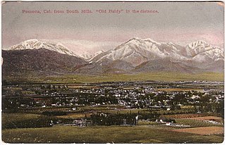
The Pomona Valley is located in the Greater Los Angeles Area between the San Gabriel Valley and San Bernardino Valley in Southern California. The valley is approximately 30 miles (48 km) east of downtown Los Angeles.

Chaffey College is a public community college in Rancho Cucamonga, California. The college serves students in Chino, Chino Hills, Fontana, Montclair, Ontario, Rancho Cucamonga and Upland. It is the oldest community college in California.

Rancho Cucamonga was a 13,045-acre Mexican land grant in present-day San Bernardino County, California, given in 1839 to the dedicated soldier, smuggler and politician Tiburcio Tapia by Mexican governor Juan Bautista Alvarado. The grant formed parts of present-day California cities Rancho Cucamonga and Upland. It extended easterly from San Antonio Creek to what is now Hermosa Avenue, and from today's Eighth Street to the mountains.

Arrowhead Springs is a highly mountainous neighborhood in the 81-square-mile (210 km2) municipality of San Bernardino, California, officially annexed to the city on November 19, 2009. The neighborhood lies below the Arrowhead geological monument, which is California Historical Landmark #977.
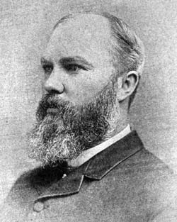
George Chaffey was a Canadian engineer, inventor and entrepreneur who with his brother William developed large parts of Southern California, including what became the community of Etiwanda and the cities of Ontario, and Upland. They undertook similar developments in Australia, which became the city of Mildura, and the town of Renmark and Paringa.
Manzanar was a town in Inyo County, California, founded by water engineer and land developer George Chaffey. Most notably, Manzanar is known for its role in the internment of Japanese Americans during World War II.

Alta Loma is one of three unincorporated areas that became part of the city of Rancho Cucamonga, California, United States in 1977. The community is located at 34.15°N 117.60°W in the foothills of the south face of the San Gabriel Mountain range, near Cucamonga Peak and Mount San Antonio. Its ZIP codes are 91701 and 91737. Elevation ranges from 1,400 feet (430 m) to 3,000 feet (910 m). The name comes from the Spanish words for "high hill." Alta Loma had previously been known as "Iamosa".

Chaffey Joint Union High School District is a 9–12 school district located in San Bernardino County, California, United States that serves the communities of Ontario, Montclair, Rancho Cucamonga, and portions of Fontana, Upland, Chino, and Mount Baldy. With more than 25,000 students, it is one of the largest high school districts in the state. The district operates eight comprehensive high schools, one online high school, one continuation high school, one community day school, and one adult education school.

The Newhall Land and Farming Company is a land management company based in Valencia which is part of Santa Clarita, United States. The company is responsible for the master community planning of Valencia and previously developed other areas such as Canyon Country and Newhall which together with Saugus and Valencia merged creating the city of Santa Clarita in 1987. The company is also responsible for the management of farm land elsewhere in the state.

Berczy Village is a residential neighbourhood in Markham, Ontario, Canada. It is bounded to the north by Major Mackenzie Drive, to the east by McCowan Road, to the south by 16th Avenue, and to the west by Kennedy Road. This area is north of Unionville. The community is named after William Berczy, Markham's founder. The name is shown on limestone plaques throughout the community's arterial road entrances.
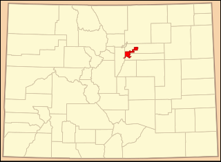
Central Park, previously Stapleton, is a neighborhood within the city limits of Denver and Aurora, Colorado. Located east of downtown Denver, the neighborhood is at the former site of the decommissioned Stapleton International Airport, which closed in 1995. It is the largest residential neighborhood within the city of Denver. The Central Park Neighborhood contains twelve specifically named sub-neighborhoods, 11 public/private schools, 50 parks, 7 pools, several shopping and business districts, a city of Denver recreation center, and a Denver library. The latest population as of 2022 is estimated at 30,000.
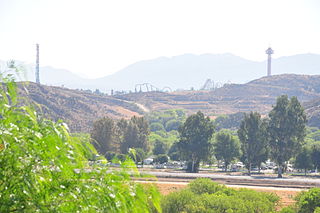
Valencia is an unincorporated community in northwestern Los Angeles County, California, United States. The area, west of Interstate 5, is expanding with residential development and already includes major commercial and industrial parks. It straddles State Route 126 and the Santa Clara River.
Summit Heights is a planned community in north Fontana, California.
Somerset Green is a gated community in Houston, Texas, developed by Hines Interests Limited Partnership. Nancy Sarnoff of the Houston Chronicle described Somerset Green as "a European-style residential development". Preston Wood & Associates was the land planner of the development.


