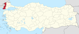
Edirne Province is a Turkish province located in East Thrace. Part of European Turkey, it is one of only three provinces located entirely within continental Europe. Edirne Province is bordered by Tekirdağ Province and Kırklareli Province to the east, and the Gallipoli peninsula of Çanakkale Province to the south-east. It shares international borders with Bulgaria to the north and Greece to the west.

The naval Battle of Zonchio took place on four separate days: 12, 20, 22 and 25 August 1499. It was a part of the Ottoman–Venetian War of 1499–1503. It was the first naval battle in history in which cannons were used on ships.

The Battle of Rymnik on September 22, 1789 took place in Wallachia, near Râmnicu Sărat, during the Russo-Turkish War of 1787-1792. The Russian general Alexander Suvorov, acting together with the Habsburg general Prince Josias of Coburg, attacked the main Ottoman army under Grand Vizier Cenaze Hasan Pasha. The result was a crushing Russo-Austrian victory.

Bátmonostor is a village in Bács-Kiskun county, in the Southern Great Plain region of southern Hungary.
Viengthong is a district (muang) of Bolikhamsai province in central Laos.

Kiwajny is a village in the administrative district of Gmina Górowo Iławeckie, within Bartoszyce County, Warmian-Masurian Voivodeship, in northern Poland, close to the border with the Kaliningrad Oblast of Russia. It lies approximately 13 kilometres (8 mi) north-west of Górowo Iławeckie, 30 km (19 mi) north-west of Bartoszyce, and 66 km (41 mi) north of the regional capital Olsztyn.

Kakki Reservoir is a reservoir, located in Pathanamthitta district of Kerala, India. The lake, which was created when Kakki dam and Anathode dam were built, is on one of the tributaries of Pamba, the Kakki tributary. The dams were built in 1966 as part of the Sabarigiri Hydroelectric project. Full reservoir level (FRL) is 981.45 meters above sea level according to the operators of the "twin" reservoirs, the Kerala State Electricity Board. The reservoir, which is also a tourist spot, is nestled in the Ranni reserve forest, very close to the Western Ghats.
Dodurga Dam is a dam in Sinop Province, Turkey, built between 1990 and 2000. The development was backed by the Turkish State Hydraulic Works.
Gölköy Dam is a dam in Bolu, Turkey, built between 1965 and 1970. The development was backed by the Turkish State Hydraulic Works.
Gülüç Dam is a dam in Zonguldak Province, Turkey, built between 1964 and 1966. The development was backed by the Turkish State Hydraulic Works.
Çakırtaş is a village in the District of Vezirköprü, Samsun Province, Turkey.
Çalköy is a village in the District of Vezirköprü, Samsun Province, Turkey.
Çaltı is a village in the district of Vezirköprü, Samsun Province, Turkey.
Çamlıca is a village in the District of Vezirköprü, Samsun Province, Turkey.
Çeltek is a village in the district of Vezirköprü, Samsun Province, Turkey.
Yolpınar is a village in the District of Vezirköprü, Samsun Province, Turkey.
Köprübaşı is a village in the Vezirköprü, Samsun Province, Turkey.
Musallar is a village in the District of Kastamonu, Kastamonu Province, Turkey.
Halife is a village in the district of Kastamonu, Kastamonu Province, Turkey.
Crenides or Krenides, or Cranides or Kranides (Κρανίδες), was a town on the Pontic coast of Bithynia, according to Arrian 60 stadia east of Sandaraca; according to Marcian only 20 stadia. It was between Heraclea and the mouth of the Billaeus.


