Oost-Maarland

Last updated

Oost-Maarland
Village
St Jozefkerk te Oost.jpeg
St Jozefkerk at Oost, also attended by inhabitants of Maarland
Netherlands location map.svg
Red pog.svg
Oost-Maarland
Location in the Netherlands
2010-NL-P11-Limburg-positiekaart-gemnamen.jpg
Red pog.svg
Oost-Maarland
Location in the province of Limburg in the Netherlands
Coordinates: 50°47′41″N5°42′47″E / 50.79472°N 5.71306°E / 50.79472; 5.71306 Coordinates: 50°47′41″N5°42′47″E / 50.79472°N 5.71306°E / 50.79472; 5.71306
Country Netherlands
Province Limburg
Municipality Eijsden-Margraten
Area
[1]
  Total1.10 km2 (0.42 sq mi)
Elevation
[2]
56 m (184 ft)
Population
 (2021) [1]
  Total950
  Density860/km2 (2,200/sq mi)
Time zone UTC+1 (CET)
  Summer (DST) UTC+2 (CEST)
Postal code
6245 [1]
Dialing code 043
Major roadsA2

Oost-Maarland is a village in the south east of the European country Netherlands. There it is an administrative population centre in the Eijsden-Margraten municipality, which forms part of the Province of Limburg. In fact Oost-Maarland consists of two separate places with a different history. One is the village and former municipality of Oost, whereas the other is an in a distance of a few hundred metres separately to the southeast situated township called Maarland.

Contents

Oost-Maarland is located some 3 km north of Eijsden, the biggest place in the municipality and 7 kilometers (4.3 mi) south of Maastricht, the provincial capital. In its northeast it borders Rijckholt and in its east and southeast the Sint Geertruid part of the Savelsbos hillside forest, which is part of the "Margraten plateau". In the west it borders the Meuse river, across which marks the border with Belgium, specifically the Liège province of Wallonia.

Inbetween Maarland and this forest since a few decennia passes the E25 highway. In between Oost and Maarland passes the railroad Liège-Maastricht. The former station on this location however doesn't exist any more.

Of the total number of about 960 inhabitants Oost has some more than 600 and Maarland some more than 300.

History

Historically Oost and Maarland are two different places.

Oost once was a seignory and a municipality of its own. (A castle and a (by now folkloristic) civic guard still witness of this era). As such for centuries Oost was a "ban" of the Dalhem county. Since the Peace of Münster in 1648 it is part of the Northern Netherlands.

Maarland once was a separately situated township of the signory of Breust, which in its turn belonged to the Liège St. Martin church. When in 1828 Breust and Oost became part of the Eijsden municipality, Maarland (which has no basic school, nor a church of its own) was added to Oost.

Thus until 1 January 2011 Oost-Maarland was part of the Eijsden municipality; on that date this municipality merged with the neighbouring one of Margraten.

From 1 January 2018, the Netherlands and Belgium peacefully swapped territory on the River Meuse just west from Maarland, in an agreement signed in 2016. [3]

Place name

Although Maarland since 1828 is a township of Oost, the relevant administrative population centre then was named "Oost-Maarland". This name is somewhat confusing as Oost is also the Dutch word for East, so that it seems as if this place were the eastern part of Maarland. Besides Oost and Maarland are situated aside each other, but Oost (despite its name) on the western side, near the river Meuse and Maarland just to the southeast. So "Oost en Maarland" ("Oost and Maarland") as a name would be more clear.

The name "Oost" by the way has nothing to do with location. It is said to be derived from "Augusta". Once Saint Augusta of Treviso was the patron saint of this village, that then was called "Augustakirchen", after the church, that then was there, dedicated to that saint. By the 18th century already the name had been deformed to "Aoust").

Culture

Apart from the Oost civic guard there is other folklore in this village; like in many other villages in this region, mostly on festival days. In Oost-Maarland some of these are joint and others are separate.

There's also a common soccer club, of which the playing field at the moment is located in Maarland. Its name is "Oranje Boys" ("Orange Boys", not to be confounded with "Orange", which is the popular name of the Duch national team, that by the way also mostly plays in orange shirts).

Furthermore, there's a common fanfare, a common carnival society and a common church chorus.

Folkloristic events around the civic guard

Every two years the civic guard [4] organises the so called Vogelschieten [5] (Bird-shooting), a contest in which is decided who will be the next shooting-king. He who shoots the very last part of a wooden bird from the high mast it was mounted on, obtains that title for the next two years and has the right to decide who will be 'his' queen during this period. On the same date in the next year there's a celebration in honor of the shooting-king.

Folkloristic "Goose beheading" in Maarland

In the eighties of the 20th century the hamlet of Maarland was repeatedly in the news with the folkloristic event "Gansslaan" (goose beheading) that was held annually on a feast day. [6] At this event, blindfolds alternately tried to slap the head of an upside-down dead goose with a saber, which was complicated by the application of a thick iron wire in the animal's neck. Although this was no longer a living goose, as was originally the case, around 1985 no municipal license was granted any more for this somewhat barbaric popular entertainment, in which the dead blood spurted around. The appeals procedure of local residents to get the refusal of a license undone was rejected by the highest national administrative judge. Since then, the event has been replaced by another with a fake goose being thrown.

Economy

Agriculture for a long time has been and partly still is one of the main economical activities in Oost and Maarland, that both have relatively vast outlying areas; in particular:

Apart from that for a long time jobs in industry and provision of services in nearby bigger places have been and still are bringing employment.

Furthermore, since a number of farms have lost (a considerable part of) their agricultural grounds due to several causes, such as extraction of grit in the river area and industrial as well as housing projects, most of them have been rebuilt thus, that in former business buildings like stables now touristic apartments are rented out.

Nature

A big part of the former fruit-tree area in Oost has been destroyed in the extraction of grit, which was abundantly present in the soil near the river. By now there's a lot of water around there, some water-recreation and some wild nature: a reservation called "Eijsder beemden" ("Eijsden meadows"), which in fact are the "Oost meadows". [7]

Environment

Map Eijsden-Margraten. (Oost-Maarland on the left, near the dark blue water; (best visible after three clicks on map)) 2013-Top33-gem-Eijsden-Margraten.jpg
Map Eijsden-Margraten. (Oost-Maarland on the left, near the dark blue water; (best visible after three clicks on map))

People

See also

Related Research Articles

Limburg (Netherlands) Province of the Netherlands

Limburg is the southernmost of the 12 provinces of the Netherlands. The province is bordered by the province of Gelderland to the north and by North Brabant to its west. Its long eastern boundary forms the international border with the state of North Rhine-Westphalia in Germany. To the west is the international border with the similarly named Belgian province of Limburg, part of which is delineated by the river Meuse. The Vaalserberg is on the extreme south-eastern point, marking the tripoint of the Netherlands, Germany and Belgium.

Limburg (Belgium) Province of Belgium

Limburg is a province in Belgium. It is the easternmost of the five Dutch-speaking provinces that together form the Region of Flanders, one of the three main political and cultural sub-divisions of modern Belgium.

Eijsden Village in the Dutch province of Limburg

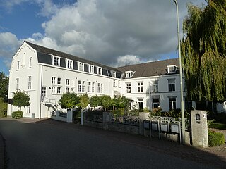
Eijsden is a village situated in the very south of the European country the Netherlands. It is located in the southeastern part of the province of Limburg.

Roermond City and municipality in Limburg, Netherlands

Roermond is a city, a municipality, and a diocese in the southeastern part of the Netherlands. Roermond is a historically important town on the lower Roer at the east bank of the river Meuse. In 1231 it received town rights. Roermond's town centre has become a designated conservation area.

Visé Municipality in Liège Province, Belgium

Visé is a city and municipality of Wallonia, located on the river Meuse in the province of Liège, Belgium.

Jeker Tributary of the Meuse through Belgium and Netherlands

The Jeker is a river in Belgium and in the Netherlands. It is a left-bank tributary to the river Meuse. The source of the Jeker is near the village of Geer, in the Belgian province of Liège. The river is approximately 54 kilometres (34 mi) long, of which about 50 kilometres (31 mi) is in Belgium and 4 kilometres (2.5 mi) in the Netherlands, where it flows into the river Meuse at Maastricht (Netherlands).

Bemelen Village in Limburg, Netherlands

Bemelen is a village in the Dutch province of Limburg. It is part of the municipality of Eijsden-Margraten, and lies about 5 km east of Maastricht.

Eckelrade Village in Limburg, Netherlands

Eckelrade is a village in the Dutch province of Limburg. It is part of the municipality of Eijsden-Margraten, and situated about 8 km southeast of the town of Maastricht.

Breust is a former village in the Dutch province of Limburg. It is located in the municipality of Eijsden-Margraten, and is now a neighbourhood of Eijsden.

Gronsveld Village in Limburg, Netherlands

Gronsveld is a village in the Dutch province of Limburg. It is part of the municipality of Eijsden-Margraten and situated southeast of the municipality of Maastricht, to which it is bordering.

Mesch Village in Limburg, Netherlands

Mesch is a village in the Dutch province of Limburg. It is located in the municipality of Eijsden-Margraten, quite near to the Netherlands' the southerly border with Belgium, on the other side of which the neighbouring village of Moelingen is situated. In its northwest, Mesch borders the larger village of Eijsden, whereas the city and municipality of Maastricht lies about 10 km farther to the north. The relatively small Voer river, which has its source in Belgium, passes through this village among other streams and waterways, before draining into the Meuse river at Eijsden. The Mergellandroute, a route often used by tourists and mapped out by the ANWB, also passes through Mesch.

Oost, Limburg

Oost is a village in the south of the Netherlands. There it is situated near the "Maas" ("Meuse") river in the southwestern part of the province of Limburg.

Sint Geertruid Village in Limburg, Netherlands

Sint Geertruid is a village in the Dutch province of Limburg. It is located the municipality of Eijsden-Margraten.

Voer

The Voer is a small river in Belgium and the Netherlands. It is a right-bank tributary to the river Meuse. It has three (creek-) tributaries of its own: the Veurs, the Noor and the Beek.

Maastricht railway station

Maastricht railway station is located in Maastricht in Limburg, Netherlands. It is the main railway station in Limburg's capital city. It is the southern terminus of the Alkmaar–Maastricht intercity service by NS. Additionally, Arriva and the Belgian NMBS serve the station with local trains.

Mosan Renaissance, also known as Maasland Renaissance, is a regional architectural style dating from the 16th and 17th centuries. The style is only remotely related to Renaissance architecture. The term should not be confused with Mosan art, which applies to Romanesque art and architecture during the Middle Ages in the region of the Meuse river valley.

Eijsden-Margraten Municipality in Limburg, Netherlands

Eijsden-Margraten (Dutch pronunciation: [ˌɛizdəˈmɑrɣraːtə ]; is a municipality situated in the very south of the Netherlands. There it is located in the southeastern part of the province of Limburg.

Moelingen Village in Flemish Community, Belgium

Moelingen is a village in the municipality of Voeren, which is part of the province of Limburg in Belgium.

Belgium–Netherlands border International border

The Belgium–Netherlands border separates Belgium and the Netherlands and is 450 km (280 mi) long.

Noor (Meuse)

The Noor or Langwater is a river in the Netherlands and Belgium. The Noor is a right-bank tributary to the river Voer, which later joins the Meuse. Rising in Eijsden-Margraten, in the Dutch province of Limburg, the Noor eventually drains in the river Voer in Voeren, in the Belgian province of Limburg.

References

  1. 1 2 3 "Kerncijfers wijken en buurten 2021". Central Bureau of Statistics. Retrieved 24 April 2022. two entries
  2. "Postcodetool for 6245AA". Actueel Hoogtebestand Nederland (in Dutch). Het Waterschapshuis. Retrieved 24 April 2022.
  3. Crisp, James (4 January 2018). "Belgium and Holland swap territory and move border after headless body shock". The Telegraph.
  4. https://commons.wikimedia.org/wiki/Category:Maestrichtsche_DD_Stadsschutterij#/media/File:20180603_Maastricht_Heiligdomsvaart_129.jpg / image of a civic guard
  5. https://nl.wikipedia.org/wiki/Schuttersfeest WpNl-article on Vogelschieten
  6. "Digibron.nl, ,Gansslaan' tijdens feest verboden".
  7. www.limburgs-landschap.nl/gebieden/eijsder-beemden.