Orane

Last updated • a couple of secsFrom Wikipedia, The Free Encyclopedia
Orane
Village
Orane - Orane.jpg
Serbia adm location map.svg
Red pog.svg
Orane
Coordinates: 42°59′08″N21°37′41″E / 42.98556°N 21.62806°E / 42.98556; 21.62806
CountryFlag of Serbia.svg  Serbia
District Jablanica District
Municipality Bojnik
Population (2002)
  Total 152
Time zone CET (UTC+1)
  Summer (DST) CEST (UTC+2)

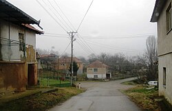
Orane is a village in the municipality of Bojnik, Serbia. According to the 2002 census, the village has a population of 152 people. [1]

Related Research Articles

References

  1. Popis stanovništva, domaćinstava i Stanova 2002. Knjiga 1: Nacionalna ili etnička pripadnost po naseljima. Republika Srbija, Republički zavod za statistiku Beograd 2003. ISBN   86-84433-00-9

Coordinates: 42°59′08″N21°37′41″E / 42.98556°N 21.62806°E / 42.98556; 21.62806

Geographic coordinate system Coordinate system

A geographic coordinate system is a coordinate system that enables every location on Earth to be specified by a set of numbers, letters or symbols. The coordinates are often chosen such that one of the numbers represents a vertical position and two or three of the numbers represent a horizontal position; alternatively, a geographic position may be expressed in a combined three-dimensional Cartesian vector. A common choice of coordinates is latitude, longitude and elevation. To specify a location on a plane requires a map projection.