Oregon, Tennessee

Last updated

Oregon is a ghost town in Wilson County, in the U.S. state of Tennessee. [1]

Ghost town City depopulated of inhabitants and that stays practically intact

A ghost town is an abandoned village, town, or city, usually one that contains substantial visible remains. A town often becomes a ghost town because the economic activity that supported it has failed, or due to natural or human-caused disasters such as floods, prolonged droughts, government actions, uncontrolled lawlessness, war, pollution, or nuclear disasters. The term can sometimes refer to cities, towns, and neighbourhoods that are still populated, but significantly less so than in past years; for example, those affected by high levels of unemployment and dereliction.

Wilson County, Tennessee County in the United States

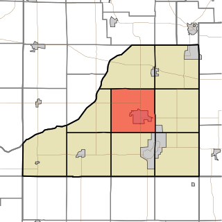
Wilson County is a county located in the U.S. state of Tennessee. As of the 2010 census, the population was 113,993. Its county seat is Lebanon. The largest city is Mt. Juliet.

U.S. state constituent political entity of the United States

In the United States, a state is a constituent political entity, of which there are currently 50. Bound together in a political union, each state holds governmental jurisdiction over a separate and defined geographic territory and shares its sovereignty with the federal government. Due to this shared sovereignty, Americans are citizens both of the federal republic and of the state in which they reside. State citizenship and residency are flexible, and no government approval is required to move between states, except for persons restricted by certain types of court orders. Four states use the term commonwealth rather than state in their full official names.

History

The community was named after the territory of Oregon. [2]

Oregon State of the United States of America

Oregon is a state in the Pacific Northwest region on the West Coast of the United States. The Columbia River delineates much of Oregon's northern boundary with Washington, while the Snake River delineates much of its eastern boundary with Idaho. The parallel 42° north delineates the southern boundary with California and Nevada. Oregon is one of only three states of the contiguous United States to have a coastline on the Pacific Ocean.

Related Research Articles

Munising Township, Michigan Civil township in Michigan, United States

Munising Township is a civil township of Alger County in the U.S. state of Michigan. As of the 2010 census, the township population was 2,983.

Bell Buckle, Tennessee Town in Tennessee, United States

Bell Buckle is a town in Bedford County, Tennessee, United States. The population was 500 at the 2010 census. The downtown area is listed on the National Register of Historic Places as the Bell Buckle Historic District.

Ardmore, Tennessee City in Tennessee, United States

Ardmore is a city in Giles and Lincoln counties, Tennessee. The population was 1,213 at the 2010 census. Ardmore is the site of a Tennessee Department of Tourist Development Welcome Center. It borders its sister city, Ardmore, Alabama.

Government Island (Oregon) Island on the Columbia River in Oregon, United States

Government Island is a 1,760-acre (710 ha) island in the Columbia River north of Portland, in Multnomah County, in the U.S. state of Oregon. Though Interstate 205 passes over it on the Glenn L. Jackson Memorial Bridge, access to the island is only by boat. There is a city controlled locked gate in the 205 fence.

North Crane, Indiana Unincorporated community in Indiana, United States

North Crane is a small unincorporated community in Wea Township, Tippecanoe County, in the U.S. state of Indiana.

Center Township, Starke County, Indiana Township in Indiana, United States

Center Township is one of nine townships in Starke County, in the U.S. state of Indiana. As of the 2010 census, its population was 6,229 and it contained 2,650 housing units.

Oregon Township, Starke County, Indiana Township in Indiana, United States

Oregon Township is one of nine townships in Starke County, in the U.S. state of Indiana. As of the 2010 census, its population was 3,367 and it contained 1,718 housing units.

Grovertown, Indiana Unincorporated community in Indiana, United States

Grovertown is an unincorporated community in southeastern Oregon Township, Starke County, in the U.S. state of Indiana.

1978 U.S. Womens Open Golf Championship

The 1978 U.S. Women's Open Golf Championship was the 33rd U.S. Women's Open, held July 20–23 at Country Club of Indianapolis in Indianapolis, Indiana.

1980 U.S. Womens Open Golf Championship

The 1980 U.S. Women's Open Golf Championship was the 35th U.S. Women's Open, held July 10–13 at Richland Country Club in Nashville, Tennessee.

Aymett Town is an unincorporated community in Giles County, Tennessee, in the United States.

Beech Hill is an unincorporated community in Franklin County, in the U.S. state of Tennessee.

Beech Hill is an unincorporated community in Giles County, in the U.S. state of Tennessee.

Belmont is an unincorporated community in Anderson County, in the U.S. state of Tennessee.

Oregon is a ghost town in Boone County, in the U.S. state of Arkansas.

Oregon is an unincorporated community in Lancaster County, in the U.S. state of Pennsylvania.

Rockland is an unincorporated community in Warren County, in the U.S. state of Kentucky.

Cainsville is an unincorporated community in Wilson County, in the U.S. state of Tennessee.

Lillard Mill is an extinct town in Marshall County, in the U.S. state of Tennessee. The GNIS classifies it as a populated place.

References

Coordinates: 35°58′09″N86°12′46″W / 35.969229°N 86.212768°W / 35.969229; -86.212768

Geographic coordinate system Coordinate system

A geographic coordinate system is a coordinate system that enables every location on Earth to be specified by a set of numbers, letters or symbols. The coordinates are often chosen such that one of the numbers represents a vertical position and two or three of the numbers represent a horizontal position; alternatively, a geographic position may be expressed in a combined three-dimensional Cartesian vector. A common choice of coordinates is latitude, longitude and elevation. To specify a location on a plane requires a map projection.