Osmanlı, Alaplı

Last updated
Osmanlı
Village
Country Flag of Turkey.svg  Turkey
Province Zonguldak Province
District Alaplı
Time zone EET (UTC+2)
  Summer (DST) EEST (UTC+3)

Osmanlı is a village in Alaplı District, Zonguldak Province, Turkey. [1]

Alaplı Place in Zonguldak, Turkey

Alaplı is a town and district of Zonguldak Province in the Black Sea region of Turkey. It is the westernmost town in Zonguldak Province and is located about 15 km (9.3 mi) south of Karadeniz Ereğli. It has 2 municipalities, one is the centre and the other is named as "Gümeli". The mayor is Nuri Tekin (CHP).

Zonguldak Province Municipality in Turkey

Zonguldak Province is a province along the western Black Sea coast region of Turkey. The province is 3.481 km2 in size and has a population of 619,703. Its adjacent provinces are Düzce to the southwest, Bolu to the south, Karabük to the southeast, and Bartın to the east. The capital is Zonguldak.

Turkey Republic in Western Asia

Turkey, officially the Republic of Turkey, is a transcontinental country located mainly in Western Asia, with a smaller portion on the Balkan Peninsula in Southeast Europe. East Thrace, located in Europe, is separated from Anatolia by the Sea of Marmara, the Bosphorous strait and the Dardanelles. Turkey is bordered by Greece and Bulgaria to its northwest; Georgia to its northeast; Armenia, the Azerbaijani exclave of Nakhchivan and Iran to the east; and Iraq and Syria to the south. Istanbul is the largest city, but more central Ankara is the capital. Approximately 70 to 80 per cent of the country's citizens identify as Turkish. Kurds are the largest minority; the size of the Kurdish population is a subject of dispute with estimates placing the figure at anywhere from 12 to 25 per cent of the population.
Related Research Articles

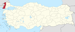
Edirne Province Province of Turkey in West Marmara

Edirne Province is a Turkish province located in East Thrace. Part of European Turkey, it is one of only three provinces located entirely within continental Europe. Edirne Province is bordered by Tekirdağ Province and Kırklareli Province to the east, and the Gallipoli peninsula of Çanakkale Province to the south-east. It shares international borders with Bulgaria to the north and Greece to the west.

Dodurga Dam is a dam in Sinop Province, Turkey, built between 1990 and 2000. The development was backed by the Turkish State Hydraulic Works.

Gölköy Dam is a dam in Bolu, Turkey, built between 1965 and 1970. The development was backed by the Turkish State Hydraulic Works.

Gülüç Dam is a dam in Zonguldak Province, Turkey, built between 1964 and 1966. The development was backed by the Turkish State Hydraulic Works.

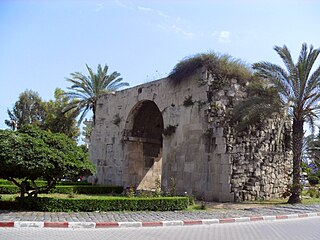
Cleopatras Gate

Cleopatra's Gate is a city gate of Tarsus, in Mersin Province, Turkey, named after the Egyptian queen Cleopatra VII.

Çakırtaş is a village in the District of Vezirköprü, Samsun Province, Turkey.

Çalköy is a village in the District of Vezirköprü, Samsun Province, Turkey.

Çaltı is a village in the district of Vezirköprü, Samsun Province, Turkey.

Çamlıca is a village in the District of Vezirköprü, Samsun Province, Turkey.

Çeltek is a village in the district of Vezirköprü, Samsun Province, Turkey.

Yeniçelik is a village in the District of Vezirköprü, Samsun Province, Turkey.

Sofular is a village in the Vezirköprü, Samsun Province, Turkey.

Yolpınar is a village in the District of Vezirköprü, Samsun Province, Turkey.

Köprübaşı is a village in the Vezirköprü, Samsun Province, Turkey.

Kardef is a village in Chelo Rural District, Chelo District, Andika County, Khuzestan Province, Iran. At the 2006 census, its population was 304, in 40 families.

Näpi is an alevik (Borough) in Rakvere Parish, Lääne-Viru County, Northern Estonia. It is located at 59° 22' N, 26° 25′ E.

Musallar is a village in the District of Kastamonu, Kastamonu Province, Turkey.

Halife is a village in the district of Kastamonu, Kastamonu Province, Turkey.

Fethiye Mosque (Krujë)

The Sultan Mehmed Fatih mosque of Krujë or Fethiye Mosque is an Ottoman-era mosque built before 1481 inside the Krujë Castle of Krujë, Albania. It is near the entrance of the Skanderbeg Museum.

Crenides or Krenides, or Cranides or Kranides (Κρανίδες), was a town on the Pontic coast of Bithynia, according to Arrian 60 stadia east of Sandaraca; according to Marcian only 20 stadia. It was between Heraclea and the mouth of the Billaeus.

References

  1. "Koyler" (in Turkish). Yerelnet.org. Retrieved 1 November 2015.

Coordinates: 41°10′59″N31°24′58″E / 41.1831°N 31.4161°E / 41.1831; 31.4161

Geographic coordinate system Coordinate system

A geographic coordinate system is a coordinate system that enables every location on Earth to be specified by a set of numbers, letters or symbols. The coordinates are often chosen such that one of the numbers represents a vertical position and two or three of the numbers represent a horizontal position; alternatively, a geographic position may be expressed in a combined three-dimensional Cartesian vector. A common choice of coordinates is latitude, longitude and elevation. To specify a location on a plane requires a map projection.