Ospedaletto Lodigiano

Last updated
Ospedaletto Lodigiano
Comune
Comune di Ospedaletto Lodigiano
Ospedaletto Lodigiano - via Balbi.jpg
Map - IT - Lodi - Ospedaletto Lodigiano.png
Italy provincial location map 2015.svg
Red pog.svg
Ospedaletto Lodigiano
Location of Ospedaletto Lodigiano in Italy
Coordinates: 45°12′N9°34′E / 45.200°N 9.567°E / 45.200; 9.567 Coordinates: 45°12′N9°34′E / 45.200°N 9.567°E / 45.200; 9.567
Country Italy
Region Lombardy
Province Lodi (LO)
Government
  Mayor Lucia Mizzi
Area
  Total 8.5 km2 (3.3 sq mi)
Elevation 64 m (210 ft)
Population (30 November 2012) [1]
  Total 1,843
  Density 220/km2 (560/sq mi)
Demonym(s) Ospedalettesi
Time zone CET (UTC+1)
  Summer (DST) CEST (UTC+2)
Postal code20080
Dialing code 0377
Website Official website

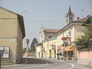
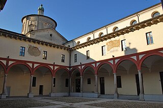
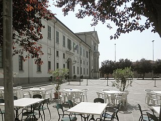
Ospedaletto Lodigiano (Lodigiano: Uspedalètt) is a comune (municipality) in the province of Lodi in the Italian region of Lombardy, located about 45 kilometres (28 mi) southeast of Milan and about 14 kilometres (9 mi) southeast of Lodi.

<i>Comune</i> third-level administrative divisions of the Italian Republic

The comune is a basic administrative division in Italy, roughly equivalent to a township or municipality.

Province of Lodi Province of Italy

The province of Lodi is a province in the Lombardy region of Italy. Its provincial capital is the city of Lodi. As of 2017, it has a population of 229,541 inhabitants over an area of c. 783 square kilometres (300 sq mi), giving the province a population density of 293.2 inhabitants per square kilometre. The provincial president is Francesco Passerini.

Italy republic in Southern Europe

Italy, officially the Italian Republic, is a European country consisting of a peninsula delimited by the Italian Alps and sorrounded by several islands. Located in the middle of the Mediterranean sea and traversed along its lenght by the Apennines, Italy has a largely temperate seasonal climate. The country covers an area of 301,340 km2 (116,350 sq mi) and shares open land borders with France, Slovenia, Austria, Switzerland and the enclaved microstates of Vatican City and San Marino. Italy has a territorial exclave in Switzerland (Campione) and a maritime exclave in the Tunisian sea (Lampedusa). With around 60 million inhabitants, Italy is the fourth-most populous member state of the European Union.

Ospedaletto Lodigiano borders the following municipalities: Brembio, Casalpusterlengo, Livraga, Somaglia, Orio Litta, Senna Lodigiana.

Brembio Comune in Lombardy, Italy

Brembio is a comune (municipality) in the Province of Lodi in the Italian region Lombardy, located about 45 kilometres (28 mi) southeast of Milan and about 14 kilometres (8.7 mi) southeast of Lodi.

Casalpusterlengo Comune in Lombardy, Italy

Casalpusterlengo is a comune (municipality) in the Province of Lodi in the Italian region Lombardy, located about 50 kilometres (31 mi) southeast of Milan and about 20 kilometres (12 mi) southeast of Lodi.

Livraga Comune in Lombardy, Italy

Livraga is a comune (municipality) in the Province of Lodi in the Italian region Lombardy, located about 45 kilometres (28 mi) southeast of Milan and about 14 kilometres (9 mi) southeast of Lodi. As of 31 December 2004, it had a population of 2,589 and an area of 12.2 square kilometres (4.7 sq mi).

See also

Related Research Articles

Bertonico Comune in Lombardy, Italy

Bertonico is a comune (municipality) in the Province of Lodi in the Italian region Lombardy, located about 45 kilometres (28 mi) southeast of Milan and about 15 kilometres (9 mi) southeast of Lodi.

Borghetto Lodigiano Comune in Lombardy, Italy

Borghetto Lodigiano is a comune (municipality) in the Province of Lodi in the Italian region Lombardy, located about 40 kilometres (25 mi) southeast of Milan and about 11 kilometres (7 mi) south of Lodi. It is located on the left slope of the Lambro river.

Casaletto Lodigiano Comune in Lombardy, Italy

Casaletto Lodigiano is a comune (municipality) in the Province of Lodi in the Italian region Lombardy, located about 20 kilometres (12 mi) southeast of Milan and about 13 kilometres (8 mi) west of Lodi.

Caselle Landi Comune in Lombardy, Italy

Caselle Landi is a comune (municipality) in the Province of Lodi in the Italian region Lombardy, located about 70 kilometres (43 mi) southeast of Milan and about 35 kilometres (22 mi) southeast of Lodi.

Corno Giovine Comune in Lombardy, Italy

Corno Giovine is a comune (municipality) in the Province of Lodi in the Italian region Lombardy, located about 80 kilometres (50 mi) southeast of Milan and about 45 kilometres (28 mi) southeast of Lodi.

Mairago Comune in Lombardy, Italy

Mairago is a comune (municipality) in the Province of Lodi in the Italian region Lombardy, located about 40 kilometres (25 mi) southeast of Milan and about 7 kilometres (4 mi) southeast of Lodi.

Maleo, Lombardy Comune in Lombardy, Italy

Maleo is a comune (municipality) in the Province of Lodi in the Italian region Lombardy, located about 60 kilometres (37 mi) southeast of Milan and about 25 kilometres (16 mi) southeast of Lodi.

Orio Litta Comune in Lombardy, Italy

Orio Litta is a comune (municipality) in the Province of Lodi in the Italian region Lombardy, located about 45 kilometres (28 mi) southeast of Milan and about 14 kilometres (9 mi) southeast of Lodi. As of 31 December 2004, it had a population of 1,982 and an area of 9.9 square kilometres (3.8 sq mi).

Ossago Lodigiano Comune in Lombardy, Italy

Ossago Lodigiano is a comune (municipality) in the Province of Lodi in the Italian region Lombardy, located about 35 kilometres (22 mi) southeast of Milan and about 8 kilometres (5 mi) southeast of Lodi.

Pieve Fissiraga Comune in Lombardy, Italy

Pieve Fissiraga is a comune (municipality) in the Province of Lodi in the Italian region Lombardy, located about 30 kilometres (19 mi) southeast of Milan and about 10 kilometres (6 mi) south of Lodi.

Salerano sul Lambro Comune in Lombardy, Italy

Salerano sul Lambro is a comune (municipality) in the Province of Lodi in the Italian region Lombardy, located about 25 kilometres (16 mi) southeast of Milan and about 10 kilometres (6 mi) southwest of Lodi.

San Martino in Strada Comune in Lombardy, Italy

San Martino in Strada is a comune (municipality) in the Province of Lodi in the Italian region Lombardy, located about 40 kilometres (25 mi) southeast of Milan and about 7 kilometres (4 mi) southeast of Lodi.

Santo Stefano Lodigiano Comune in Lombardy, Italy

Santo Stefano Lodigiano is a comune (municipality) in the Province of Lodi in the Italian region Lombardy, located about 60 kilometres (37 mi) southeast of Milan and about 25 kilometres (16 mi) southeast of Lodi.

Secugnago Comune in Lombardy, Italy

Secugnago is a comune (municipality) in the Province of Lodi in the Italian region Lombardy, located about 45 kilometres (28 mi) southeast of Milan and about 13 kilometres (8.1 mi) southeast of Lodi. As of 31 December 2004, it had a population of 1,801 and an area of 6.7 square kilometres (2.6 sq mi).

Somaglia Comune in Lombardy, Italy

Somaglia is a comune (municipality) in the province of Lodi in the Italian region of Lombardy, located about 50 kilometres (31 mi) southeast of Milan and about 20 kilometres (12 mi) southeast of Lodi.

Turano Lodigiano Comune in Lombardy, Italy

Turano Lodigiano is a comune (municipality) in the Province of Lodi in the Italian region Lombardy, located about 45 kilometres (28 mi) southeast of Milan and about 13 kilometres (8 mi) east of Lodi.

Villanova del Sillaro Comune in Lombardy, Italy

Villanova del Sillaro is a comune (municipality) in the Province of Lodi in the Italian region Lombardy, located about 35 kilometres (22 mi) southeast of Milan and about 9 kilometres (6 mi) south of Lodi.

References

  1. All demographics and other statistics: Italian statistical institute Istat.