
Heidekreis is a district (Landkreis) in Lower Saxony, Germany. It is bounded by the districts of Harburg, Lüneburg, Uelzen, Celle, Hanover, Nienburg, Verden and Rotenburg.

Bad Fallingbostel is the district town (Kreisstadt) of the Heidekreis district in the German state of Lower Saxony. Since 1976 the town has had a state-recognised Kneipp spa and has held the title of Bad since 2002. It has close ties to Walsrode, a few miles to the west. Until 2015, there was a British Army base in Bad Fallingbostel, It also hosted Defender 2020 the largest US Army/Nato exercise since the Cold war. The town has around 11,000 inhabitants.

The Böhme is a right-bank, northeastern tributary of the Aller in the district of Soltau-Fallingbostel in the north German state of Lower Saxony. The river is 72 kilometres (45 mi) long.

Stalag XI-B and Stalag XI-D / 357 were two German World War II prisoner-of-war camp (Stammlager) located just to the east of the town of Fallingbostel in Lower Saxony, in north-western Germany.
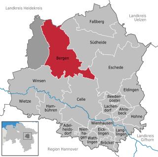
Bergen is a town in the north of Celle district on the Lüneburg Heath, in Lower Saxony, Germany. Administratively it acts as a municipal borough divided into 12 subordinate parishes based on the town and its surrounding villages: Becklingen, Belsen, Bergen, Bleckmar, Diesten, Dohnsen, Eversen, Hagen, Hassel, Offen, Sülze and Wardböhmen. Bergen-Belsen concentration camp was located in the area of Belsen.

The Sieben Steinhäuser is a group of five dolmens on the Lüneburg Heath in the NATO training area of Bergen-Hohne, in the state of Lower Saxony in northern Germany. The stones are considered to be part of the funnelbeaker culture. The gravesite was granted protected cultural monument status in 1923.

Lohheide is an unincorporated area in the district of Celle, in Lower Saxony, Germany.

Bergen-Hohne Training Area is a NATO military training area in the southern part of the Lüneburg Heath, in the state of Lower Saxony in northern Germany. It covers an area of 284 square kilometres, which makes it the largest military training area in Germany.

Ostenholz Moor is a raised bog on the Lüneburg Heath in the German state of Lower Saxony. It is named after the village of Ostenholz and is not far from Meißendorf. The bog is almost entirely within the Bergen-Hohne Military Training Area and, as a result, has been largely left to develop naturally. The River Meiße separates Ostenholz Moor from the nature and bird reserve of the Meißendorf Lakes and Bannetzer Moor.

Oerbke is an unincorporated German village in Soltau-Fallingbostel district in the southern part of the Lüneburg Heath in Lower Saxony. Oerbke lies on the A7 autobahn east of Bad Fallingbostel and is the seat of administration for the Osterheide area.
Wense is a village in the Heidmark in Lower Saxony, Germany. In 1935/1936 its inhabitants were 'relocated', because the German armed forces, the Wehrmacht, wanted to establish a vast military training area in the Heidmark, which today is the largest in Europe.
The Heidmark is an area of the Lüneburg Heath, much of which has not been accessible to the population since about 1935/1936. The establishment of a large military training area by the German armed forces, the Wehrmacht, as part of their rearmament and preparation for war resulted in the evacuation of 24 villages and, since then the training area has been out-of-bounds to non-military personnel. Today it has become the Bergen-Hohne Training Area, the largest of its kind in Europe.

Munster Training Area is a military training area in Germany on the Lüneburg Heath. It comprises two separate areas with different purposes: Munster North (Munster-Nord) and Munster South (Munster-Süd). The two areas are separated geographically by the town of Munster and several barracks. When the military training area was established a camp or Lager was built about 1.5 kilometres from the town centre which became known as Munsterlager. Between Munster North and South there is a road corridor to the nearby training area of Bergen-Hohne over which exercising troops can transfer from one area to the other. There are many rare and endangered plant species on this terrain today that thrive in the environment created by the training area.
Sülze is a village in the local borough of Bergen located in the northern part of Celle district on the Lüneburg Heath in North Germany. The infamous Bergen-Belsen concentration camp was located not far from Sülze, one of several farming villages in the borough. The general Bergen area today is economically heavily dependent on the surrounding military bases and the Bergen-Hohne Training Area to the west, which is the largest military training area in Western Europe.
Vierde is a village within the borough of Bad Fallingbostel in Soltau-Fallingbostel district in the Heidmark.

Ettenbostel was a village in the old district (Altkreis) of Fallingbostel located in the Heidmark in the north German state of Lower Saxony. The villagers were 'relocated' in 1935/36 because the German Wehrmacht wanted to create a huge military training area on the heathland and forest of the Heidmark. Today this has become the Bergen-Hohne Training Area and is the largest in Europe.
Benhorn was a village in the old district of Fallingbostel, on the Heidmark in Lower Saxony in North Germany. It disappeared from the map in 1935/36, because the German Wehrmacht wanted to establish the Bergen-Hohne Training Area, today the largest military training area in Germany. The inhabitants were resettled.
Bockhorn is a parish in the borough of Walsrode in the Heidekreis district in the Lüneburg Heath in the north German state of Lower Saxony. About 290 people live in this heath parish which has an area of 9.0 km².

Bergen-Hohne Garrison was a major British garrison in the post-Cold War period, with facilities located close to Bergen at Lager Hohne, at Lager Oerbke near Fallingbostel and at Celle in Lower Saxony, Germany. It was home to 7th Armoured Brigade and most of its subordinate units. It formed a major part of British Forces Germany.
Hoher Stein may refer to:


