Frankenfeld | |
|---|---|
Location of Frankenfeld within Heidekreis district 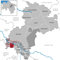 | |
 Frankenfeld  Frankenfeld | |
| Coordinates: 52°46′6″N9°25′44″E / 52.76833°N 9.42889°E Coordinates: 52°46′6″N9°25′44″E / 52.76833°N 9.42889°E | |
| Country | Germany |
| State | Lower Saxony |
| District | Heidekreis |
| Municipal assoc. | Rethem/Aller |
| Subdivisions | 3 Ortsteile |
| Government | |
| • Mayor | Renate Rodewald |
| Area | |
| • Total | 24.26 km2 (9.37 sq mi) |
| Elevation | 18 m (59 ft) |
| Population (2020-12-31) [1] | |
| • Total | 528 |
| • Density | 22/km2 (56/sq mi) |
| Time zone | UTC+01:00 (CET) |
| • Summer (DST) | UTC+02:00 (CEST) |
| Postal codes | 27336 |
| Dialling codes | 0 51 65 |
| Vehicle registration | HK, SFA |
Frankenfeld is a municipality in the Heidekreis district, in Lower Saxony, Germany.
