The European route E 22 is one of the longest European routes. It has a length of about 5,320 km (3,310 mi). Many of the E-roads have been extended into Asia since the year 2000; the E 22 was extended on 24 June 2002.

Piraeus station refers to two railway termini in Piraeus, Greece, approximately 9 km south-west of the centre of Athens. The southern building (37°56′53″N23°38′36″E) is the present terminus of Athens Metro Line 1, formerly the Athens-Piraeus Electric Railways that opened in 1869. The northern building (37°56′57″N23°38′33″E) is the railway terminus for standard gauge railway services on the main axis to Thessaloniki via Larisa and for the Proastiakos to Acharnes Junction and Chalcis.
The Raber House is an Italianate style house located at 5760 South Lafayette Avenue in the Washington Park neighborhood of Chicago, Illinois, United States. The house was built in 1870 by Thomas Wing. It was designated a Chicago Landmark on April 16, 1996.
Pieńki-Kolonia is a village in the administrative district of Gmina Michałowo, within Białystok County, Podlaskie Voivodeship, in north-eastern Poland, close to the border with Belarus.
Dąbrówka is a village in the administrative district of Gmina Sokółka, within Sokółka County, Podlaskie Voivodeship, in north-eastern Poland, close to the border with Belarus.

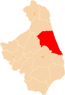
Kurowszczyzna is a village in the administrative district of Gmina Sokółka, within Sokółka County, Podlaskie Voivodeship, in north-eastern Poland, close to the border with Belarus. It lies approximately 2 kilometres (1 mi) south of Sokółka and 37 km (23 mi) north-east of the regional capital Białystok.

Nowinka is a village in the administrative district of Gmina Szudziałowo, within Sokółka County, Podlaskie Voivodeship, in north-eastern Poland, close to the border with Belarus. It lies approximately 4 kilometres (2 mi) west of Szudziałowo, 15 km (9 mi) south-east of Sokółka, and 37 km (23 mi) north-east of the regional capital Białystok.

Słójka is a village in the administrative district of Gmina Szudziałowo, within Sokółka County, Podlaskie Voivodeship, in north-eastern Poland, close to the border with Belarus. It lies approximately 4 kilometres (2 mi) west of Szudziałowo, 14 km (9 mi) south-east of Sokółka, and 37 km (23 mi) north-east of the regional capital Białystok.

Dewsbury Town Hall is a Victorian Town Hall that stands in front of the old marketplace in the centre of Dewsbury, West Yorkshire, England.

Maprik District is a district of East Sepik Province in Papua New Guinea. It is one of the six administrative districts that make up the province.

Crowne Plaza Copenhagen Towers is a hotel in the Ørestad city area of Copenhagen. It is renowned for being the first hotel in Denmark that generates all of its power from renewable sources.
Söğütçük is a village in the District of Çine, Aydın Province, Turkey. As of 2010 it had a population of 128 people.
Bağlıca is a village in the District of Gercüş, Batman Province, Turkey. As of 2011, it had a population of 281 people.

The Bolshoy Zelenchuk is a river in the North Caucasus, Russia. It is a left tributary of the Kuban River into which it flows at Nevinnomyssk.

Sacrario militare di Pocol is a cemetery and shrine near Passo Falzarego, in the locality of Pocol in the comune of Cortina d'Ampezzo in the Veneto region of northern Italy. The small church and cemetery were built in 1916 as a military cemetery by the 5th Alpine group. A shrine was built in 1935 as memorial to the thousands who died during World War I on the Dolomite front. It is a massive square tower of stone, clearly visible from the entire Ampezzo valley below. The remains of 9,707 Italian soldiers and 37 Austro-Hungarian soldiers are buried in the shrine. In a crypt in the centre of the structure rests the body of general Antonio Cantore, who was awarded the gold medal for military valor.
The Stephen A. Douglas High School was a district-run high school servicing the Fishtown, Port Richmond and Kensington areas of Philadelphia.

Baie de Somme is a large estuary in the Picardie région of France. The bay drains six rivers into the English Channel, principally the River Somme, and covers a total area of 72 km2 (28 sq mi). The bay is noted for its ornithological richness, as well as being a major tourist attraction.
Kathrota is a village and former non-salute princely state on Saurashtra peninsula in Gujarat, western India.
Commerce Township is an inactive township in Scott County, in the U.S. state of Missouri.


