Mount Owen is in the Tasman district of the South Island of New Zealand. It stands at 1875 metres (6150 feet) above sea level and is part of the Marino Mountains.

The European route E 22 is one of the longest European routes. It has a length of about 5,320 km (3,310 mi). Many of the E-roads have been extended into Asia since the year 2000; the E 22 was extended on 24 June 2002.
Kolkata Metropolitan Area, also known as the Calcutta Metropolitan Area and Greater Kolkata, is the urban agglomeration of the city of Kolkata in the Indian state of West Bengal. It is the third most populous metropolitan area in India after Delhi and Mumbai. The area is administered by the Kolkata Metropolitan Development Authority. The area covers 72 cities, and 527 towns and villages.
Penumantra is a village in West Godavari district of the Indian state of Andhra Pradesh. The village is the site of the headquarters of Penumantra Mandal.
San Francisco de Asis de Yarusyacán District is one of thirteen districts of the province Pasco in Peru.

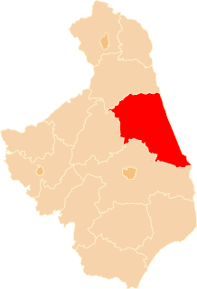
Kraśniany is a village in the administrative district of Gmina Sokółka, within Sokółka County, Podlaskie Voivodeship, in north-eastern Poland, close to the border with Belarus. It lies approximately 6 kilometres (4 mi) north of Sokółka and 43 km (27 mi) north-east of the regional capital Białystok.
Kuryły is a village in the administrative district of Gmina Sokółka, within Sokółka County, Podlaskie Voivodeship, in north-eastern Poland, close to the border with Belarus.
Or is a river in Orenburg Oblast of Russia and Aktobe Province of Kazakhstan. It is a left tributary of the Ural River, and is 332 km long, with a drainage basin of 18 600 km². The river is formed by the confluence of the Shiyli and Terisbutak Rivers, which have their sources on the western slopes of the Mugodzhar Hills, and it joins the Ural River by the city of Orsk. Most of its discharge are from melting snow. The average discharge, 61 km from its mouth, is 21.3 m³/sek. The spring flooding lasts from April to mid-May. The rest of the year the waterlevel is very low. The river freezes in late October and is icebound until March - April. The river is used for irrigation and water supply.
Baota District, is a district in Yan'an Municipality, Shaanxi Province, China, and contains the municipality's headquarters. The district is named for the Baota Pagoda, which is contained in its borders.
İkizdere Dam is a dam in Aydın Province, Turkey, which began construction in 1999. The development was backed by the Turkish State Hydraulic Works.
Liisi is an island belonging to the country of Estonia.
Orikalaid is an island belonging to the country of Estonia.

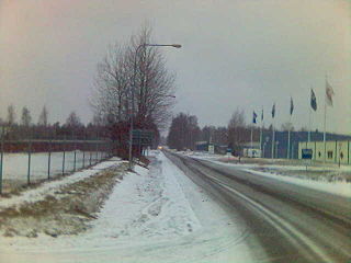
Jägarvallen is a neighborhood in Linköping with a little over 140 households and almost 400 residents. It is located on the outskirts of the city, between Ryd and Malmen airfield, and is crossed by an old stretch of the road to Mjölby.
Güneytepe is a village in the District of Şuhut, Afyonkarahisar Province, Turkey.
Čevo, historically also known as Kčevo (Кчево), is a village in the Cetinje Municipality, in central Montenegro.
Maine Township is a township in Linn County, Iowa.

Çorum Archaeological Museum is an archaeological museum in Çorum, Turkey. It was formally established in 1968, with items found in Alacahöyük, Boğazköy, Ortaköy, Eskiyapar, Pazarlı, Kuşsaray and Alişar Höyük.
Gremuchiy is an urban-type settlement as part of the Krasnogorievsk rural locality in the Boguchansky District of Russia. It is located in the north-eastern part of the Krasnoyarsk Krai. It got its name from the Gremuchiy brook.

Gidgee located at 29.5411°N 141.2110°E is a remote rural locality and civil parish of Evelyn County, New South Wales in far northwest New South Wales.


