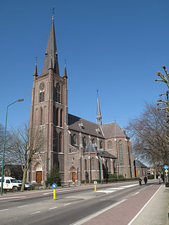
Moerdijk is a municipality and a town in the South of the Netherlands, in the province of North Brabant.

Fijnaart is a town in the Dutch province of North Brabant. It is located in the municipality of Moerdijk, about 8 km west of the town of Zevenbergen.

Lage Zwaluwe is a village in the municipality Drimmelen, North Brabant, the Netherlands. The Lage Zwaluwe railway station and the Moerdijk bridges lie to the west of the village.

Zevenbergen is a Dutch city which is a part of the municipality of Moerdijk. Zevenbergen is located in the northwest of the province of North Brabant near Breda.

Klundert is a city in the Dutch province of North Brabant. It is located close to the Hollands Diep, about 3 km northwest of Zevenbergen. It received city rights in 1357.

The Duchy of Brabant was a State of the Holy Roman Empire established in 1183. It developed from the Landgraviate of Brabant and formed the heart of the historic Low Countries, part of the Burgundian Netherlands from 1430 and of the Habsburg Netherlands from 1482, until it was partitioned after the Dutch revolt.

Nieuwendijk is a village in the Dutch province of North Brabant. It is a part of the municipality of Altena, and lies about 8 km south of Gorinchem.

Sint Annaparochie is a village of the municipality of Waadhoeke in Friesland, the Netherlands. It lies approximately 15 km northwest of Leeuwarden and had approximately 4,830 inhabitants in 2021. The village is named after Saint Anne, the mother of Mary.

Willemstad is a city in the Dutch province of North Brabant. It is located in the municipality of Moerdijk. Its population as of 2021 was 2,490.
Achterdijk is a hamlet in the Dutch province of North Brabant. It is located in the municipality of Moerdijk, about 2 km northeast of the town of Zevenbergen.

Noordhoek is a village in the Dutch province of North Brabant. It is located in the municipality of Moerdijk, about 5 km west of Zevenbergen.

Fijnaart en Heijningen is a former municipality in the Dutch province of North Brabant. It covered the villages of Fijnaart and Heijningen.

Vijfheerenlanden, literally "lands of five Lords", is a municipality in the province of Utrecht in the Netherlands. The municipality was created on 1 January 2019 through the merger of the former municipalities of Vianen (Utrecht), Leerdam and Zederik. Vijfheerenlanden has 59,150 inhabitants on 1 January 2022.

Haps is a village in the Dutch province of North Brabant. It is located in the former municipality of Cuijk, about 5 kilometres (3.1 mi) south of the town of Cuijk. Since 2022 it has been part of the new municipality of Land van Cuijk.

Hedikhuizen is a village in the Dutch province of North Brabant. It is located in the municipality of Heusden, about 3 km east of that city.

Standdaarbuiten is a village in the Dutch province of North Brabant located in the municipality of Moerdijk, about 9 km northeast of Roosendaal.

Veen is a village in the Dutch province of North Brabant. It is located in the municipality of Altena, about 20 km northwest of 's-Hertogenbosch. It is infamous for its New Year's Eve tradition during which scrap cars are burnt, and in 2020 even firemen were attacked with fireworks.
Westhoek can refer to the following places:

Stampersgat is a village situated in the municipality of Halderberge, in the north-west of the North Brabant province in the Netherlands.


