Willemstad, North Brabant

Last updated
Willemstad
Willemstad haven.jpg
The port of Willemstad with the tower of the former city hall in the back
Willemstad vlag.svg
Willemstad wapen.svg
2010-NL-P10-Noord-Brabant-positiekaart-gemnamen.jpg
Red pog.svg
Willemstad
Location in the province of North Brabant in the Netherlands
Netherlands location map.svg
Red pog.svg
Willemstad
Willemstad (Netherlands)
Coordinates: 51°41′31″N4°26′16″E / 51.69194°N 4.43778°E / 51.69194; 4.43778
Country Netherlands
Province North Brabant
Municipality Moerdijk
Area
[1]
  Total16.70 km2 (6.45 sq mi)
Elevation
[2]
0.9 m (3.0 ft)
Population
 (2021) [1]
  Total2,490
  Density150/km2 (390/sq mi)
Time zone UTC+1 (CET)
  Summer (DST) UTC+2 (CEST)
Postal code
4797 [1]
Dialing code 0168

Willemstad is a city in the Dutch province of North Brabant. It is located in the municipality of Moerdijk. Its population as of 2021 was 2,490. [1]

Contents

Willemstad is a small historical town with well preserved fortifications. It lies on the Hollands Diep, close to the Haringvliet and Volkerak. It received city rights in 1585. The Reformed Church was built in 1607 as the first new Protestant church building in the Netherlands (see: the Reformation and its influence on church architecture).

History

The current name was first used in 1639 as Willemstat, and refers to William the Silent who fortified the settlement in 1583. [3] The settlement used to be known as Ruigenhil, and was located at a strategic location along the Hollands Diep. In 1587, the fortifications were completed, and Willemstad received a heptagon (seven sided) shape with seven bastions. Even though the fortification have been decommissioned in 1926, the layout is still clearly visible and mainly intact. [4]

The Dutch Reformed church was built between 1597 and 1607 and has an octagon shape with a dome with ridge turret on top. There is an incomplete tower in the south-western corner. The church was severely damaged by war in 1944. It was nearly completely restored in 1950 when it was devastated by fire. [4]

The Gouvernementshuis was built between 1623 and 1625 for Maurice, Prince of Orange. After his death in 1625, it was used as the residence of the governor of Willemstad until 1795. It was extensively restored between 1968 and 1973, and served as town hall until 1996. [4]

Willemstad was home to 1,154 people in 1840. In 1970, the entire centre was declared a protected site. [5] Willemstad was a separate municipality until 1997, when it became part of Zevenbergen, which changed its name to Moerdijk in 1998. [6]

Related Research Articles

<span class="mw-page-title-main">Moerdijk</span> Municipality in North Brabant, Netherlands

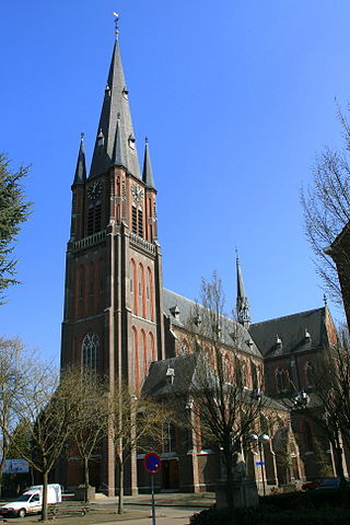
Moerdijk is a municipality and a town in the South of the Netherlands, in the province of North Brabant.

<span class="mw-page-title-main">Fijnaart</span> Town in North Brabant, Netherlands

Fijnaart is a town in the Dutch province of North Brabant. It is located in the municipality of Moerdijk, about 8 km west of the town of Zevenbergen.

<span class="mw-page-title-main">Lage Zwaluwe</span> Village in North Brabant, Netherlands

Lage Zwaluwe is a village in the municipality Drimmelen, North Brabant, the Netherlands. The Lage Zwaluwe railway station and the Moerdijk bridges lie to the west of the village.

<span class="mw-page-title-main">Zevenbergen</span> City in North Brabant, Netherlands

Zevenbergen is a Dutch city which is a part of the municipality of Moerdijk. Zevenbergen is located in the northwest of the province of North Brabant near Breda.

<span class="mw-page-title-main">Klundert</span> City in North Brabant, Netherlands

Klundert is a city in the Dutch province of North Brabant. It is located close to the Hollands Diep, about 3 km northwest of Zevenbergen. It received city rights in 1357.

<span class="mw-page-title-main">Numansdorp</span> Town in South Holland, Netherlands

Numansdorp is a town and former municipality in the province South Holland in the Netherlands and is located on the island Hoeksche Waard near the Hollands Diep. On 1 January 1984, the municipalities Numansdorp and Klaaswaal were merged into one municipality called Cromstrijen. Cromstrijen was merged into the new municipality Hoeksche Waard in January 2019.

<span class="mw-page-title-main">Geffen, Netherlands</span> Village in North Brabant, Netherlands

Geffen had been an independent municipality in the Dutch province of North Brabant until 1993, when it became a part of the newly formed municipality Maasdonk. This lasted until 2015, when Maasdonk was dissolved and Geffen became part of Oss.

<span class="mw-page-title-main">Retranchement</span> Village in Zeeland, Netherlands

Retranchement is a village in the Dutch province of Zeeland. It is located on the Belgian border, about 9 km northwest of Oostburg, in the municipality of Sluis.

<span class="mw-page-title-main">Noordhoek, Moerdijk</span> Village in North Brabant, Netherlands

Noordhoek is a village in the Dutch province of North Brabant. It is located in the municipality of Moerdijk, about 5 km west of Zevenbergen.

<span class="mw-page-title-main">Oudemolen, North Brabant</span> Place in North Brabant, Netherlands

Oudemolen is a hamlet in the province of North Brabant, one of the twelve provinces in the Netherlands. Presently it is located in the municipality of Moerdijk, which is an amalgamation of a variety of former municipalities, prominently among them Fijnaart, Klundert, Willemstad and the village of Moerdijk. Oudemolen was administered in the past by the municipality of Fijnaart.

<span class="mw-page-title-main">Budel</span> Town in North Brabant, Netherlands

Budel is a town in the Dutch province of North Brabant. It is located in the municipality of Cranendonck, 25 km outside Eindhoven. Kempen Airport is located near Budel.

<span class="mw-page-title-main">Halsteren</span> Town in North Brabant, Netherlands

Halsteren is a town in the Dutch province of North Brabant. It is located in the municipality of Bergen op Zoom, about 1 km north of that city. Halsteren has an old church from the 14th century and a new church, built in 1919. A little village called Polder was located between Halsteren and Tholen in the Middle Ages.

<span class="mw-page-title-main">Hedikhuizen</span> Village in North Brabant, Netherlands

Hedikhuizen is a village in the Dutch province of North Brabant. It is located in the municipality of Heusden, about 3 km east of that city.

<span class="mw-page-title-main">Nieuw-Vossemeer</span> Village in North Brabant, Netherlands

Nieuw-Vossemeer is a village in the Dutch province of North Brabant. It is located in the municipality of Steenbergen, about 10 km northeast of Bergen op Zoom.

<span class="mw-page-title-main">Reek, Netherlands</span> Village in North Brabant, Netherlands

Reek is a village in the Dutch province of North Brabant. It is located in the former municipality of Landerd, about 3 km east of Schaijk.

<span class="mw-page-title-main">Rijswijk, North Brabant</span> Village in North Brabant, Netherlands

Rijswijk is a village in the Dutch province of North Brabant. It is located in the municipality of Altena, about 5 km southeast of Gorinchem.

<span class="mw-page-title-main">Standdaarbuiten</span> Village in North Brabant, Netherlands

Standdaarbuiten is a village in the Dutch province of North Brabant located in the municipality of Moerdijk, about 9 km northeast of Roosendaal.

<span class="mw-page-title-main">Veen, Netherlands</span> Village in North Brabant, Netherlands

Veen is a village in the Dutch province of North Brabant. It is located in the municipality of Altena, about 20 km northwest of 's-Hertogenbosch. It is infamous for its New Year's Eve tradition during which scrap cars are burnt, and in 2020 even firemen were attacked with fireworks.

<span class="mw-page-title-main">Velp, North Brabant</span> Village in North Brabant, Netherlands

Velp is a village in the Dutch province of North Brabant. It is located in the former municipality of Grave, about 2 km southwest of the city. Until 1794, it was part of the Land van Ravenstein, a Catholic enclave of Palatinate-Neuburg within the Dutch Republic.

<span class="mw-page-title-main">Volkerakdam</span> Hydraulic engineering structures in the Netherlands

The Volkerakdam or Volkerakwerken is the name given to a group of hydraulic engineering structures located between Goeree-Overflakkee and North Brabant in The Netherlands. The works are not a single dam, but are composed of three distinct structures: a dam between Goeree-Overflakkee and Hellegatsplein, a series of locks from Hellegatsplein to North Brabant, and a bridge from Hellegatsplein to Hoekse Waard. The works cross three separate bodies of water: the Haringvliet, Hollands Diep and Volkerak. The works together comprise the fifth project of the Delta Works.

References

  1. 1 2 3 4 "Kerncijfers wijken en buurten 2021". Central Bureau of Statistics. Retrieved 17 April 2022.
  2. "Postcodetool for 4797AA". Actueel Hoogtebestand Nederland (in Dutch). Het Waterschapshuis. Retrieved 17 April 2022.
  3. "Willemstad - (geografische naam)". Etymologiebank (in Dutch). Retrieved 17 April 2022.
  4. 1 2 3 Chris Kolman & Ronald Stenvert (1997). Willemstad (in Dutch). Zwolle: Waanders. ISBN   90 400 9945 6 . Retrieved 17 April 2022.
  5. "Willemstad". Plaatsengids (in Dutch). Retrieved 17 April 2022.
  6. Ad van der Meer and Onno Boonstra, Repertorium van Nederlandse gemeenten , KNAW, 2011.