Amerongen is a town in the municipality of Utrechtse Heuvelrug in the province of Utrecht, Netherlands, on the border of the Utrecht Hill Ridge. It lies about 7 km southwest of Veenendaal.

Hagestein is a village and former city in the municipality of Vijfheerenlanden, Utrecht, Netherlands, on the Lek River, about 2 km east of Vianen. It received city rights in 1382. Hagestein was destroyed in 1405 by the Count of Holland and the Prince-Bishop of Utrecht.

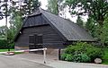
Den Dolder is a village in the Dutch province of Utrecht. It is a part of the municipality of Zeist, and lies about 4 km northeast of Bilthoven. Den Dolder has a railway station on the route between Amersfoort and Utrecht and is best known for its mental institutions such as Dennendal and the Willem Arntz Hoeve. Den Dolder also houses the big Dutch sauce manufacturer Remia referring to Den Dolder as Holland's Heart of Sauces as is depicted on the factory's side and is visible from the train passing by.
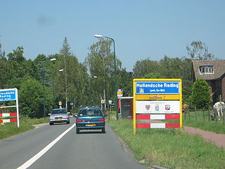
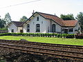
Hollandsche Rading is a village in the Dutch province of Utrecht. It is a part of the municipality of De Bilt, and lies about 5 km south of Hilversum. Hollandsche Rading has a railway station on the route between Utrecht and Hilversum.

Groenekan is a village in the Dutch province of Utrecht. It is a part of the municipality of De Bilt, and lies about 3 km west of Bilthoven.

Benschop is a village in the Dutch province of Utrecht. It is a part of the municipality of Lopik, and lies about 4 km west of IJsselstein. Benschop is an extremely long village: apart from a relatively compact town centre, it consists of a long ribbon of houses on both sides of the Benschopsche Wetering. Until 1989, Benschop was a separate municipality.

Maarsbergen is a settlement in the Dutch province of Utrecht. It is a part of the municipality of Utrechtse Heuvelrug, and lies about 18 km east of Utrecht.
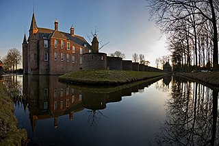
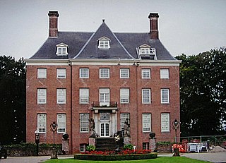
Oud-Zuilen is a village in the Dutch province of Utrecht. It is a part of the municipality of Stichtse Vecht, and lies about 4 km northwest of Utrecht. It is in an area called the "Vechtstreek". Zuylen Castle is located in the village.

Tienhoven is a village in the Dutch province of Utrecht. It is a part of the municipality of Stichtse Vecht, and lies about 7 km (4.3 mi) north of Utrecht.

Papekop is a village in the Dutch province of Utrecht. It is a part of the municipality of Oudewater, and lies about 3 km northwest of the city of Oudewater.

Nieuwer-Ter-Aa is a village in the Dutch province of Utrecht (province). It is a part of the municipality of Stichtse Vecht, and lies about 13 km northwest of Utrecht.

Kockengen is a village in the Dutch province of Utrecht. It is a part of the municipality of Stichtse Vecht, and lies about 11 km northeast of Woerden.

Hei- en Boeicop is a village in the Dutch province of Utrecht. Part of the municipality of Vijfheerenlanden, it lies about 9 km south of IJsselstein.
Leerbroek is a village in the Dutch province of Utrecht. It is a part of the municipality of Vijfheerenlanden, and lies about 9 km (6 mi) northeast of Gorinchem.

Botrivier is a small town of approximately 10 000 people, situated in the Overberg region of the Western Cape in South Africa.

Tricht is a village in the Dutch province of Gelderland. It is a part of the municipality of West Betuwe, and lies about 10 km west of Tiel.

Elgin is a large, lush area of land, circled by mountains, in the Overberg region of South Africa. This broad upland valley lies about 70 km southeast of Cape Town, just beyond the Hottentots Holland Mountains.
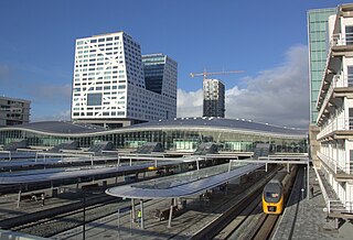
Utrecht Centraal, officially Station Utrecht Centraal, is the transit hub that integrates three bicycle parkings, two bus stations, two tram stops and the central railway station for Utrecht, Netherlands. It is the biggest train station in the Netherlands.
Bredasdorp is a town in the Southern Overberg region of the Western Cape, South Africa, and the main economic and service hub of that region. It lies on the northern edge of the Agulhas Plain, about 160 kilometres (100 mi) south-east of Cape Town and 35 kilometres (22 mi) north of Cape Agulhas, the southernmost tip of Africa.

Zijderveld is a village in the Dutch province of Utrecht (province). It is located about 6 km northeast of Leerdam, in the municipality of Vijfheerenlanden.