
The Qinghai–Tibet railway or Qingzang railway, is a high-elevation railway that connects Xining, Qinghai Province, to Lhasa, Tibet Autonomous Region of China.

The Yarlung Tsangpo Grand Canyon, also known as the Yarlung Zangbo Grand Canyon, the Tsangpo Canyon, the Brahmaputra Canyon or the Tsangpo Gorge, is a canyon along the Yarlung Tsangpo River in Tibet Autonomous Region, China. It is the deepest canyon in the world, and at 504.6 kilometres (313.5 mi) is slightly longer than the Grand Canyon in the United States, making it one of the world's largest. The Yarlung Tsangpo originates near Mount Kailash and runs east for about 1,700 kilometres (1,100 mi), draining a northern section of the Himalayas before it enters the gorge just downstream of Pei, Tibet, near the settlement of Zhibe. The canyon has a length of about 240 kilometres (150 mi) as the gorge bends around Mount Namcha Barwa and cuts its way through the eastern Himalayan range. Its waters drop from about 2,900 metres (9,500 ft) near Pei to about 1,500 metres (4,900 ft) at the end of the Upper Gorge where the Po Tsangpo River enters. The river continues through the Lower Gorge to the Indian border at an elevation of 660 metres (2,170 ft). The river then enters Arunachal Pradesh and eventually becomes the Brahmaputra.

Hainan Tibetan Autonomous Prefecture, formerly known as Tsolho Tibetan Autonomous Prefecture, is an autonomous prefecture of Northeastern Qinghai Province in Western China. The prefecture has an area of 45,895 square kilometres (17,720 sq mi) and its seat is located in Gonghe County. Its name literally means "south of (Qinghai) Lake."
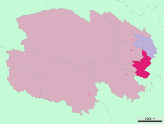
Huangnan Tibetan Autonomous Prefecture is an autonomous prefecture of Eastern Qinghai, China, bordering Gansu to the east. The prefecture has area of 17,921 km2 (6,919 sq mi) and its seat is in Tongren County.
Ngari Prefecture or Ali Prefecture is a prefecture of China's Tibet Autonomous Region covering Western Tibet, whose traditional name is Ngari Khorsum. Its administrative centre and largest settlement is the town of Shiquanhe. It is one of the least densely populated areas in the world, with 0.3 people per kilometer.
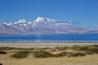
Baidi is a township in Nagarzê County, Shannan Prefecture, Tibet Autonomous Region of China. It lies on a lake, at an altitude of 4,919 metres (16,141 ft) and is located about 121 kilometres (75 mi) south-west of Lhasa. The village of Baidi is located in the township.

Gertse County, Gêrzê County or Gaize County is a county located in Ngari Prefecture in the northwest of the Tibet Autonomous Region, China, bordering Xinjiang to the north.

Lhatse County is a county of Xigazê in the Tibet Autonomous Region, China. It was established in 1959, with Lhatse Town as the county seat. In 1968, Quxar Town became the county seat.
Bilung is a township in Biru County, Tibet Autonomous Region of China.
Bünsum, Gyaimain is a village in Qonggyai County, Tibet Autonomous Region of China. It lies at an altitude of 4,755 metres.
Cazê is a township in Ngamring County, Tibet Autonomous Region of China. It lies at an altitude of 4,787 metres.
Cêngdo is a township in Markam County, Chamdo Prefecture, Tibet Autonomous Region of China.
Drakna, Drakne, or Chagnê is a township in Gyirong County, Tibet Autonomous Region of China.
Chamco is a village and township (村) in Tingri County, Tibet Autonomous Region of China.
Chamoling is a township in Riwoqê County, Tibet Autonomous Region of China. It lies at an altitude of 4,651 metres.
Chênggo is a township in Gonggar County, Tibet Autonomous Region of China. It lies at an altitude of 4,744 metres.
Congdü is a township in Nyalam County, the Tibet Autonomous Region of China. It lies at an altitude of 3,763 metres. The village has a population of about 237.
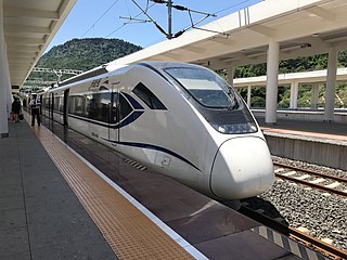
The Sichuan–Tibet railway, Sichuan–Xizang railway or Chuanzang railway is a high-elevation higher-speed railway in China that will connect Chengdu, the provincial capital of Sichuan, and Lhasa, the provincial capital of Tibet, when fully completed. The line will be 1,629 km (1,012 mi) long, and significantly cut travel time from Chengdu to Lhasa from 48 to 13 hours.
This article documents the situation of the COVID-19 pandemic in the Tibet Autonomous Region.

Tibet Autonomous Regional People's Government is the provincial administrative agency of Tibet, People 's Republic of China. The provincial government consists of the Tibet Autonomous Regional People's Congress, the TAR People's Congress Standing Committee, and has a mandate to frame local laws and regulations, such as the use of the Tibetan language in the region. Additionally, rules for adapting national laws to the province are also the responsibility of the People's Government.