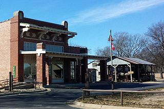
Scott is an unincorporated community and census-designated place (CDP) in Lonoke and Pulaski counties in the central part of the U.S. state of Arkansas. Per the 2020 census, the population was 97. It is part of the Little Rock–North Little Rock–Conway Metropolitan Statistical Area.

Little Rock National Cemetery is a United States National Cemetery, located approximately two miles (3 km) south-east of the Arkansas State Capitol Building, being within the city of Little Rock, and Pulaski County, Arkansas. It encompasses 31.7 acres (12.8 ha), and as of the end of 2005, had 25,172 interments. Administered by the United States Department of Veterans Affairs, it is currently closed to new interments.

Princeton Cemetery is a historic pre-Civil War cemetery in rural Dallas County, Arkansas. It is located on County Road 201, southeast of Princeton, which was the county's first seat. The oldest grave is that of William Suggs, an early settler of Princeton who died in 1849. The cemetery is an open tract of land, about 3 acres (1.2 ha) in size, surrounded by forest on three sides, and the road on the fourth.
In the United States, Canada, Australia, and elsewhere, a pioneer cemetery is a cemetery that is the burial place for pioneers. American pioneers founded such cemeteries during territorial expansion of the United States, with founding dates spanning, at least, from the late 18th to early 20th centuries.
A pioneer cemetery is a cemetery for the earliest settlers in an area.

Holly Grove Cemetery is a historic cemetery, located on the south side of Crooked Bayou Drive, 3 miles (4.8 km) southeast of McGehee, Arkansas. The cemetery is the only surviving remnant of the community of Trippe Junction, established in 1857 by the families of William Fletcher Trippe and his brother-in-law Benjamin McGehee. A railroad spur line was constructed to the area in 1877, and a small town grew up around it. By the 1920s all of its businesses had failed, and by 1930 all but one building had succumbed to fire. The Holly Grove Methodist Church adjoined the cemetery, and was the site of many funeral services. The church was serving as a school when it burned in 1913. In 1958, a group of citizens raised money to assist with maintenance and upkeep of the cemetery. A bicentennial marker was erected by the Desha Historical Society in 1974. The southern section of the cemetery was listed on the National Register of Historic Places in 1999.
St. Peter's Cemetery is a historic rural cemetery in eastern Jefferson County, Arkansas. It is located east of Pine Bluff, Arkansas, on the south side of Morgan Drive, about 2 miles (3.2 km) west of Arkansas Highway 88. The 2-acre (0.81 ha) cemetery was established in 1827, and is one of the few surviving remnants of the former community of New Gascony, one of the county's oldest communities. The cemetery has lain dormant since 1927, and is maintained by volunteers.

The Frenchman's Mountain Methodist Episcopal Church–South and Cemetery is a historic church in Cato, Arkansas. Located at the junction of Cato, Frenchman Mountain, and Camp Joseph Robinson Roads, it is a single-story wood-frame structure, built in 1880 as a two-story building to house both religious services and the local Masonic lodge. The upper story, housing the lodge facilities, was removed in 1945. The congregation was organized in 1872 in Cato, the oldest community in northern Pulaski County. The church declined after most of the land in the area was taken to establish Camp Joseph T. Robinson, with the church now enclaved within its bounds.

The Rough and Ready Cemetery is a cemetery in Drew County, Arkansas. It is located about 1 mile (1.6 km) south of the Monticello Civic Center on Arkansas Highway 19. It is located near the site of the village of Rough and Ready, which was one of the first settlements in Drew County and served as its first county seat, and is its only known surviving feature. The oldest known grave dates to 1847, although the oldest dated marker is marked 1860. A number of the county's early settlers are among the more than 200 graves in the cemetery.
Hampton Springs Cemetery is a cemetery in rural Dallas County, Arkansas, at the junction of county roads 425 and 427, near the city of Carthage. The cemetery is divided into two sections, one in which traditional European grave markers predominate, and another section in which graves are marked by a local adaptation of African burial customs.
The Helena Confederate Cemetery is located in the southwest corner of the Maple Hill Cemetery on Holly Street in Helena, Arkansas. It is a small section of the larger cemetery, under one acre in size, and is marked by two significant memorials: the Confederate Memorial and the memorial to Confederate Army General Patrick Cleburne, whose burial here is the only known place associated with his life. The Cleburne memorial is a marble shaft 15 feet (4.6 m) in height, topped by an urn with flames coming from its top. The Confederate Memorial is a marble depiction of a soldier, mounted on a 30-foot (9.1 m) granite shaft, surrounded by pyramids of cannonballs and inverted cannons. The cemetery has more than 100 marked graves, 15 of which are unidentified Confederate dead, and 23 are of those killed in the 1863 Battle of Helena.

The Garden Point Cemetery is a historic cemetery on Arkansas Highway 140 in southern Etowah, Arkansas. It is the city's oldest cemetery, and where many of its earliest citizens are buried. The cemetery occupies a ridge of land south of the city center, which is one of the highest areas overlooking the Mississippi River plains. Although the oldest known graves date to 1890, the oldest marked grave is dated 1903, and is for Reddrick Henry Jackson, one of Etowah's founders. The cemetery, now owned by the city, has more than 2000 burials.

Bethel Cemetery is a cemetery in rural western Lawrence County, Arkansas. It is located off County Road 225, about 1.1 miles (1.8 km) north of Arkansas Highway 117, roughly midway between Black Rock and Smithville. Its oldest portion occupies a roughly triangular parcel of land, surrounded by a perimeter road, with a gate at the eastern corner. It is located next to the site of a church which was established in the 1820s, and its oldest grave is supposedly the 1835 burial of an American Revolutionary War veteran. The oldest dated grave marker is marked 1858, and the cemetery continues to be used today. The cemetery is a reminder of the community of Denton, which flourished in the mid-19th century, but declined after it was bypassed by the railroad.
The Wolf Cemetery is a historic cemetery in rural Baxter County, Arkansas. It is located near the end of County Road 68, just south of its crossing of railroad tracks and north of the White River. It is a small parcel of less than 0.5 acres (0.20 ha), set on a rise above the river plain. The cemetery was established c. 1820, and contains the remains of a number of Baxter County's earliest settlers from the Adams and Wolf families. There are 25 marked and about 75 unmarked graves, with the oldest marked grave dating to 1823. Its most recent burial was in the early 20th century.

The Putnam Cemetery is a historic cemetery on SE Metro Parkway, just south of Walton Boulevard, in Bentonville, Arkansas. Now completely surrounded by commercial development, this small cemetery is ringed by an iron fence with an arch identifying it, and is located just behind hotels that front on Walton Boulevard. The cemetery was established in 1860, and was the family burial ground of the Putnam family, who were some of Benton County's earliest settlers. It has fourteen marked graves, and an unknown number of unmarked ones.

Fairview Cemetery, also known as the Van Buren Cemetery, is a historic cemetery on the east side of Arkansas Highway 59 in Van Buren, Arkansas. The 10-acre (4.0 ha) cemetery's oldest graves date to 1816, the period of the region's settlement, and include some of Van Buren's first settlers. First established as an informal private burial ground, it was given to the city by John Drennen in 1846.
The Singleton Family Cemetery is a historic cemetery on the western outskirts of Charleston, Arkansas. Established in the 1870s, it contains more than 120 graves; approximately half of these are marked graves. It is the oldest site associated with the early formation of Charleston, and several of its earliest settlers are buried here. The most prominent grave is that of Julia Singleton Cormack, one of the community's first school teachers. The cemetery continues to be used by the Singleton family descendants.

The McCraw Cemetery is a historic cemetery in Jacksonville, Arkansas. It is located in a wooded area on the city's southeastern outskirts, well south of the Military Road, and west of the Military Mobile Homes. It has 37 marked graves, of which ten are of children. The markers date from 1841 to 1937, and include some of the first settlers of northern Pulaski County. The cemetery, a family plot of the McCraw family, was lost for many years, and is now under the care of the Reed's Bridge Historical Society.

The Pyeatte-Mason Cemetery is a small historic cemetery at the junction of Waterside and Lily Streets on the west side of Maumelle, Arkansas. It occupies a small wooded lot, and has ten marked graves. It contains graves of some of Pulaski County's earliest settlers, the Pyeatte and Carnahan families. They settled this area in 1812, calling it Crystal Hill. The only dated graves in the cemetery are marked 1818 and 1883. They were led by the brothers James Pyeatt, a farmer, and Jacob Pyeatt, who operated a ferry on the Arkansas River. The first Protestant services held in Arkansas were conducted in 1812 in the home of James Pyeatt by the Reverend John Carnahan of the Cumberland Presbyterian Church. The original settlement, called Pyeattstown, grew to 150 people by 1819. Pyeatte township was formed in 1823. James Pyeatt died in 1833 and was buried near his land in a small cemetery that is now near the Maumelle Country Club's golf course. The township of Maumelle was formed in 1842. It was composed of two sections: Little Maumelle and Big Maumelle.

