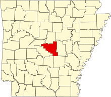
[3] Name on the Register [4] Image Date listed [5] Location City or town Description 1 All Souls Church All Souls Church August 12, 1977 (# 77000275 Off Highway 130 34°41′56″N 92°05′47″W / 34.698889°N 92.096389°W / 34.698889; -92.096389 (All Souls Church ) Scott 2 Bailey Allinder House Bailey Allinder House December 27, 2002 (# 02001600 301 Skyline Dr. 34°46′52″N 92°15′29″W / 34.781111°N 92.258056°W / 34.781111; -92.258056 (Bailey Allinder House ) North Little Rock 3 Argenta Historic District Argenta Historic District March 15, 1993 (# 93000094 Roughly Melrose Cir. and Willow St. south to W. 4th St., and Main St. from W. 6th St. to W. 3rd St.; also 616 Orange St., 116 W. 7th St., 206 W. 7th St., 212 W. 7th St., 220 W. 7th St., 616 Maple St., and 620 Maple St.; also roughly bounded by N. Poplar, 9th St., N. Broadway, W. 4th, and Broadway 34°45′32″N 92°16′11″W / 34.758889°N 92.269722°W / 34.758889; -92.269722 (Argenta Historic District ) North Little Rock Second and third sets of boundaries represent boundary increases of February 22, 2002 and March 8, 2007 respectively 4 ARKANSAS II (riverboat) Upload image June 14, 1990 (# 90000899 Southern end of Locust St. on David D. Terry Lake 34°45′05″N 92°15′41″W / 34.751389°N 92.261389°W / 34.751389; -92.261389 (ARKANSAS II (riverboat) North Little Rock 5 Arkansas Ordnance Plant Guard House Arkansas Ordnance Plant Guard House September 20, 2006 (# 06000831 100 Veteran's Circle 34°52′03″N 92°07′22″W / 34.867519°N 92.122679°W / 34.867519; -92.122679 (Arkansas Ordnance Plant Guard House ) Jacksonville On the grounds of the Jacksonville Museum of Military History 6 Carl Bailey Company Building Carl Bailey Company Building September 23, 2009 (# 09000737 3100 E. Broadway 34°45′17″N 92°13′55″W / 34.754858°N 92.232064°W / 34.754858; -92.232064 (Carl Bailey Company Building ) North Little Rock 7 Baker House Baker House December 6, 1978 (# 78000627 109 5th St. 34°45′30″N 92°16′05″W / 34.758333°N 92.268056°W / 34.758333; -92.268056 (Baker House ) North Little Rock 8 Barth-Hempfling House Barth-Hempfling House October 16, 1986 (# 86002860 507 Main St. 34°46′03″N 92°16′03″W / 34.7675°N 92.2675°W / 34.7675; -92.2675 (Barth-Hempfling House ) North Little Rock 9 Bayou Meto (Reed's Bridge) Battlefield Bayou Meto (Reed's Bridge) Battlefield December 31, 2002 (# 02001627 Highway 161 at Bayou Meto 34°50′44″N 92°07′06″W / 34.845556°N 92.118333°W / 34.845556; -92.118333 (Bayou Meto (Reed's Bridge) Battlefield ) Jacksonville 10 Cecil M. Buffalo Jr. House Upload image September 17, 2018 (# 100002951 16324 Arch Street Pike 34°38′27″N 92°18′33″W / 34.6409°N 92.3091°W / 34.6409; -92.3091 (Cecil M. Buffalo Jr. House ) Landmark 11 Burns Park Golf Center Upload image September 26, 2022 (# 100008148 28 Championship Dr. 34°47′27″N 92°18′27″W / 34.7907°N 92.3075°W / 34.7907; -92.3075 (Burns Park Golf Center ) North Little Rock 12 Carmichael House Upload image May 24, 2018 (# 100002478 13905 Arch Street Pike 34°37′27″N 92°18′49″W / 34.6242°N 92.3135°W / 34.6242; -92.3135 (Carmichael House ) Landmark 13 Cherry House Cherry House June 1, 1992 (# 92000562 217 Dooley Rd. 34°46′54″N 92°15′23″W / 34.781667°N 92.256389°W / 34.781667; -92.256389 (Cherry House ) North Little Rock Designed by Frank Carmean 14 Cherry-Luter Estate Cherry-Luter Estate September 4, 1992 (# 92001155 521 W. Scenic Dr. 34°47′03″N 92°17′23″W / 34.784167°N 92.289722°W / 34.784167; -92.289722 (Cherry-Luter Estate ) North Little Rock 15 CITY OF OAKLAND (USS HOGA ) CITY OF OAKLAND (USS HOGA ) June 30, 1989 (# 89001429 Arkansas Inland Maritime Museum 34°45′09″N 92°16′04″W / 34.752420°N 92.267818°W / 34.752420; -92.267818 (CITY OF OAKLAND (USS HOGA ) North Little Rock Tugboat; at Pearl Harbor fought ship fires and helped push sinking USS Nevada out of the ship channel; served Oakland harbor for many years; The vessel was transferred to the Arkansas Inland Maritime Museum (AIMM) in 2005 [6] and was scheduled to be moved to North Little Rock, Arkansas in 2007. The move has been delayed by damage from Hurricane Katrina along the proposed tow route to AIMM and transport costs. [7] She was moved to the Arkansas Inland Maritime Museum in November 2015. 16 Crestview Park Crestview Park December 4, 1986 (# 86003583 Off Crestview Boulevard [8] 34°46′56″N 92°15′53″W / 34.7822°N 92.2647°W / 34.7822; -92.2647 (Crestview Park ) North Little Rock 17 Doe Branch Post Office Doe Branch Post Office January 26, 2001 (# 01000003 32100 Kanis Rd. 34°47′16″N 92°35′38″W / 34.787778°N 92.593889°W / 34.787778; -92.593889 (Doe Branch Post Office ) Ferndale 18 Duffy House Duffy House September 29, 2014 (# 14000793 124 E. A St. 34°46′58″N 92°15′34″W / 34.7827°N 92.2594°W / 34.7827; -92.2594 (Duffy House ) North Little Rock 19 East End Methodist Episcopal Church East End Methodist Episcopal Church November 12, 2008 (# 08001038 2401 E. Washington Ave. 34°45′14″N 92°14′26″W / 34.753794°N 92.240583°W / 34.753794; -92.240583 (East End Methodist Episcopal Church ) North Little Rock 20 Edgemere Street Bridge Edgemere Street Bridge April 9, 1990 (# 90000533 Edgemere St., at Lake No. 3 34°47′40″N 92°15′00″W / 34.794444°N 92.25°W / 34.794444; -92.25 (Edgemere Street Bridge ) North Little Rock 21 Barney L. Elias House Barney L. Elias House January 27, 2015 (# 14001201 335 Goshen Ave. 34°47′02″N 92°15′04″W / 34.7838°N 92.2512°W / 34.7838; -92.2512 (Barney L. Elias House ) North Little Rock 22 Engelberger House Engelberger House June 14, 1990 (# 90000895 2105 N. Maple St. 34°46′28″N 92°16′06″W / 34.774444°N 92.268333°W / 34.774444; -92.268333 (Engelberger House ) North Little Rock 23 Joseph E. England Jr. House Joseph E. England Jr. House June 1, 1992 (# 92000566 313 Skyline Dr. 34°46′53″N 92°15′29″W / 34.781389°N 92.258056°W / 34.781389; -92.258056 (Joseph E. England Jr. House ) North Little Rock 24 Faucette Building Faucette Building December 6, 1978 (# 78000628 4th and Main Sts. 34°45′26″N 92°16′01″W / 34.757222°N 92.266944°W / 34.757222; -92.266944 (Faucette Building ) North Little Rock 25 James Peter Faucette House James Peter Faucette House January 4, 1978 (# 78000629 316 W. 4th St. 34°45′25″N 92°16′15″W / 34.756944°N 92.270833°W / 34.756944; -92.270833 (James Peter Faucette House ) North Little Rock 26 First Presbyterian Church Manse First Presbyterian Church Manse November 19, 1993 (# 93001251 415 N. Maple St. 34°45′30″N 92°16′09″W / 34.758333°N 92.269167°W / 34.758333; -92.269167 (First Presbyterian Church Manse ) North Little Rock 27 Fort Logan H. Roots Military Post Fort Logan H. Roots Military Post September 4, 1974 (# 74000498 Scenic Hill Dr. 34°46′26″N 92°17′42″W / 34.773889°N 92.295°W / 34.773889; -92.295 (Fort Logan H. Roots Military Post ) North Little Rock 28 Frenchman's Mountain Methodist Episcopal Church-South and Cemetery Frenchman's Mountain Methodist Episcopal Church-South and Cemetery October 22, 1976 (# 76000450 West of Cato on Cato Rd. 34°55′41″N 92°15′53″W / 34.928056°N 92.264722°W / 34.928056; -92.264722 (Frenchman's Mountain Methodist Episcopal Church-South and Cemetery ) Cato 29 Hanger Cotton Gin Hanger Cotton Gin October 8, 1976 (# 76000463 Harper Rd. and Gates Lane 34°41′11″N 92°14′12″W / 34.686389°N 92.236667°W / 34.686389; -92.236667 (Hanger Cotton Gin ) Sweet Home 30 Harris House Upload image January 1, 1976 (# 76000451 Southeast of Hensley off Highway 365 34°29′40″N 92°10′07″W / 34.494444°N 92.168611°W / 34.494444; -92.168611 (Harris House ) Hensley 31 Hodge-Cook House Hodge-Cook House November 19, 1993 (# 93001252 620 N. Maple St. 34°45′36″N 92°16′07″W / 34.76°N 92.268611°W / 34.76; -92.268611 (Hodge-Cook House ) North Little Rock 32 Howell-Garner-Monfee House Howell-Garner-Monfee House January 4, 1978 (# 78000630 300 W. 4th St. 34°45′25″N 92°16′13″W / 34.756944°N 92.270278°W / 34.756944; -92.270278 (Howell-Garner-Monfee House ) North Little Rock 33 George D.D. Huie Grocery Store Building George D.D. Huie Grocery Store Building January 20, 2005 (# 04001504 1400 N. Pine St. 34°46′01″N 92°15′37″W / 34.767014°N 92.260183°W / 34.767014; -92.260183 (George D.D. Huie Grocery Store Building ) North Little Rock 34 Immaculate Heart of Mary Church Immaculate Heart of Mary Church December 22, 1982 (# 82000901 North of North Little Rock off Highway 365 34°52′36″N 92°20′32″W / 34.876667°N 92.342222°W / 34.876667; -92.342222 (Immaculate Heart of Mary Church ) North Little Rock 35 Immaculate Heart of Mary School Immaculate Heart of Mary School September 16, 1993 (# 93000965 Off Highway 365 , north of Blue Hill Rd. 34°52′35″N 92°20′26″W / 34.876389°N 92.340556°W / 34.876389; -92.340556 (Immaculate Heart of Mary School ) Marche 36 Jacksonville Commercial Historic District Jacksonville Commercial Historic District February 8, 2016 (# 15000631 1st from Mulberry to W. Hickory Sts. 34°51′57″N 92°06′39″W / 34.865971°N 92.110728°W / 34.865971; -92.110728 (Jacksonville Commercial Historic District ) Jacksonville 37 Jeffries House Jeffries House June 1, 1992 (# 92000567 415 Skyline Dr. 34°46′50″N 92°15′21″W / 34.780556°N 92.255833°W / 34.780556; -92.255833 (Jeffries House ) North Little Rock 38 K. C. Baking Powder Building Upload image May 12, 2021 (# 100006529 3401 East Broadway 34°45′18″N 92°13′43″W / 34.7550°N 92.2286°W / 34.7550; -92.2286 (K. C. Baking Powder Building ) North Little Rock 39 Dr. Charles H. Kennedy House Upload image September 21, 2017 (# 100001651 6 Edenwood Ln. 34°49′01″N 92°14′53″W / 34.816873°N 92.247950°W / 34.816873; -92.247950 (Dr. Charles H. Kennedy House ) North Little Rock 40 Alton and Ruby Mae Kerby House Upload image September 15, 2021 (# 100006929 532 Skyline Dr. 34°46′48″N 92°15′15″W / 34.7800°N 92.2542°W / 34.7800; -92.2542 (Alton and Ruby Mae Kerby House ) North Little Rock 41 Kleiber House Kleiber House June 1, 1992 (# 92000561 637 Skyline Dr. 34°46′55″N 92°15′16″W / 34.781944°N 92.254444°W / 34.781944; -92.254444 (Kleiber House ) North Little Rock 42 La Belle Creole Upload image January 10, 2024 (# 100009764 8101 Barrett Road 34°49′45″N 92°31′42″W / 34.8292°N 92.5283°W / 34.8292; -92.5283 (La Belle Creole ) Roland vicinity 43 Lake No. 1 Bridge Lake No. 1 Bridge April 9, 1990 (# 90000534 Avondale Rd., over Lake No. 1 34°47′20″N 92°15′08″W / 34.788889°N 92.252222°W / 34.788889; -92.252222 (Lake No. 1 Bridge ) North Little Rock 44 Lakeshore Drive Bridge Lakeshore Drive Bridge April 9, 1990 (# 90000532 Lakeshore Dr. at Lake No. 3 34°47′41″N 92°15′06″W / 34.794722°N 92.251667°W / 34.794722; -92.251667 (Lakeshore Drive Bridge ) North Little Rock 45 Lakewood Park Lakewood Park December 4, 1986 (# 86003586 North end of Lake No. 3 34°47′50″N 92°15′05″W / 34.797129°N 92.251469°W / 34.797129; -92.251469 (Lakewood Park ) North Little Rock 46 Laman Plaza Gazebo Upload image April 10, 2024 (# 100008567 2700 Willow St. 34°46′47″N 92°16′13″W / 34.7797°N 92.2702°W / 34.7797; -92.2702 (Laman Plaza Gazebo ) North Little Rock 47 Land's End Plantation Land's End Plantation January 27, 1999 (# 99000044 1 Land's End Ln. 34°53′36″N 92°07′08″W / 34.893333°N 92.118889°W / 34.893333; -92.118889 (Land's End Plantation ) Scott 48 Lloyd England Hall Upload image May 9, 1997 (# 97000403 Northwestern corner of the junction of Missouri Ave. and 6th St. 34°49′31″N 92°17′13″W / 34.825278°N 92.286944°W / 34.825278; -92.286944 (Lloyd England Hall ) North Little Rock Houses the Arkansas National Guard Museum 49 Locust Street Overpass Upload image January 12, 2021 (# 100006030 Locust St. between S.A. Jones Dr. (East 9th St.) and East 13th St. 34°45′50″N 92°15′41″W / 34.7639°N 92.2615°W / 34.7639; -92.2615 (Locust Street Overpass ) North Little Rock 50 E. O. Manees House E. O. Manees House August 6, 1975 (# 75000413 216 W. 4th St. 34°45′24″N 92°16′11″W / 34.756667°N 92.269722°W / 34.756667; -92.269722 (E. O. Manees House ) North Little Rock 51 Matthews House Matthews House September 29, 1983 (# 83001165 406 Goshen 34°45′54″N 92°15′02″W / 34.765°N 92.250556°W / 34.765; -92.250556 (Matthews House ) North Little Rock 52 Justin Matthews Jr. House Justin Matthews Jr. House December 18, 1990 (# 90001933 257 Skyline Dr. 34°46′54″N 92°15′30″W / 34.781667°N 92.258333°W / 34.781667; -92.258333 (Justin Matthews Jr. House ) North Little Rock 53 Matthews-Bradshaw House Matthews-Bradshaw House June 1, 1992 (# 92000568 524 Skyline Dr. 34°46′47″N 92°15′17″W / 34.779722°N 92.254722°W / 34.779722; -92.254722 (Matthews-Bradshaw House ) North Little Rock 54 Matthews-Bryan House Matthews-Bryan House June 1, 1992 (# 92000560 320 Dooley Rd. 34°46′51″N 92°15′15″W / 34.780833°N 92.254167°W / 34.780833; -92.254167 (Matthews-Bryan House ) North Little Rock 55 Matthews-Dillon House Matthews-Dillon House June 1, 1992 (# 92000563 701 Skyline Dr. 34°46′55″N 92°15′21″W / 34.781944°N 92.255833°W / 34.781944; -92.255833 (Matthews-Dillon House ) North Little Rock 56 Matthews-Godt House Matthews-Godt House June 1, 1992 (# 92000565 248 Skyline Dr. 34°46′55″N 92°15′32″W / 34.781944°N 92.258889°W / 34.781944; -92.258889 (Matthews-Godt House ) North Little Rock 57 Matthews-MacFadyen House Matthews-MacFadyen House June 1, 1992 (# 92000569 206 Dooley Rd. 34°46′52″N 92°15′23″W / 34.781111°N 92.256389°W / 34.781111; -92.256389 (Matthews-MacFadyen House ) North Little Rock 58 Maumelle Ordnance Works Bunker #4 Maumelle Ordnance Works Bunker #4 May 24, 2006 (# 06000417 4 Willastein Dr. 34°51′16″N 92°24′46″W / 34.854444°N 92.412778°W / 34.854444; -92.412778 (Maumelle Ordnance Works Bunker #4 ) Maumelle 59 Maumelle River Bridge Maumelle River Bridge January 21, 2020 (# 100004894 Old AR 300 over the Maumelle River 34°51′05″N 92°29′00″W / 34.8514°N 92.4833°W / 34.8514; -92.4833 (Maumelle River Bridge ) Natural Steps vicinity 60 McCraw Cemetery McCraw Cemetery September 20, 2006 (# 06000829 East of 2101 Old Military Rd. 34°51′10″N 92°05′15″W / 34.852778°N 92.0875°W / 34.852778; -92.0875 (McCraw Cemetery ) Jacksonville 61 McKenzie House McKenzie House March 5, 1992 (# 92000105 4911 Highway 161 34°41′39″N 92°05′48″W / 34.694167°N 92.096667°W / 34.694167; -92.096667 (McKenzie House ) Scott 62 Robert and Marion Millett House No. 1 Upload image January 14, 2021 (# 100006033 1708 Waterside Dr. 34°47′01″N 92°14′49″W / 34.7837°N 92.2469°W / 34.7837; -92.2469 (Robert and Marion Millett House No. 1 ) North Little Rock 63 North Little Rock City Hall North Little Rock City Hall August 6, 1975 (# 75000414 3rd and Main Sts. 34°45′22″N 92°16′02″W / 34.756111°N 92.267222°W / 34.756111; -92.267222 (North Little Rock City Hall ) North Little Rock 64 North Little Rock High School North Little Rock High School February 25, 1993 (# 92001625 101 W. 22nd St. 34°46′34″N 92°16′05″W / 34.776111°N 92.268056°W / 34.776111; -92.268056 (North Little Rock High School ) North Little Rock 65 North Little Rock Post Office North Little Rock Post Office December 22, 1982 (# 82000915 420 N. Main St. 34°45′28″N 92°16′02″W / 34.7578°N 92.2672°W / 34.7578; -92.2672 (North Little Rock Post Office ) North Little Rock Now houses the Argenta Branch Library 66 North Little Rock Veterans Administration Hospital Historic District North Little Rock Veterans Administration Hospital Historic District February 20, 2013 (# 13000021 2200 Fort Roots Dr. 34°46′40″N 92°17′50″W / 34.7777°N 92.2971°W / 34.7777; -92.2971 (North Little Rock Veterans Administration Hospital Historic District ) North Little Rock 67 Old Central Fire Station Old Central Fire Station December 22, 1977 (# 77000274 506 Main St. 34°45′30″N 92°16′02″W / 34.7583°N 92.2672°W / 34.7583; -92.2672 (Old Central Fire Station ) North Little Rock 68 Owings House Owings House June 1, 1992 (# 92000564 563 Skyline Dr. 34°46′50″N 92°15′13″W / 34.7806°N 92.2536°W / 34.7806; -92.2536 (Owings House ) North Little Rock 69 Palarm Bayou Pioneer Cemetery Upload image January 20, 2005 (# 04001491 Lot 13 in the Mountain Crest Subdivision, northeast of Highway 365 34°54′01″N 92°26′23″W / 34.9003°N 92.4397°W / 34.9003; -92.4397 (Palarm Bayou Pioneer Cemetery ) Morgan The Mountain Crest Subdivision is a gated community. 70 Park Hill Fire Station and Water Company Complex Park Hill Fire Station and Water Company Complex November 19, 1993 (# 93001248 3417-3421 Magnolia St. 34°47′13″N 92°15′52″W / 34.7869°N 92.2644°W / 34.7869; -92.2644 (Park Hill Fire Station and Water Company Complex ) North Little Rock 71 Park Hill Historic District Park Hill Historic District August 16, 2000 (# 00000935 Roughly bounded by Plainview Circle, Crestview Boulevard, Ridge St., and H Ave. 34°47′09″N 92°15′40″W / 34.7858°N 92.2611°W / 34.7858; -92.2611 (Park Hill Historic District ) North Little Rock 72 Pruniski House Pruniski House February 9, 1990 (# 90000116 345 Goshen Ave. 34°47′07″N 92°15′12″W / 34.7853°N 92.2533°W / 34.7853; -92.2533 (Pruniski House ) North Little Rock 73 T. R. Pugh Memorial Park T. R. Pugh Memorial Park December 4, 1986 (# 86003585 Near the junction of Fairway Ave. and Lakeshore Dr. [9] 34°47′30″N 92°14′57″W / 34.7917°N 92.2492°W / 34.7917; -92.2492 (T. R. Pugh Memorial Park ) North Little Rock 74 Pyeatte-Mason Cemetery Pyeatte-Mason Cemetery November 7, 1996 (# 96001276 Southwestern corner of the junction of Waterside and Lily Sts. 34°51′07″N 92°25′10″W / 34.8519°N 92.4194°W / 34.8519; -92.4194 (Pyeatte-Mason Cemetery ) Maumelle 75 Rapillard House Rapillard House November 19, 1993 (# 93001249 123 W. 7th St. 34°45′39″N 92°16′06″W / 34.7608°N 92.2683°W / 34.7608; -92.2683 (Rapillard House ) North Little Rock 76 Rock Island-Argenta Depot Rock Island-Argenta Depot September 21, 1989 (# 89001403 4th and Hazel 34°45′24″N 92°15′13″W / 34.7567°N 92.2536°W / 34.7567; -92.2536 (Rock Island-Argenta Depot ) North Little Rock 77 Roland Cutoff site Upload image March 22, 2024 (# 100009787 Address Restricted Roland vicinity 78 Roundtop Filling Station Roundtop Filling Station January 24, 2008 (# 07001432 Junction of Trammel and Roundtop Rds. 34°48′44″N 92°10′42″W / 34.8122°N 92.1783°W / 34.8122; -92.1783 (Roundtop Filling Station ) Sherwood 79 Gene Rush House Upload image January 24, 2019 (# 100003335 9515 Barrett Rd. 34°50′13″N 92°31′18″W / 34.8370°N 92.5217°W / 34.8370; -92.5217 (Gene Rush House ) Roland 80 St. Joseph's Home St. Joseph's Home May 4, 1976 (# 76000462 Camp Robinson Rd. off Highway 176 34°48′59″N 92°16′17″W / 34.8164°N 92.2714°W / 34.8164; -92.2714 (St. Joseph's Home ) North Little Rock 81 Fred and Lucy Alexander Schaer House Fred and Lucy Alexander Schaer House September 27, 2007 (# 07000993 13219 U.S. Route 70 34°46′25″N 92°07′07″W / 34.7736°N 92.1186°W / 34.7736; -92.1186 (Fred and Lucy Alexander Schaer House ) Galloway 82 Seed Warehouse No. 5 Seed Warehouse No. 5 January 21, 2010 (# 09001259 Southwestern corner of U.S. Route 165 and Highway 161 34°41′47″N 92°05′47″W / 34.6963°N 92.0965°W / 34.6963; -92.0965 (Seed Warehouse No. 5 ) Scott 83 Sam and Shirley Strauss House Sam and Shirley Strauss House September 28, 2015 (# 15000634 4 Sunset Dr. 34°47′02″N 92°20′53″W / 34.7838°N 92.348°W / 34.7838; -92.348 (Sam and Shirley Strauss House ) Cammack Village 84 Sylvan Hills Country Club Golf Course Sylvan Hills Country Club Golf Course July 28, 2010 (# 10000289 7400 North Highway 107 34°49′20″N 92°13′39″W / 34.8222°N 92.2275°W / 34.8222; -92.2275 (Sylvan Hills Country Club Golf Course ) Sherwood 85 USS RAZORBACK (SS-394) USS RAZORBACK (SS-394) September 1, 2005 (# 04001502 Northern bank of the Arkansas River in the vicinity of an Interstate 30 bridge 34°45′13″N 92°15′49″W / 34.7536°N 92.2636°W / 34.7536; -92.2636 (USS RAZORBACK (SS-394) ) North Little Rock WWII U.S. submarine that served Turkey 86 Walnut Grove Methodist Church Walnut Grove Methodist Church September 28, 1977 (# 77000273 West of Little Rock on Walnut Grove Rd. 34°46′00″N 92°30′42″W / 34.7667°N 92.5117°W / 34.7667; -92.5117 (Walnut Grove Methodist Church ) Shady Grove 87 Walter Vestal House Upload image February 8, 2021 (# 100006034 331 Goshen Ave. 34°47′03″N 92°15′06″W / 34.7842°N 92.2518°W / 34.7842; -92.2518 (Walter Vestal House ) North Little Rock 88 Waterside Street Bridge Waterside Street Bridge June 14, 1990 (# 90000888 Waterside St. near its junction with Jacksonville Boulevard 34°46′59″N 92°14′46″W / 34.7831°N 92.2461°W / 34.7831; -92.2461 (Waterside Street Bridge ) North Little Rock 89 West-Blazer House Upload image September 21, 2017 (# 100001652 8107 Peters Rd. 34°56′24″N 92°05′24″W / 34.9400°N 92.0901°W / 34.9400; -92.0901 (West-Blazer House ) Jacksonville