National Register of Historic Places listings in Miller County, Arkansas

Last updated

Location of Miller County in Arkansas Map of Arkansas highlighting Miller County.svg
Location of Miller County in Arkansas

This is a list of the National Register of Historic Places listings in Miller County, Arkansas.

Contents

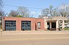
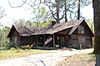
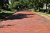
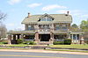
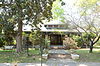
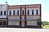
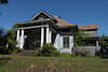
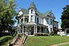
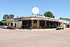
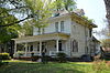
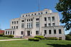
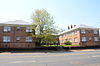
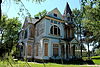
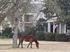
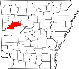
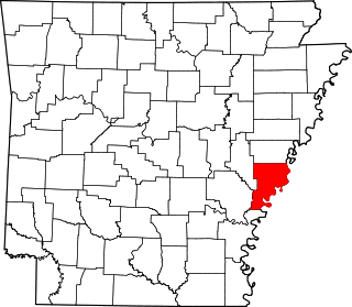
This is intended to be a complete list of the properties and districts on the National Register of Historic Places in Miller County, Arkansas, United States. The locations of National Register properties and districts for which the latitude and longitude coordinates are included below, may be seen in a map. [1]

There are 34 properties and districts listed on the National Register in the county, and four former listings.

Contents: Counties in Arkansas


    This National Park Service list is complete through NPS recent listings posted November 10, 2023. [2]

Map all coordinates using: OpenStreetMap

Current listings

[3] Name on the Register [4] ImageDate listed [5] Location City or townDescription
1 Wallace Adams Service Station
Wallace Adams Service Station Wallace Adams Service Station.JPG
Wallace Adams Service Station
August 1, 2008
(#08000726)
523 E. 3rd St.
33°26′39″N94°02′17″W / 33.444258°N 94.03795°W / 33.444258; -94.03795 (Wallace Adams Service Station)
Texarkana
2 Patrick J. Ahern House
Patrick J. Ahern House Patrick J. Ahern House.JPG
Patrick J. Ahern House
January 20, 2005
(#04001508)
403 Laurel St.
33°25′35″N94°02′23″W / 33.426389°N 94.039722°W / 33.426389; -94.039722 (Patrick J. Ahern House)
Texarkana
3 Averitt House
Averitt House Averitt House.JPG
Averitt House
July 24, 1992
(#92000958)
Western side of U.S. Route 71, 6 miles south of Texarkana
33°20′50″N93°57′51″W / 33.347222°N 93.964167°W / 33.347222; -93.964167 (Averitt House)
Mount Pleasant
4 Beech Street Brick Street
Beech Street Brick Street BeechStBricks1.JPG
Beech Street Brick Street
May 22, 2007
(#07000438)
Beech St. between 14th and 24th Sts.
33°26′50″N94°02′21″W / 33.447222°N 94.039167°W / 33.447222; -94.039167 (Beech Street Brick Street)
Texarkana
5 Beech Street Historic District
Beech Street Historic District BeechStDistrict1.JPG
Beech Street Historic District
January 21, 2010
(#09001254)
Roughly Beech St. between 14th and 23rd Sts.
33°26′26″N94°02′22″W / 33.440553°N 94.039325°W / 33.440553; -94.039325 (Beech Street Historic District)
Texarkana
6 Bottoms House
Bottoms House Bottoms House.JPG
Bottoms House
June 8, 1982
(#82002124)
500 Hickory
33°25′44″N94°02′05″W / 33.428889°N 94.034722°W / 33.428889; -94.034722 (Bottoms House)
Texarkana
7 Buhrman-Pharr Hardware Company Historic District
Buhrman-Pharr Hardware Company Historic District Buhrman1.JPG
Buhrman-Pharr Hardware Company Historic District
September 24, 2004
(#04001045)
610 and 620 E 3rd St.
33°25′36″N94°02′15″W / 33.426667°N 94.0375°W / 33.426667; -94.0375 (Buhrman-Pharr Hardware Company Historic District)
Texarkana
8 Canaan Baptist Church
Canaan Baptist Church Canaanchurch1.JPG
Canaan Baptist Church
June 14, 1990
(#90000903)
Junction of Laurel and 10th Sts.
33°25′59″N94°02′29″W / 33.433056°N 94.041389°W / 33.433056; -94.041389 (Canaan Baptist Church)
Texarkana
9 John Clifton House
John Clifton House John Clifton House.JPG
John Clifton House
June 2, 2000
(#00000608)
1803 Pecan St.
33°26′23″N94°02′14″W / 33.439722°N 94.037222°W / 33.439722; -94.037222 (John Clifton House)
Texarkana
10 Confederate Section-Old Rondo Cemetery
Confederate Section-Old Rondo Cemetery Confederate Section-Old Rondo Cemetery, 1 of 5.JPG
Confederate Section-Old Rondo Cemetery
September 22, 2004
(#04001029)
1612 Smith Rd.
33°26′47″N93°58′03″W / 33.446389°N 93.9675°W / 33.446389; -93.9675 (Confederate Section-Old Rondo Cemetery)
Rondo
11 Cotton Belt Railroad Office Building
Cotton Belt Railroad Office Building Cottonbelt1.JPG
Cotton Belt Railroad Office Building
August 1, 2008
(#08000727)
312 E. Broad St.
33°25′21″N94°02′26″W / 33.422469°N 94.040561°W / 33.422469; -94.040561 (Cotton Belt Railroad Office Building)
Texarkana
12 Crenshaw Site January 26, 1994
(#93001521)
Address Restricted
Hervey
13 Dean House
Dean House DeanHouse1.JPG
Dean House
December 12, 1976
(#76000433)
1520 Beech St.
33°26′19″N94°02′19″W / 33.438611°N 94.038611°W / 33.438611; -94.038611 (Dean House)
Texarkana
14 East Broad Street Historic District
East Broad Street Historic District EastBroadStreet1.JPG
East Broad Street Historic District
August 1, 2008
(#08000729)
100 block of E. Broad St.
33°25′18″N94°02′32″W / 33.421639°N 94.042358°W / 33.421639; -94.042358 (East Broad Street Historic District)
Texarkana
15 Augustus M. Garrison House
Augustus M. Garrison House Garrisonhouse1.JPG
Augustus M. Garrison House
March 25, 1982
(#82002126)
600 Pecan St.
33°25′45″N94°02′11″W / 33.429167°N 94.036389°W / 33.429167; -94.036389 (Augustus M. Garrison House)
Texarkana
16 Hopkins Feed and Seed Store
Hopkins Feed and Seed Store Hopkins1.JPG
Hopkins Feed and Seed Store
August 1, 2008
(#08000728)
301 E. 3rd St.
33°25′24″N94°02′29″W / 33.423364°N 94.041339°W / 33.423364; -94.041339 (Hopkins Feed and Seed Store)
Texarkana
17 Kiblah School
Kiblah School Kiblah School.JPG
Kiblah School
November 20, 1989
(#88003210)
Route 1
33°03′12″N93°52′01″W / 33.053333°N 93.866944°W / 33.053333; -93.866944 (Kiblah School)
Doddridge
18 Kittrell House
Kittrell House Kittrell House.JPG
Kittrell House
December 22, 1982
(#82000864)
1103 Hickory St.
33°26′01″N94°02′11″W / 33.433611°N 94.036389°W / 33.433611; -94.036389 (Kittrell House)
Texarkana
19 Miller County Courthouse
Miller County Courthouse MillerCourthouse1.JPG
Miller County Courthouse
May 29, 1998
(#98000578)
400 Laurel St.
33°25′35″N94°01′38″W / 33.426389°N 94.027222°W / 33.426389; -94.027222 (Miller County Courthouse)
Texarkana
20 Mullins Court
Mullins Court Mullins Court.JPG
Mullins Court
January 29, 2007
(#06001313)
605 Hickory St.
33°25′53″N94°02′08″W / 33.431389°N 94.035556°W / 33.431389; -94.035556 (Mullins Court)
Texarkana
21 Charles J. Neif House
Charles J. Neif House Neifhouse1.JPG
Charles J. Neif House
August 5, 1994
(#94000822)
1410 Pecan St.
33°26′12″N94°02′13″W / 33.436667°N 94.036944°W / 33.436667; -94.036944 (Charles J. Neif House)
Texarkana
22 Nix Creek Bridge January 4, 2021
(#100007323)
US 71 over Nix Cr.
33°25′22″N94°01′50″W / 33.4229°N 94.0306°W / 33.4229; -94.0306 (Nix Creek Bridge)
Texarkana
23 Old Arkansas 2-Mayton Segment
Old Arkansas 2-Mayton Segment Old Arkansas 2-Mayton Segment.JPG
Old Arkansas 2-Mayton Segment
May 16, 2008
(#08000440)
County Roads 122 and 123
33°23′43″N93°44′40″W / 33.395142°N 93.744517°W / 33.395142; -93.744517 (Old Arkansas 2-Mayton Segment)
Garland Part of Arkansas Highway 2
24 Old US 67, Mandeville
Old US 67, Mandeville Old US 67, Mandeville.JPG
Old US 67, Mandeville
January 21, 2004
(#03001458)
Highway 296, County Road 138, and southeast of the current U.S. Route 67
33°29′16″N93°57′35″W / 33.487778°N 93.959722°W / 33.487778; -93.959722 (Old US 67, Mandeville)
Mandeville
25 Orr School
Orr School OrrSchool1.jpg
Orr School
July 30, 1976
(#76000434)
831 Laurel St.
33°25′48″N94°02′31″W / 33.43°N 94.041944°W / 33.43; -94.041944 (Orr School)
Texarkana
26 Ritchie Grocery Building
Ritchie Grocery Building RitchieBuilding.JPG
Ritchie Grocery Building
June 14, 1990
(#90000900)
Junction of Front and Olive Sts.
33°25′15″N94°02′29″W / 33.420833°N 94.041389°W / 33.420833; -94.041389 (Ritchie Grocery Building)
Texarkana
27 Swift Building
Swift Building Swiftbuilding1.JPG
Swift Building
August 1, 2008
(#08000725)
410 E. Broad St.
33°25′23″N94°02′22″W / 33.422956°N 94.039486°W / 33.422956; -94.039486 (Swift Building)
Texarkana
28 Texarkana Union Station
Texarkana Union Station Texarkana Union Station Wiki (1 of 1).jpg
Texarkana Union Station
November 19, 1978
(#78000611)
State Line and Front St.
33°25′12″N94°02′33″W / 33.42°N 94.0425°W / 33.42; -94.0425 (Texarkana Union Station)
Texarkana Extends into Bowie County, Texas
29 Texarkana US Post Office and Courthouse
Texarkana US Post Office and Courthouse State Line Avenue.jpg
Texarkana US Post Office and Courthouse
March 24, 2000
(#00000245)
5th St. and State Line Ave.
33°25′30″N94°02′34″W / 33.425°N 94.042778°W / 33.425; -94.042778 (Texarkana US Post Office and Courthouse)
Texarkana Extends into Bowie County, Texas
30 Texarkana, Arkansas, Municipal Building
Texarkana, Arkansas, Municipal Building Texarkana Municipal Auditorium IMG 67413.jpg
Texarkana, Arkansas, Municipal Building
January 21, 2004
(#03001456)
Walnut and 3rd Sts.
33°25′25″N94°02′22″W / 33.423611°N 94.039444°W / 33.423611; -94.039444 (Texarkana, Arkansas, Municipal Building)
Texarkana
31 J.K. Wadley House
J.K. Wadley House Wadley1.JPG
J.K. Wadley House
February 12, 1999
(#99000155)
618 Pecan St.
33°25′47″N94°02′11″W / 33.429722°N 94.036389°W / 33.429722; -94.036389 (J.K. Wadley House)
Texarkana
32 Alvah Horace Whitmarsh House
Alvah Horace Whitmarsh House Whitmarshhouse1.JPG
Alvah Horace Whitmarsh House
August 29, 1980
(#80000778)
711 Pecan St.
33°25′57″N94°02′26″W / 33.4325°N 94.040556°W / 33.4325; -94.040556 (Alvah Horace Whitmarsh House)
Texarkana
33 Williams-Arnold-Staley House
Williams-Arnold-Staley House Williams-Arnold-Staley House.jpg
Williams-Arnold-Staley House
November 3, 2023
(#100009342)
1005 Pecan St.
33°25′59″N94°02′15″W / 33.4330°N 94.0375°W / 33.4330; -94.0375 (Williams-Arnold-Staley House)
Texarkana
34 Wynn-Price House
Wynn-Price House Wynward Hall- the Wynn-Price Plantation Home.jpg
Wynn-Price House
January 23, 1992
(#90001950)
Price St.
33°21′48″N93°43′24″W / 33.363333°N 93.723333°W / 33.363333; -93.723333 (Wynn-Price House)
Garland

Former listings

[3] Name on the RegisterImageDate listedDate removedLocationCity or townDescription
1 First Methodist Church December 22, 1982
(#82000863)
January 14, 2002400 E. 6th
Texarkana
2 Claude Foulke House
Claude Foulke House Claudehouse1.JPG
Claude Foulke House
April 22, 1982
(#82002125)
September 2, 2022501 Pecan St.
33°25′41″N94°02′09″W / 33.428056°N 94.035833°W / 33.428056; -94.035833 (Claude Foulke House)
Texarkana Demolished in March, 2022. [6]
3 Dr. J. A. Lightfoot House June 30, 1995
(#95000792)
January 14, 2002422 Pecan Street
Texarkana
4 Red River Bridge
Red River Bridge THREE-QUARTER VIEW OF BRIDGE FROM RIVER BANK, LOOKING EAST - Red River Bridge, Spanning Red River at U.S. Highway 82, Garland, Miller County, AR HAER ARK,46-GARCI,1-4.tif
Red River Bridge
April 4, 1990
(#90000517)
August 11, 1999over the Red River
Garland Replaced in 1990. Historic Bridges of Arkansas MPS

See also

Related Research Articles

<span class="mw-page-title-main">National Register of Historic Places listings in Carroll County, Arkansas</span>

This is a list of the National Register of Historic Places listings in Carroll County, Arkansas.

<span class="mw-page-title-main">National Register of Historic Places listings in Arkansas County, Arkansas</span>

This is a list of the National Register of Historic Places listings in Arkansas County, Arkansas.

<span class="mw-page-title-main">National Register of Historic Places listings in Desha County, Arkansas</span>

This is a list of the National Register of Historic Places listings in Desha County, Arkansas.

<span class="mw-page-title-main">National Register of Historic Places listings in Cross County, Arkansas</span>

This is a list of the National Register of Historic Places listings in Cross County, Arkansas.

<span class="mw-page-title-main">National Register of Historic Places listings in Franklin County, Arkansas</span>

This is a list of the National Register of Historic Places listings in Franklin County, Arkansas.

<span class="mw-page-title-main">National Register of Historic Places listings in Cleveland County, Arkansas</span>

This is a list of the National Register of Historic Places listings in Cleveland County, Arkansas.

<span class="mw-page-title-main">National Register of Historic Places listings in Garland County, Arkansas</span>

This is a list of the National Register of Historic Places listings in Garland County, Arkansas.

<span class="mw-page-title-main">National Register of Historic Places listings in Dallas County, Arkansas</span>

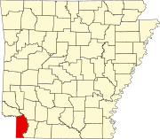
This is a list of the National Register of Historic Places listings in Dallas County, Arkansas.

<span class="mw-page-title-main">National Register of Historic Places listings in Independence County, Arkansas</span>

This is a list of the National Register of Historic Places listings in Independence County, Arkansas.

<span class="mw-page-title-main">National Register of Historic Places listings in Lee County, Arkansas</span>

This is a list of the National Register of Historic Places listings in Lee County, Arkansas.

<span class="mw-page-title-main">National Register of Historic Places listings in Lonoke County, Arkansas</span>

This is a list of the National Register of Historic Places listings in Lonoke County, Arkansas.

<span class="mw-page-title-main">National Register of Historic Places listings in Logan County, Arkansas</span>

This is a list of the National Register of Historic Places listings in Logan County, Arkansas.

<span class="mw-page-title-main">National Register of Historic Places listings in Lawrence County, Arkansas</span>

This is a list of the National Register of Historic Places listings in Lawrence County, Arkansas.

<span class="mw-page-title-main">National Register of Historic Places listings in Nevada County, Arkansas</span>

This is a list of the National Register of Historic Places listings in Nevada County, Arkansas.

<span class="mw-page-title-main">National Register of Historic Places listings in Ouachita County, Arkansas</span>

This is a list of the National Register of Historic Places listings in Ouachita County, Arkansas.

<span class="mw-page-title-main">National Register of Historic Places listings in Phillips County, Arkansas</span>

This is a list of the National Register of Historic Places listings in Phillips County, Arkansas.

<span class="mw-page-title-main">National Register of Historic Places listings in Polk County, Arkansas</span>

This is a list of the National Register of Historic Places listings in Polk County, Arkansas.

<span class="mw-page-title-main">National Register of Historic Places listings in Searcy County, Arkansas</span>

This is a list of the National Register of Historic Places listings in Searcy County, Arkansas.

<span class="mw-page-title-main">National Register of Historic Places listings in Union County, Arkansas</span>

This is a list of the National Register of Historic Places listings in Union County, Arkansas.

<span class="mw-page-title-main">National Register of Historic Places listings in White County, Arkansas</span>

This is a list of the National Register of Historic Places listings in White County, Arkansas.

References

  1. The latitude and longitude information provided in this table was derived originally from the National Register Information System, which has been found to be fairly accurate for about 99% of listings. Some locations in this table may have been corrected to current GPS standards.
  2. National Park Service, United States Department of the Interior, "National Register of Historic Places: Weekly List Actions", retrieved November 10, 2023.
  3. 1 2 Numbers represent an alphabetical ordering by significant words. Various colorings, defined here, differentiate National Historic Landmarks and historic districts from other NRHP buildings, structures, sites or objects.
  4. "National Register Information System". National Register of Historic Places . National Park Service. March 13, 2009.
  5. The eight-digit number below each date is the number assigned to each location in the National Register Information System database, which can be viewed by clicking the number.
  6. "Vintage Arkansas-side home undergoes demolition".