National Register of Historic Places listings in Drew County, Arkansas

Last updated

Location of Drew County in Arkansas Map of Arkansas highlighting Drew County.svg
Location of Drew County in Arkansas

This is a list of the National Register of Historic Places listings in Drew County, Arkansas.

Contents

This is intended to be a complete list of the properties and districts on the National Register of Historic Places in Drew County, Arkansas, United States. The locations of National Register properties and districts for which the latitude and longitude coordinates are included below, may be seen in a map. [1]

There are 25 properties and districts listed on the National Register in the county.

Contents: Counties in Arkansas


    This National Park Service list is complete through NPS recent listings posted May 13, 2022. [2]

Map all coordinates using: OpenStreetMap  
Download coordinates as: KML

Current listings

[3] Name on the Register [4] ImageDate listed [5] Location City or townDescription
1 Arkansas A&M College 4th District Faculty House May 9, 2022
(#100007719)
481 University Dr.
33°35′22″N91°48′53″W / 33.5895°N 91.8146°W / 33.5895; -91.8146 (Arkansas A&M College 4th District Faculty House)
Monticello
2 Arkansas Agricultural and Mechanical College Student Union September 14, 2021
(#100006921)
346 University Dr.
33°35′27″N91°48′39″W / 33.5907°N 91.8109°W / 33.5907; -91.8109 (Arkansas Agricultural and Mechanical College Student Union)
Monticello
3 Bank of Tillar May 9, 2022
(#100007720)
168 South Railroad St.
33°42′30″N91°27′03″W / 33.7084°N 91.4507°W / 33.7084; -91.4507 (Bank of Tillar)
Tillar
4 Garvin Cavaness House
Garvin Cavaness House Garvin Cavaness House 002.jpg
Garvin Cavaness House
May 23, 1980
(#80000775)
404 S. Main St.
33°37′22″N91°47′30″W / 33.6228°N 91.7917°W / 33.6228; -91.7917 (Garvin Cavaness House)
Monticello
5 Drew County Courthouse
Drew County Courthouse Drew County Courthouse 004.jpg
Drew County Courthouse
October 17, 1997
(#97001226)
210 S. Main St.
33°37′36″N91°47′29″W / 33.6267°N 91.7914°W / 33.6267; -91.7914 (Drew County Courthouse)
Monticello
6 Champ Grubbs House
Champ Grubbs House Champ Grubbs House.jpg
Champ Grubbs House
November 20, 1992
(#92001619)
Highway 172 west of New Hope
33°30′46″N91°56′03″W / 33.5128°N 91.9342°W / 33.5128; -91.9342 (Champ Grubbs House)
New Hope
7 Robert Lee Hardy House
Robert Lee Hardy House Hardy House 001.jpg
Robert Lee Hardy House
April 26, 1982
(#82002113)
207 S. Main St.
33°37′36″N91°47′26″W / 33.6267°N 91.7906°W / 33.6267; -91.7906 (Robert Lee Hardy House)
Monticello
8 Hotchkiss House
Hotchkiss House Hotchkiss House.jpg
Hotchkiss House
December 12, 1976
(#76000404)
509 N. Boyd St.
33°37′53″N91°47′39″W / 33.6314°N 91.7942°W / 33.6314; -91.7942 (Hotchkiss House)
Monticello
9 Jerome Elementary School No. 22
Jerome Elementary School No. 22 Jerome School 22.jpg
Jerome Elementary School No. 22
September 28, 2005
(#05001068)
N. Louisiana Boulevard
33°24′11″N91°28′08″W / 33.4031°N 91.4689°W / 33.4031; -91.4689 (Jerome Elementary School No. 22)
Jerome
10 Lambert House
Lambert House Lambert House 001.jpg
Lambert House
December 22, 1983
(#83003545)
204 W. Jackson St.
33°37′35″N91°47′34″W / 33.6264°N 91.7928°W / 33.6264; -91.7928 (Lambert House)
Monticello
11 Look See Tree
Look See Tree Look See Tree.jpg
Look See Tree
January 23, 2008
(#07001427)
Southwestern corner of the junction of Highway 83 and Pleasant Springs Rd.
33°47′10″N91°44′59″W / 33.7861°N 91.7497°W / 33.7861; -91.7497 (Look See Tree)
Coleman
12 Monticello Commercial Historic District
Monticello Commercial Historic District Downtown Monticello, Arkansas 001.jpg
Monticello Commercial Historic District
September 23, 2011
(#11000688)
Bounded roughly by Trotter Ave., Edwards St., Railroad Ave. & Chester St.
33°37′46″N91°47′27″W / 33.6294°N 91.7908°W / 33.6294; -91.7908 (Monticello Commercial Historic District)
Monticello
13 Monticello Confederate Monument
Monticello Confederate Monument Monticello Confederate Monument.jpg
Monticello Confederate Monument
April 26, 1996
(#96000449)
Oakland Cemetery, east of the junction of Oakland Ave. and Hyatt St.
33°38′04″N91°47′52″W / 33.6344°N 91.7978°W / 33.6344; -91.7978 (Monticello Confederate Monument)
Monticello
14 Monticello North Main Street Historic District
Monticello North Main Street Historic District Monticello North Main Historic District 003.jpg
Monticello North Main Street Historic District
February 18, 1979
(#79000437)
Irregular pattern along Westwood Ave. and N. Main St.
33°38′01″N91°47′27″W / 33.6336°N 91.7908°W / 33.6336; -91.7908 (Monticello North Main Street Historic District)
Monticello
15 Monticello Post Office
Monticello Post Office Monticello, Arkansas Post Office.jpg
Monticello Post Office
August 14, 1998
(#98000920)
211 W. Gaines St.
33°37′46″N91°47′31″W / 33.6294°N 91.7919°W / 33.6294; -91.7919 (Monticello Post Office)
Monticello
16 Ridgeway Hotel Historic District
Ridgeway Hotel Historic District Ridgeway Hotel Historic District 001.jpg
Ridgeway Hotel Historic District
January 22, 2009
(#08000952)
200-206 E. Gaines St.
33°37′44″N91°47′24″W / 33.6289°N 91.79°W / 33.6289; -91.79 (Ridgeway Hotel Historic District)
Monticello
17 Rough and Ready Cemetery
Rough and Ready Cemetery Rough and Ready Cemetery.jpg
Rough and Ready Cemetery
November 22, 1999
(#99001376)
Approximately 1 mile southeast of the Monticello Civic Center on Highway 19
33°36′50″N91°47′21″W / 33.6139°N 91.7892°W / 33.6139; -91.7892 (Rough and Ready Cemetery)
Monticello
18 St. Mary's Episcopal Church
St. Mary's Episcopal Church St. Mary's Episcopal Church in Monticello, Arkansas.jpg
St. Mary's Episcopal Church
April 4, 1996
(#96000352)
115 S. Main St.
33°37′39″N91°47′26″W / 33.6275°N 91.7906°W / 33.6275; -91.7906 (St. Mary's Episcopal Church)
Monticello
19 Saline Cemetery
Saline Cemetery Saline Cemetery.jpg
Saline Cemetery
June 15, 2011
(#11000353)
.3 miles south of the junction of US 278 & Allis Rd.
33°37′11″N91°54′30″W / 33.6197°N 91.9083°W / 33.6197; -91.9083 (Saline Cemetery)
Wilmar vicinity
20 Science Building May 12, 2021
(#100006534)
562 University Dr.
33°35′30″N91°48′50″W / 33.5916°N 91.8138°W / 33.5916; -91.8138 (Science Building)
Monticello
21 Selma Methodist Church
Selma Methodist Church Selma Methodist Church.jpg
Selma Methodist Church
September 22, 1972
(#72000202)
North of Highway 4 in Selma
33°41′52″N91°34′11″W / 33.6978°N 91.5697°W / 33.6978; -91.5697 (Selma Methodist Church)
Selma
22 Selma Rosenwald School
Selma Rosenwald School Selma Rosenwald School.jpg
Selma Rosenwald School
March 2, 2006
(#06000069)
Selma-Collins Rd., approximately 0.25 miles south of U.S. Route 278
33°40′30″N91°33′58″W / 33.675°N 91.5661°W / 33.675; -91.5661 (Selma Rosenwald School)
Selma
23 Taylor Log House and Site
Taylor Log House and Site Taylor Log House and Site.jpg
Taylor Log House and Site
October 16, 1995
(#95001168)
Highway 138 west of Winchester
33°46′11″N91°33′04″W / 33.7697°N 91.5511°W / 33.7697; -91.5511 (Taylor Log House and Site)
Winchester
24 Frank Tillar Memorial Methodist Episcopal Church, South
Frank Tillar Memorial Methodist Episcopal Church, South Frank Tillar Memorial Methodist Episcopal Church, South.JPG
Frank Tillar Memorial Methodist Episcopal Church, South
June 4, 1997
(#97000525)
W. Railroad St., north of Highway 277
33°42′37″N91°27′13″W / 33.7103°N 91.4536°W / 33.7103; -91.4536 (Frank Tillar Memorial Methodist Episcopal Church, South)
Tillar
25 Veasey-DeArmond House September 14, 1989
(#89001424)
Highway 81, 15 miles north of Monticello
33°30′41″N91°51′31″W / 33.5114°N 91.8586°W / 33.5114; -91.8586 (Veasey-DeArmond House)
Lacey

See also

Related Research Articles

National Register of Historic Places listings in Carroll County, Arkansas

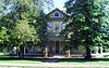
This is a list of the National Register of Historic Places listings in Carroll County, Arkansas.

National Register of Historic Places listings in Boone County, Arkansas

This is a list of the National Register of Historic Places listings in Boone County, Arkansas.

National Register of Historic Places listings in Arkansas County, Arkansas

This is a list of the National Register of Historic Places listings in Arkansas County, Arkansas.

National Register of Historic Places listings in Desha County, Arkansas

This is a list of the National Register of Historic Places listings in Desha County, Arkansas.

National Register of Historic Places listings in Cross County, Arkansas

This is a list of the National Register of Historic Places listings in Cross County, Arkansas.

National Register of Historic Places listings in Franklin County, Arkansas

This is a list of the National Register of Historic Places listings in Franklin County, Arkansas.

National Register of Historic Places listings in Faulkner County, Arkansas

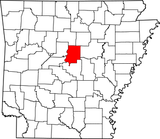
This is a list of the National Register of Historic Places listings in Faulkner County, Arkansas.

National Register of Historic Places listings in Crittenden County, Arkansas

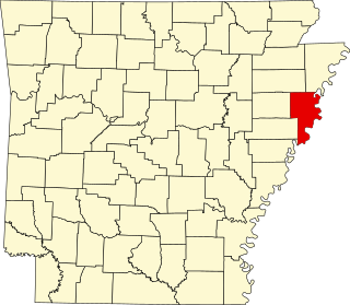
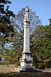
This is a list of the National Register of Historic Places listings in Crittenden County, Arkansas.

National Register of Historic Places listings in Garland County, Arkansas

This is a list of the National Register of Historic Places listings in Garland County, Arkansas.

National Register of Historic Places listings in Dallas County, Arkansas

This is a list of the National Register of Historic Places listings in Dallas County, Arkansas.

National Register of Historic Places listings in Independence County, Arkansas

This is a list of the National Register of Historic Places listings in Independence County, Arkansas.

National Register of Historic Places listings in Lee County, Arkansas

This is a list of the National Register of Historic Places listings in Lee County, Arkansas.

National Register of Historic Places listings in Ouachita County, Arkansas

This is a list of the National Register of Historic Places listings in Ouachita County, Arkansas.

National Register of Historic Places listings in Phillips County, Arkansas

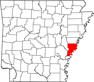
This is a list of the National Register of Historic Places listings in Phillips County, Arkansas.

National Register of Historic Places listings in Polk County, Arkansas

This is a list of the National Register of Historic Places listings in Polk County, Arkansas.

National Register of Historic Places listings in Sharp County, Arkansas

This is a list of the National Register of Historic Places listings in Sharp County, Arkansas.

National Register of Historic Places listings in Searcy County, Arkansas

This is a list of the National Register of Historic Places listings in Searcy County, Arkansas.

National Register of Historic Places listings in Union County, Arkansas

This is a list of the National Register of Historic Places listings in Union County, Arkansas.

National Register of Historic Places listings in Stone County, Arkansas

This is a list of the National Register of Historic Places listings in Stone County, Arkansas.

National Register of Historic Places listings in White County, Arkansas

This is a list of the National Register of Historic Places listings in White County, Arkansas.

References

  1. The latitude and longitude information provided in this table was derived originally from the National Register Information System, which has been found to be fairly accurate for about 99% of listings. Some locations in this table may have been corrected to current GPS standards.
  2. National Park Service, United States Department of the Interior, "National Register of Historic Places: Weekly List Actions", retrieved May 13, 2022.
  3. Numbers represent an alphabetical ordering by significant words. Various colorings, defined here, differentiate National Historic Landmarks and historic districts from other NRHP buildings, structures, sites or objects.
  4. "National Register Information System". National Register of Historic Places . National Park Service. March 13, 2009.
  5. The eight-digit number below each date is the number assigned to each location in the National Register Information System database, which can be viewed by clicking the number.