Randolph County is located between the Ozark Mountains and Arkansas Delta in the U.S. state of Arkansas. The county is named for John Randolph, a U.S. senator from Virginia influential in obtaining congressional approval of the Louisiana Purchase, which includes today's Randolph County. Created as Arkansas's 32nd county on October 29, 1835, Randolph County has two incorporated cities, including Pocahontas, the county seat and most populous city. The county is also the site of numerous unincorporated communities and ghost towns.

Marion County is located in the Ozark Mountains in the U.S. state of Arkansas. The county is named for Francis Marion, the famous "Swamp Fox" of the Revolutionary War. Created as Arkansas's 35th county in 1836, Marion County is home to one incorporated town and four incorporated cities, including Yellville, the county seat. The county is also the site of numerous unincorporated communities and ghost towns. The county included part of what is now Searcy County, Arkansas, with many opposing to dividing them, which helped fueled the bloody Tutt-Everett War between 1844 and 1850.
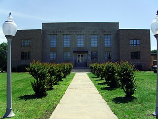
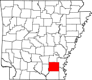
Lincoln County is located between the Arkansas Timberlands and Arkansas Delta in the U.S. state of Arkansas. It is also within the Pine Bluff metro area, and on the outer edge of the Central Arkansas region. The county is named for President Abraham Lincoln. Created as Arkansas's 65th county on March 28, 1871, Lincoln County has three incorporated cities, including Star City, the county seat and most populous city. The county contains 46 unincorporated communities and ghost towns, Cane Creek State Park at the confluence of Cane Creek and Bayou Bartholomew, and nine listings on the National Register of Historic Places to preserve the history and culture of the county.

Ashley County is a rural South Arkansas county with a culture, economy, and history based on timber and agriculture. Created as Arkansas's 52nd county on November 30, 1848, Ashley County has seven incorporated municipalities, including Hamburg, the county seat and Crossett, the most populous city. The county is also the site of numerous unincorporated communities and ghost towns. The county is named for Chester Ashley, a prominent lawyer in the Arkansas Territory and U.S. senator from the state from 1844 to 1848.

Tillar is a town in Desha and Drew counties in the U.S. state of Arkansas. The population was 225 at the 2010 census. The area west of it was known as Tillar Station. Frank Tillar Memorial Methodist Episcopal Church, South is listed on the National Register of Historic Places.

Des ArcDEZ-ark is a city on the White River in the Arkansas Delta, United States. It is the largest city in Prairie County, Arkansas, and the county seat for the county's northern district. Incorporated in 1854, Des Arc's position on the river has shaped its culture, history, and economy, beginning as a major lumber shipping port but leaving the city vulnerable to major floods in 1927 and 1937. As river shipping declined, Des Arc was bypassed by railroads, Interstate highways, and much of the post-industrial society. Des Arc's history is preserved by seven listings on the National Register of Historic Places, and the region's history is interpreted at Lower White River Museum State Park. The city's population stopped growing in the 1980s and has been declining since, with a population of 1,717 at the 2010 Census.

Selma is a town in Johnston County, North Carolina, United States. In 2010, the population was 6,073, and as of 2018 the estimated population was 6,913. Selma is part of the Raleigh-Durham-Cary Combined Statistical Area. The area has a population over 1.7 million residents, though the town of Selma is able to maintain its rural character. The Everitt P. Stevens House, located in Selma, was the site of the last Grand Review of the Confederate Army held on April 6, 1865, after its defeat at the Battle of Bentonville.

U.S. Route 165 is a north–south United States highway spur of U.S. Highway 65. It currently runs for 412 miles (663 km) from U.S. Route 90 in Iowa, Louisiana north to U.S. Highway 70 in North Little Rock, Arkansas. The route passes through the states of Arkansas and Louisiana. It passes through the cities of Monroe and Alexandria in Louisiana. A segment of US 165 serves as a routing of the Great River Road within Arkansas.

U.S. Route 64 is a U.S. highway running from Teec Nos Pos, Arizona east to Nags Head, North Carolina. In the U.S. state of Arkansas, the route runs 246.35 miles (396.46 km) from the Oklahoma border in Fort Smith east to the Tennessee border in Memphis. The route passes through several cities and towns, including Fort Smith, Clarksville, Russellville, Conway, Searcy, and West Memphis. US 64 runs parallel to Interstate 40 until Conway, when I-40 takes a more southerly route.
Drew Central School District 5 is a public school district located in Drew County, Arkansas.
Crocketts Bluff is an unincorporated community in Arkansas County, Arkansas, United States. It is the location of Crocketts Bluff Hunting Lodge, which is located at the end of the dirt road north of the point at which AR 153 turns south, and is listed on the National Register of Historic Places. Crocketts Bluff sits at an elevation of 171 feet the highest point in Arkansas County. The ZIP Code for Crocketts Bluff is 72038.

New Edinburg is an unincorporated census-designated place in Cleveland County, Arkansas, United States. Per the 2020 census, the population was 134.
Lake Dick is an unincorporated community in Jefferson County, Arkansas, United States. Lake Dick is northeast of Pine Bluff and south of Altheimer.
Princeton is a small unincorporated rural village in Princeton Township, Dallas County, Arkansas, United States, located at the junction of Arkansas highways 8 and 9, 7.5 miles (12.1 km) southwest of Carthage. Princeton Cemetery, which is listed on the National Register of Historic Places, is located in the community. It was first listed as a CDP in the 2020 census with a population of 13.

Twelve special routes of U.S. Route 63 currently exist. Arkansas and Missouri each contain five, with two in Iowa. There are also five former routings that have been removed from the system.

The Selma Rosenwald School is a historic school building, just south of US Route 278 on the Selma-Collins Road in Selma, Arkansas. Built in 1924 with funds provided by philanthropist Julius Rosenwald, it is the only surviving Rosenwald School in Drew County. It is a single story wood-frame building with two classrooms. The building was used as a school, serving grades 1 through 10, until 1964. It was then acquired by the local Masonic Lodge.
Dermott School District is a school district headquartered in Dermott, Arkansas. In Chicot County, it serves Dermott. A portion of the district extends into Desha County, where it serves Halley. Another portion extends into Drew County, where it includes Collins.
Springhill is an unincorporated community in Faulkner County, Arkansas, United States. The community is located at the junction of U.S. Route 65 and Arkansas Highway 287, 3 miles (4.8 km) south of Greenbrier.
Aplin is an unincorporated rural village in Perry County, Arkansas, United States. The community is located along Arkansas Highway 60, 10.3 miles (16.6 km) west-southwest of Perryville. In addition to several homes, there is a hearth manufactury located at Aplin, and a church. The Camp House, which is listed on the National Register of Historic Places, is near the community.
Collins is an unincorporated community and census-designated place (CDP) in Drew County, Arkansas, United States. It is located along Arkansas Highway 35, 7 miles (11 km) west of Dermott and 15 miles (24 km) southeast of Monticello. It was first listed as a CDP in the 2020 census with a population of 149.