
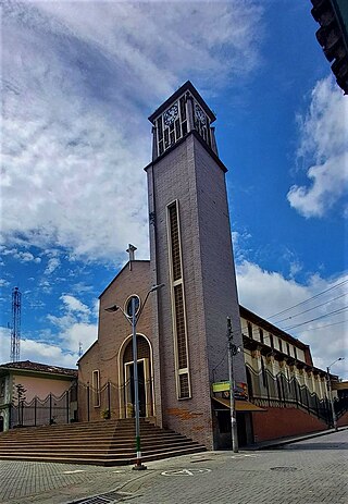
Chinchiná is a town and municipality located in the department of Caldas in Colombia, 17 kilometres (11 mi) southwest of Manizales. Founded in 1857 by Antioquian colonists, Chinchiná is settled in a valley surrounded by coffee plantations, called "fincas", in the Central Cordillera of the Andes. Known as Colombia's "coffee heart", the town is home to the Buendía coffee factory and Cenicafé, a coffee research center.

Manizales is a city in central Colombia. It is the capital of the Department of Caldas, and lies near the Nevado del Ruiz volcano.

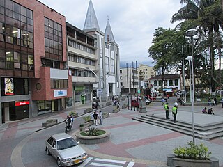
Armenia is the capital of Quindío Department in the South American country of Colombia. Armenia is a medium-sized city and part of the "coffee axis" along with Pereira and Manizales. It's one of the main centers of the national economy and of the Colombian coffee growing axis. As a result, the historic center of Armenia was named as part of the "Coffee Cultural Landscape" of UNESCO World Heritage Site in 2011.

Sevilla is a town and municipality in the Valle del Cauca Department, Colombia. Widely recognized and famous as one of the best Colombian coffee producers. It is also known as the "Coffee Capital of Colombia" In 2003, the municipality had a population of approximately 60,000.
Montenegro is a municipality in the western part of the department of Quindío, Colombia. It is located 10 km west of the departmental capital Armenia. In 2023 it had an estimated population of 38,240.

Pereira is the capital city of the Colombian department of Risaralda. It's located in the foothills of the Andes in a coffee-producing area of Colombia officially known as the "Coffee Axis". Pereira, alongside the rest of the Coffee Axis, form part of UNESCO World Heritage Site known as the "Coffee Cultural Landscape of Colombia". It's the most populated city in the Coffee Axis. Pereira is also part of the Central West Metropolitan Area, which has 735.769 residents and is composed of Pereira and the neighboring cities of Dosquebradas and La Virginia. It's considered the most important city in the "Coffee Axis" from a geopolitical and economic standpoint.
Quimbaya is a town and municipality in the western part of the department of Quindío, Colombia. It's 20 km northwest of the departmental capital Armenia. The name of the city derives from the name of the Precolumbian culture that inhabited the area, the Quimbaya civilization. Located along the Colombian coffee growing axis, the municipality was made part of the "Coffee Cultural Landscape" UNESCO World Heritage Site in 2011.

Pijao is a municipality in the south-eastern part of the department of Quindío, Colombia. The town is located 31 km south of the departmental capital Armenia in the Colombian coffee growing axis, it's part of the "Coffee Cultural Landscape" UNESCO World Heritage Site in 2011.
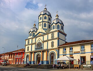
Calarcá is a municipality in the eastern part of the department of Quindío, Colombia. It is located 4 km east of the departmental capital Armenia. Its nickname is La Villa del Cacique in homage of its writers. The city was founded in 1886 by Segundo Henao during the time of colonization by people from Antioquia. It is the second most populated city in Quindío, after Armenia.
Filandia is a town and municipality in the northern part of the department of Quindío, Colombia. It's located on the west side of Cordillera Central of the Andes mountain range running through central Colombia, 26 km north of the departmental capital Armenia. In 2023 the estimated population of Filandia was 12,596 inhabitants.

Génova is a municipality in the southern part of the department of Quindío, Colombia. It's located 52 km south of the departmental capital Armenia.
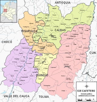
The Colombian coffee region, also known as the Coffee Triangle is a part of the Paisa region in the rural area of Colombia. It is famous for growing and producing the majority of Colombian coffee. There are four departments in the area: Caldas, Quindío, Risaralda and Tolima. The most visited cities are Manizales, Armenia, Pereira, and Ibagué.

Aguadas is a town and municipality in the Colombian department of Caldas. It is bordered to the north by Abejorral, to the east by Sonsón, to the southeast by Salamina, to the south by Pacora, to the west by Caramanta and Valparaiso, and to the northwest by La Pintada. The municipality of Aguadas, located in the northern part of the department, was founded in 1808 by José Narciso Estrada. In addition to the fame of Aguadeño hats, which are very similar to palm-straw Panama hats. Aguadas offers visitors its historic center, which was declared a national monument in 1982. It has a temperate climate thanks to the variety of climates ranging from warm to moor.

Pácora is a town and municipality in the Colombian Department of Caldas. It is located in northern Caldas-Department, on the slopes of the Andes Central Mountains of the Republic of Colombia. With an average annual temperature of 18 °C, the town is bordered to the northeast with Aguadas, Caldas, to the south with Salamina, Caldas and La Merced, and to the west separated by the Cauca River, Marmato-Caldas and Caramanta-Antioquia department. The villages in Pácora are San Bartolomé, Castilla, Las Coles, Los Morros, San Lorenzo and Buenos Aires.

Salamina is a town and municipality in the Colombian department of Caldas. It is located north of the department and has a township called San Felix. It was declared a national monument and historic heritage of mankind.

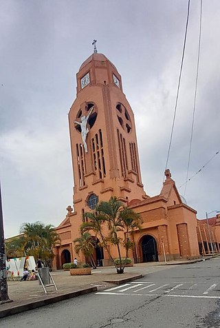
Supía is a town and municipality in the Colombian Department of Caldas. Located along the Colombian coffee growing axis, it was part of the "Coffee Cultural Landscape" UNESCO World Heritage Site in 2011.
Caicedonia is a town and municipality located in the Department of Valle del Cauca, Colombia, situated about 172 km from the capital Cali. Founded in 1910 by Daniel Gutierrez, Juan Bautista Angely and a group of settlers from Antioquia, Caldas, and Tolima, it was named after Lisandro Caicedo and became a municipality in 1923. Mostly mountainous, its economy is based on agriculture and commerce, its main exports are corn, coffee, sugarcane and bananas. Given its location on the border with the Quindío Department, only 35 km from that department's capital, Armenia, Caicedonia belongs ethnographically and culturally to the Paisa region.

The contribution of travel and tourism to GDP was US$5,880.3bn in 2016. Tourism generated 556,135 jobs in 2016. Foreign tourist visits were predicted to have risen from 0.6 million in 2007 to 4 million in 2017. Responsible tourism became a peremptory need for Colombia because it minimizes negative social, economic and environmental impacts and makes positive contributions to the conservation of natural and cultural heritage.

Coffee production in Colombia has a reputation for producing mild, well-balanced coffee beans. Colombia's average annual coffee production of 11.5 million bags is the third total highest in the world, after Brazil and Vietnam, though highest in terms of the arabica bean. The beans are exported to United States, Germany, France, Japan, and Italy. Most coffee is grown in the Colombian coffee growing axis region, while other regions focus on quality instead of volumes, such as Sierra Nevada de Santa Marta. In 2007, the European Union granted Colombian coffee a protected designation of origin status. In 2011, UNESCO declared the "Coffee Cultural Landscape" of Colombia, a World Heritage site.
The Coffee Airport is an under construction international airport in the town of Palestina, Caldas, Colombia. It is planned to replace La Nubia Airport, that currently serves the city of Manizales and the Colombian coffee growing axis region at large.


