Cheriyamundam is a village and Grama Panchayat in Kerala, India. It covers an area of 11.95 km2 and includes 25,760 (1991) inhabitants. It lies near the Tirur River.

Kuttippuram is a town and a block headquarters, which is situated in the Tirur Taluk, Malappuram district of Kerala state, India. The town is located 34 kilometres south-west of Palakkad. The Bharathappuzha river flows through Kuttippuram. According to the last Census of India conducted in 2011,
Chathamangalam is a village in Kozhikode district of Kerala state, India.

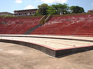
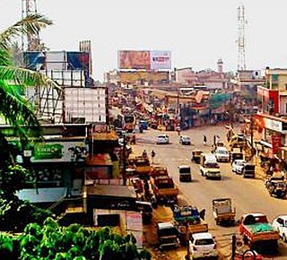
Valanchery is a major municipal town in Malappuram district, Kerala, India. It is one of the four municipalities in Tirur Taluk, besides Tirur, Kottakkal, and Tanur. It is situated about 40 kilometres (25 mi) southeast to Karipur International Airport and 25 kilometres (16 mi) southwards to the district headquarters, and forms a part of Malappuram metropolitan area. It is also one of the major commercial towns under the Malappuram urban agglomeration. Valanchery, which was a part of the erstwhile princely state of the Valluvanad in the early medieval period, had been under the direct control of the Zamorin of Calicut following the Tirunavaya war of 14th century CE. During British Raj, Valanchery was included in the Ponnani Taluk of erstwhile Malabar District. Vattapara accident zone is an accident zone near Valanchery. Valanchery is situated on National Highway 66. There is a huge demand to bifurcate the Tirur and Perinthalmanna taluks and form a new taluk, headquarters at Valanchery. It is under consideration by the state government.
Kottur is a grama panchayat and a community development block in the Kozhikode district of Kerala, India.
Athavanad is a village and Gram Panchayath in the Tirur Taluk, in the Malappuram District of the state of Kerala, India. The town lies on the National Highway 17, between Puthanathani and Valanchery. Puthanathani is the main town of the Athavanad village and the village office is located in Athavanad Para & Kurumbathoor. Nearby towns include Valanchery, Tavanur, Tirunavaya, Kuttippuram, Irimbiliyam, and Edayur. Athavanad is also famous for historical Azhvanchery Mana which built about 400 years ago.

Irimbiliyam is a census town near valanchery in Malappuram district in the state of Kerala, India. There is lot of small villages Like Mankery, Angadi, MOSCOW, Shapumpadi, and Also palli padi, thirunilam
Kalpakanchery is a revenue village and a Gram Panchayat in Tirur Taluk, Malappuram district, Kerala, India. The village is located 21 kilometres (13 mi) south-west to the city of Malappuram.
Kattipparuthi is a census town in Malappuram district in the state of Kerala, India. It is a part of Valanchery municipality.

Marakkara is a grama panchayath in Kuttippuram Block Panchayat, Tirur Taluk, Malappuram district in the state of Kerala, India.

Purathur is a beautiful sandy coastal village and a Grama Panchayat in Tirur Taluk, Malappuram district in the state of Kerala, India. Bharathappuzha river and Tirur River merges together in Purathur and join with the Arabian Sea at Padinjarekara Azhimukham, which is also the southernmost tip of Purathur Gram panchayat. Opposite to Padinjarekara Azhimukham is Ponnani port. The village is located at the southernmost tip of Tirur Taluk and is bordered by historically important Ponnani port in Ponnani Municipality of Ponnani taluk to south.
Thalakkad is a census town in Malappuram district in the state of Kerala, India.
Veliyankode is a beautiful sandy coastal village and a Gram panchayat in Ponnani taluk, Malappuram district in the state of Kerala, India. It is located on the middle of Malabar Coast, between Ponnani and Perumbadappu.

Puthuponnani is coastal locality in Ponnani taluk of Malappuram district in the state of Kerala, India.
Puthanathani is a census town in Malappuram district in the state of Kerala, India. The town lies on the National Highway 66 (India), between Kottakkal and Valanchery. Roads to Vailathur and Thirunavaya also can be seen in Puthanathani.
Perumbadappu is a village located in Ponnani taluk, Malappuram district, Kerala state, India. It is situated 15 kilometers south of Ponnani, bordering Thrissur district. Perumbadappu is also headquarters of one of the 15 Block Panchayats in the district and a police station. Perumbadappu is located south of Veliyankode, in the middle of Malabar Coast.
Kalady is a census town near Edappal in Kalady Grama Panjayath, Ponnani Taluk, Malappuram district, Kerala
Kakkidippuram is a small village in Kerala, composed of WARD 2 & 3 of Alankode panchayath of Malappuram District.
Athavanad is a village and Grama Panchayat in the Malappuram district, the Indian state of Kerala.
Valiyakunnu is a town located in Malappuram district, Kerala, India.

