Panther Creek (Mackinaw River tributary)

Last updated
Panther Creek
Physical characteristics
Main source Woodford County south of Minonk, Illinois
40°52′57″N89°01′32″W / 40.8825336°N 89.0256328°W / 40.8825336; -89.0256328 (Panther Creek origin)
River mouth Confluence with the Mackinaw River southeast of Eureka, Illinois
630 ft (190 m)
40°39′40″N89°11′47″W / 40.6611475°N 89.1964714°W / 40.6611475; -89.1964714 (Panther Creek mouth) Coordinates: 40°39′40″N89°11′47″W / 40.6611475°N 89.1964714°W / 40.6611475; -89.1964714 (Panther Creek mouth)
Length 26 mi (42 km)
Basin features
Progression Panther Creek → Mackinaw → Illinois → Mississippi → Gulf of Mexico
GNIS ID 415347
Map all coordinates using: OpenStreetMap  ·  Google Maps
Download coordinates as: KML  ·  GPX

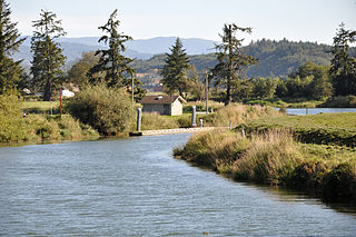
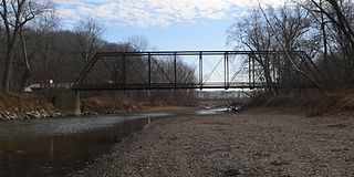
Panther Creek is a large creek (or small river) in the U.S. state of Illinois. [1] It rises near Minonk, and after flowing southwestward approximately 26 miles (42 km), [2] discharges into the Mackinaw River near Eureka. The largest town in the Panther Creek drainage is El Paso, Illinois.

Illinois State of the United States of America

Illinois is a state in the Midwestern and Great Lakes region of the United States. It has the fifth largest gross domestic product (GDP), the sixth largest population, and the 25th largest land area of all U.S. states. Illinois is often noted as a microcosm of the entire United States. With Chicago in northeastern Illinois, small industrial cities and immense agricultural productivity in the north and center of the state, and natural resources such as coal, timber, and petroleum in the south, Illinois has a diverse economic base, and is a major transportation hub. Chicagoland, Chicago's metropolitan area, encompasses over 65% of the state's population. The Port of Chicago connects the state to international ports via two main routes: from the Great Lakes, via the Saint Lawrence Seaway, to the Atlantic Ocean and from the Great Lakes to the Mississippi River, via the Illinois Waterway to the Illinois River. The Mississippi River, the Ohio River, and the Wabash River form parts of the boundaries of Illinois. For decades, Chicago's O'Hare International Airport has been ranked as one of the world's busiest airports. Illinois has long had a reputation as a bellwether both in social and cultural terms and, through the 1980s, in politics.

Minonk, Illinois City in Illinois, United States

Minonk is a city in Minonk Township, Woodford County, Illinois, United States. The population was 2,078 at the 2010 census, down from 2,168 in 2000. It is part of the Peoria, Illinois Metropolitan Statistical Area.

Mackinaw River tributary of the Illinois River in east and central Illinois

The Mackinaw River is a 130-mile-long (210 km) tributary of the Illinois River in the U.S. state of Illinois. Its watershed covers approximately 1,136 square miles (3,000 km2), and contains some of the most productive agricultural land in the United States. The river itself maintains some of the highest quality streams in the state and provides habitat for 60-70 native fish species and 25-30 species of mussels. Its name, also spelled Mackinac, is derived from the Ojibwe word mikinaak meaning "turtle".

Panther Creek drains much of eastern Woodford County. [3] The creek flows through a region of intense corn and soybean cultivation, formerly part of the Illinois Grande Prairie. Together with the rest of the Mackinaw River's drainage, the creek ultimately feeds the lower Illinois River.

Woodford County, Illinois County in the United States

Woodford County is a county located in the state of Illinois. The 2010 United States Census listed its population at 38,664. Its county seat is Eureka.

Maize Cereal grain

Maize, also known as corn, is a cereal grain first domesticated by indigenous peoples in southern Mexico about 10,000 years ago. The leafy stalk of the plant produces pollen inflorescences and separate ovuliferous inflorescences called ears that yield kernels or seeds, which are fruits.

Soybean legume grown for its edible bean with many uses

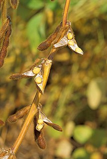
The soybean, or soya bean, is a species of legume native to East Asia, widely grown for its edible bean, which has numerous uses.

This Panther Creek should not be confused with a much smaller Panther Creek in Cass County, which flows through the Jim Edgar Panther Creek State Fish and Wildlife Area.

Cass County, Illinois County in the United States

Cass County is a county located in the U.S. state of Illinois. As of the 2010 United States Census, the population was 13,642. Its county seat is Virginia. It is the home of the Jim Edgar Panther Creek State Fish and Wildlife Area.

Jim Edgar Panther Creek State Fish and Wildlife Area

The Jim Edgar Panther Creek State Fish and Wildlife Area (JEPC) is a conservation area located within Cass County in the U.S. state of Illinois. It is 16,550 acres (6,698 ha) in size. A mix of plowed upland prairie and Panther Creek woodlands, the site is managed by the Illinois Department of Natural Resources. It is drained by the Sangamon River. It is named for former Governor of Illinois Jim Edgar.

See also

Related Research Articles

Illinois River Illinois tributary of the Mississippi River in the United States

The Illinois River is a principal tributary of the Mississippi River, approximately 273 miles (439 km) long, in the U.S. state of Illinois. The river drains a large section of central Illinois, with a drainage basin of 28,756.6 square miles (74,479 km2). The drainage basin extends into Wisconsin, Indiana, and a very small area of southwestern Michigan. This river was important among Native Americans and early French traders as the principal water route connecting the Great Lakes with the Mississippi. The French colonial settlements along the rivers formed the heart of the area known as the Illinois Country. After the construction of the Illinois and Michigan Canal and the Hennepin Canal in the 19th century, the role of the river as link between Lake Michigan and the Mississippi was extended into the era of modern industrial shipping. It now forms the basis for the Illinois Waterway.

North Platte River major tributary of the Platte River

The North Platte River is a major tributary of the Platte River and is approximately 716 miles (1,152 km) long, counting its many curves. In a straight line, it travels about 550 miles (890 km), along its course through the U.S. states of Colorado, Wyoming, and Nebraska.

Trask River river in Oregon

The Trask River is in northwestern Oregon in the United States. It drains a mountainous timber-producing area of the Northern Oregon Coast Range west of Portland into Tillamook Bay and the Pacific Ocean. It is one of five rivers—the Tillamook, the Trask, the Wilson, the Kilchis, and the Miami—that flow into the bay.

Skykomish River river in Washington

The Skykomish River is a Washington river which drains the west side of the Cascade Mountains in the southeast section of Snohomish County and the northeast corner of King County. The river starts with the confluence of the North Fork Skykomish River and South Fork Skykomish River approximately one mile west of Index, then flowing northwesterly towards Puget Sound. It is joined by the Sultan River and the Wallace River at Sultan. It then meets the Snoqualmie River to form the Snohomish River at Monroe. The Snohomish River continues along the river valley eventually dumping into Port Gardner Bay on Possession Sound.

Catoctin Creek is a 14.1-mile-long (22.7 km) tributary of the Potomac River in Loudoun County, Virginia, with a watershed of 59,000 acres (240 km2). Agricultural lands make up 67 percent and forests 30 percent of Catoctin Creek's watershed. It is the main drainage system for the northern Loudoun Valley, including all of the Catoctin Valley.

Carp River is a 40.2-mile-long (64.7 km) river in Chippewa and Mackinac counties in the U.S. state of Michigan. 21.7 miles (34.9 km) of the river were added to the National Wild and Scenic Rivers System in 1992.

Boneyard Creek creek through Champaign and Urbana, Illinois, USA

Boneyard Creek is a 3.3-mile-long (5.3 km) waterway that drains much of the cities of Champaign and Urbana, Illinois. It is a tributary of the Saline Branch of the Salt Fork Vermilion River, which is a tributary of the south-flowing Vermilion River and the Wabash River. The creek flows through the northern sections of the campus of the University of Illinois at Urbana-Champaign. The newsletter of the university's ACM chapter is Banks of the Boneyard, named after the creek.

The Little Mackinaw River is an 18.5-mile-long (29.8 km) river in the U.S. state of Illinois. It is a tributary of the Mackinaw River, which it joins near Hopedale in Tazewell County. The river's name is derived from the Ojibwe word mikinaak meaning "turtle".

Goose Creek (Potomac River tributary) tributary of the Potomac River in Virginia, United States

Goose Creek is a 53.9-mile-long (86.7 km) tributary of the Potomac River in Fauquier and Loudoun counties in northern Virginia. It comprises the principal drainage system for the Loudoun Valley.

Funks Grove, Illinois Unincorporated community in Illinois, United States

Funks Grove is a historic unincorporated community on U.S. Route 66 in McLean County, Illinois, United States southwest of Bloomington. The grove for which the settlement is named, Funk's Grove, is a National Natural Landmark.

Piscasaw Creek is a 31.6-mile-long (50.9 km) tributary of the Kishwaukee River in Wisconsin and Illinois. Rising in Walworth County, Wisconsin, it passes through McHenry County, Illinois before discharging into the Kishwaukee in Boone County, Illinois. Piscasaw Creek's mouth is located near Belvidere, Illinois.

The Red River is a 7.5-mile-long (12.1 km) tributary of Panther Creek in Woodford County, Illinois. Its headwaters are located southeast of Eureka, and after draining several townships it flows into Panther Creek in Palestine Township. Soon afterwards, Panther Creek itself flows into the Mackinaw River near Congerville. Via the Mackinaw River, the Red River of Illinois is part of the Illinois River and Mississippi River watershed.

Little Schuylkill River river in the United States of America

The Little Schuylkill River is a 30.6-mile-long (49.2 km) tributary of the Schuylkill River in northeast Pennsylvania in the United States.

Coldwater River (Western Michigan) river in Michigan, United States of America

The Coldwater River is a 19.4-mile-long (31.2 km) stream in the U.S. state of Michigan. Located in western Michigan, the river is a part of the Grand River drainage basin.

Sugar Creek (Sangamon River tributary) tributary of the Sangamon River in Illinois

Sugar Creek, a tributary of the Sangamon River, is a large creek in central Illinois, United States. It rises in Talkington Township in southwestern Sangamon County, flows briefly through northeastern Macoupin County, and then runs northeastward through south-central Sangamon County before discharging into Lake Springfield. The creek drains Auburn and Virden, Illinois and has a total length of 52.8 miles (85.0 km).

Yellow Creek is a tributary of the Pecatonica River in Stephenson County, in the US state of Illinois. The 50 mile (80.5 km) stream also flows through a small part of Jo Daviess County. The waters of Yellow Creek were accessed for water quality in 1996, 28 miles (45.1 km) were listed as "fair" and 22 miles (35.4 km) "good." During the 1832 Black Hawk War the Battle of Waddams Grove was fought along Yellow Creek.

Ocqueoc River river in the United States of America

The Ocqueoc River is stream in Presque Isle County in the northeastern part of the lower peninsula in the U.S. state of Michigan. It is 34.2 miles (55.0 km) long and encompasses a watershed of approximately 94,394 acres (382.00 km2).

Clearwater River (Idaho) river in the United States of America

The Clearwater River is in the northwestern United States, in north central Idaho. Its length is 74.8 miles (120.4 km), it flows westward from the Bitterroot Mountains along the Idaho-Montana border, and joins the Snake River at Lewiston. In October 1805, the Lewis and Clark Expedition descended the Clearwater River in dugout canoes, putting in at "Canoe Camp," five miles (8 km) downstream from Orofino; they reached the Columbia Bar and the Pacific Ocean about six weeks later.

Arroyo Calabasas is a 7.0-mile-long (11.3 km) tributary of the Los Angeles River, in the southwestern San Fernando Valley area of Los Angeles County in California.

References

  1. U.S. Geological Survey Geographic Names Information System: Panther Creek
  2. U.S. Geological Survey. National Hydrography Dataset high-resolution flowline data. The National Map, accessed May 13, 2011
  3. Illinois Atlas & Gazetteer. Freeport, Maine: DeLorme Mapping. 1991. ISBN   0-89933-213-7.