Papaplaya District

Last updated
Papaplaya
District
Country Flag of Peru.svg  Peru
Region San Martín
Province San Martín
Founded May 8, 1936
Capital Papaplaya
Government
   Mayor Orlando Hipushima Chumbe
Area
  Total 686.19 km2 (264.94 sq mi)
Elevation 100 m (300 ft)
Population (2005 census)
  Total 2,648
  Density 3.9/km2 (10.0/sq mi)
Time zone PET (UTC-5)
UBIGEO 220911

Papaplaya District is one of fourteen districts of the province San Martín in Peru. [1]

Districts of Peru third level administrative subdivision of Peru

The districts of Peru are the third-level country subdivisions of Peru. They are subdivisions of the provinces, which in turn are subdivisions of the larger regions or departments. There are 1,838 districts in total.

San Martín Province Province in San Martín, Peru

The San Martín Province is one of 10 provinces of the San Martín Region in northern Peru.

Peru republic in South America

Peru, officially the Republic of Peru, is a country in western South America. It is bordered in the north by Ecuador and Colombia, in the east by Brazil, in the southeast by Bolivia, in the south by Chile, and in the west by the Pacific Ocean. Peru is a megadiverse country with habitats ranging from the arid plains of the Pacific coastal region in the west to the peaks of the Andes mountains vertically extending from the north to the southeast of the country to the tropical Amazon Basin rainforest in the east with the Amazon river.

Related Research Articles

La Tinguiña District District in Ica, Peru

La Tinguiña District is one of fourteen districts of the province Ica in Peru.

Parcona District District in Ica, Peru

Parcona District is one of fourteen districts of the province Ica in Peru. Parcona is the second smallest of the fourteen districts.

Santiago District, Ica District in Ica, Peru

Santiago District is one of fourteen districts of the province Ica in Peru.

Tate District District in Ica, Peru

Tate District is smallest of fourteen districts of the province Ica in Peru.

El Ingenio District District in Ica, Peru

El Ingenio District is one of five districts of the province Nasca in Peru.

Colca District is one of twenty-eight districts of the province Huancayo in Peru.

Sicaya District District in Junín, Peru

Sicaya District is one of twenty-eight districts of the province Huancayo in Peru.

Paca District District in Junín, Peru

Paca District is one of thirty-four districts of the province Jauja in Peru.

Pomacancha is one of thirty-four districts of the Jauja Province in Peru.

Tunan Marca District District in Junín, Peru

Tunan Marca District is one of thirty-four districts of the province Jauja in Peru.

Yauli District is one of thirty-four districts of the province Jauja in Peru.

Huantán District District in Lima, Peru

Huantán District is one of thirty-three districts of the province Yauyos in Peru.

Madean District is one of thirty-three districts of the province Yauyos in Peru.

Huayllahuara District is one of nineteen districts of the province Huancavelica in Peru.

Ayaví District is one of sixteen districts of the province Huaytará in Peru.

San Francisco de Sangayaico District is one of sixteen districts of the province Huaytará in Peru.

Maquia District is one of eleven districts of the province Requena in Peru.

Vargas Guerra District is one of six districts of the province Ucayali in Peru.

A658 road

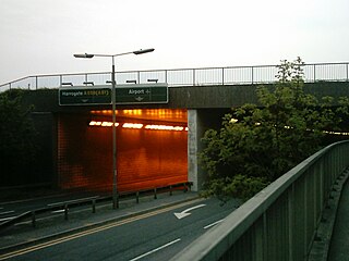
The A658 is a road in the UK running from Bradford, West Yorkshire (53.7949°N 1.7487°W), to Knaresborough, North Yorkshire (54.0065°N 1.4327°W), passing along the way Leeds Bradford International Airport, where it runs through a tunnel directly under the main runway. The road originally terminated south of the village of Pannal at the junction with the A61 but was extended when the south Harrogate and Knaresborough bypass was built and the road now ends east of Knaresborough where it meets the A59.

Bhagauna Village in Bihar, India

Bhagauna is a village in West Champaran district in the Indian state of Bihar.

References

Coordinates: 6°12′42″S75°47′42″W / 6.2118°S 75.7949°W / -6.2118; -75.7949

Geographic coordinate system Coordinate system

A geographic coordinate system is a coordinate system that enables every location on Earth to be specified by a set of numbers, letters or symbols. The coordinates are often chosen such that one of the numbers represents a vertical position and two or three of the numbers represent a horizontal position; alternatively, a geographic position may be expressed in a combined three-dimensional Cartesian vector. A common choice of coordinates is latitude, longitude and elevation. To specify a location on a plane requires a map projection.