Sauce District

Last updated
Sauce
Sawsi
District

Laguna de Sauce, San Martin06.jpg

Country Flag of Peru.svg  Peru
Region San Martín
Province San Martín
Founded May 20, 1936
Capital Sauce
Government
   Mayor Sebastian Calderon Bacon
Area
  Total 103 km2 (40 sq mi)
Elevation 600 m (2,000 ft)
Population (2005 census)
  Total 5,350
  Density 52/km2 (130/sq mi)
Time zone PET (UTC-5)
UBIGEO 220913

Sauce (hispanicized spelling of Quechua sawsi willow) [1] is one of fourteen districts of the province San Martín in Peru. [2]

Willow genus of plants

Willows, also called sallows and osiers, form the genus Salix, around 400 species of deciduous trees and shrubs, found primarily on moist soils in cold and temperate regions of the Northern Hemisphere. Most species are known as willow, but some narrow-leaved shrub species are called osier, and some broader-leaved species are referred to as sallow. Some willows are low-growing or creeping shrubs; for example, the dwarf willow rarely exceeds 6 cm (2.4 in) in height, though it spreads widely across the ground.

Districts of Peru third level administrative subdivision of Peru

The districts of Peru are the third-level country subdivisions of Peru. They are subdivisions of the provinces, which in turn are subdivisions of the larger regions or departments. There are 1,838 districts in total.

San Martín Province Province in San Martín, Peru

The San Martín Province is one of 10 provinces of the San Martín Region in northern Peru.

Contents

Geography

Located in the foothills of the Cordillera Oriental (Peru), the town is 614 m a.s.l. and 51 km south of the Tarapoto city, across the Huallaga River, 6°42’12” south latitude and 76°15’15” west longitude.

The section of the Cordillera Oriental in Peru is in the extreme south-west of the area of study, where manifestation like the spurs of the eastern flank. This unit has modelled itself on metamorphic rocks of the Paleozoic. The eastern limit is more or less uniform and Colorado is located in the beginnings of the tributaries of the valley of the river. It crosses for the average basin of the Marcapata River and goes out of the area of study for Lanlacuni Bajo.

Tarapoto Town in San Martín Region, Peru

Tarapoto is a commercial hub town in the San Martín Province of the San Martín Region or northern Peru. It is an hour by plane from Lima, in the high jungle plateau to the east of what is known as the selva baja. Although Moyobamba is the capital of the region, Tarapoto is the region's largest city and is linked to the Upper Amazon and the historic city of Yurimaguas by a relatively well-maintained transandean highway, paved in 2008-9.

Huallaga River river in Peru

The Huallaga River is a tributary of the Marañón River, part of the Amazon Basin. Old names for this river include Guallaga and Rio de los Motilones. The Huallaga is born on the slopes of the Andes in central Peru and joins the Marañón before the latter reaches the Ucayali River to form the Amazon. Its main affluents are the Monzón, Mayo, Biabo, Abiseo and Tocache rivers. Coca is grown in most of those valleys, which are also exposed to periodic floods.

Places of interest

Related Research Articles

Department of Huánuco Region in 11 provinces and 76 districts, Peru

Huánuco is a department in central Peru. It is bordered by the La Libertad, San Martín, Loreto and Ucayali regions in the north, the Ucayali Region in the east, the Pasco Region in the south and the Lima and Ancash regions in the west. Its capital is the city Huánuco.

Incahuasi District District in Lambayeque, Peru

Incahuasi District or Inkawasi is one of six districts of the Ferreñafe Province in the lambayeque Region in Peru.

Macari District District in Puno, Peru

Macari District is one of nine districts of the Melgar Province in Peru. The capital of the district is Macari.

Cachimayo District District in Cusco, Peru

Cachimayo District is one of nine districts of the province Anta in Peru.

Coya District District in Cusco, Peru

Coya District is one of eight districts of the Calca Province in the Cusco Region of Peru.

Pisac District District in Cusco, Peru

Pisac District is one of eight districts of the province Calca in Peru.

Taray District District in Cusco, Peru

Taray District is one of eight districts of the Calca Province in the Cusco Region in Peru. Its seat is Taray. The town lies near Pisac, southwest of it, at a stream called Pawayuq (Pahuayoc), an affluent of Willkanuta River.

San Pedro District is one of eight districts of the province Canchis in Peru.

Tinta District District in Cusco, Peru

Tinta District is one of eight districts of the Canchis Province in Peru.

Pallpata District is one of eight districts of the Espinar Province in Peru.

Quelloúno is one of ten districts of the La Convención Province in the Cusco Region in Peru.

Omacha District is one of nine districts of the province Paruro in Peru.

Inka Wasi, Ayacucho

Inka Wasi or Inkawasi is an archaeological site in Peru. It is located in the Ayacucho Region, Parinacochas Province, Pullo District.
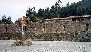
Colcampata

Colcampata is an archaeological site in Peru. It is situated in the Cusco Region, Cusco Province, Cusco District.

Markapukyu is an archaeological site in Peru. It is situated in the Pasco Region, Pasco Province, Yarusyacán District, at a height of 3,787 metres (12,425 ft).

Carachupa

Carachupa is an archaeological site with rock art in Peru. It is located near the village of Carachupa, in Lonya Grande District, region of Amazonas.

Purunllacta, Soloco

Purunllacta or Purum Llacta (possibly from Quechua purum, purun savage, wild / wasteland, llaqta place is an archaeological site in Peru. It is situated in the Amazonas Region, Chachapoyas Province, Soloco District, southwest and near the archaeological site of Purum Llaqta of the Cheto District.

Putka (Junín) mountain in Peru

Putka is a mountain in the Paryaqaqa mountain range in the Andes of Peru, about 5,300 metres (17,388 ft) high. It is located in the Junín Region, Yauli Province, in the districts of Suitucancha and Yauli, north of Qarwachuku.

Putkaqucha is a lake in Peru located in the Junín Region, Yauli Province, Suitucancha District. It lies in the Paryaqaqa or Waruchiri mountain range, south of the mountain Putka.

Mataqucha

Mataqucha is a mountain in the Andes of Peru, about 5,000 metres (16,404 ft) high, at a small lake of the same name. The mountain is located in the Lima Region, Cajatambo Province, Gorgor District, in the Huaura Province, Ambar District, and in the Oyón Province, Caujul District. It lies southeast of Wathiyaqucha and Puka Parya.

References

  1. Diccionario Quechua - Español - Quechua, Academía Mayor de la Lengua Quechua, Gobierno Regional Cusco, Cusco 2005 (Quechua-Spanish dictionary)
  2. (in Spanish) Instituto Nacional de Estadística e Informática. Banco de Información Distrital Archived 2008-04-23 at the Wayback Machine .. Retrieved April 11, 2008.

Coordinates: 6°41′23″S76°13′02″W / 6.6898°S 76.2171°W / -6.6898; -76.2171

Geographic coordinate system Coordinate system

A geographic coordinate system is a coordinate system that enables every location on Earth to be specified by a set of numbers, letters or symbols. The coordinates are often chosen such that one of the numbers represents a vertical position and two or three of the numbers represent a horizontal position; alternatively, a geographic position may be expressed in a combined three-dimensional Cartesian vector. A common choice of coordinates is latitude, longitude and elevation. To specify a location on a plane requires a map projection.