
Makran, mentioned in some sources as Mecran and Mokrān, is the coastal region of Baluchistan. It is a semi-desert coastal strip in Balochistan, in Pakistan and Iran, along the coast of the Gulf of Oman. It extends westwards, from the Sonmiani Bay to the northwest of Karachi in the east, to the fringes of the region of Bashkardia/Bāšgerd in the southern part of the Sistān and Balučestān province of modern Iran. Makrān is thus bisected by the modern political boundary between Pakistan and Iran.

Yazdegerd III was the last Sasanian King of Kings of Iran from 632 to 651. His father was Shahriyar and his grandfather was Khosrow II.

Bahram II was the fifth Sasanian King of Kings (shahanshah) of Iran, from 274 to 293. He was the son and successor of Bahram I. Bahram II, while still in his teens, ascended the throne with the aid of the powerful Zoroastrian priest Kartir, just like his father had done.

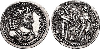
Bahram IV, was the Sasanian King of Kings of Iran from 388 to 399. He was likely the son and successor of Shapur III.
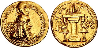
Shapur I was the second Sasanian King of Kings of Iran. The dating of his reign is disputed, but it is generally agreed that he ruled from 240 to 270, with his father Ardashir I as co-regent until the death of the latter in 242. During his co-regency, he helped his father with the conquest and destruction of the Arab city of Hatra, whose fall was facilitated, according to Islamic tradition, by the actions of his future wife al-Nadirah. Shapur also consolidated and expanded the empire of Ardashir I, waged war against the Roman Empire, and seized its cities of Nisibis and Carrhae while he was advancing as far as Roman Syria. Although he was defeated at the Battle of Resaena in 243 by Roman emperor Gordian III, he was the following year able to win the Battle of Misiche and force the new Roman Emperor Philip the Arab to sign a favorable peace treaty that was regarded by the Romans as "a most shameful treaty".

Ardashir I, also known as Ardashir the Unifier, was the founder of the Sasanian Empire. He was also Ardashir V of the Kings of Persis, until he founded the new empire. After defeating the last Parthian shahanshah Artabanus IV on the Hormozdgan plain in 224, he overthrew the Parthian dynasty and established the Sasanian dynasty. Afterwards, Ardashir called himself "shahanshah" and began conquering the land that he called Iran.

Sakastan was a Sasanian province in Late Antiquity, that lay within the kust of Nemroz. The province bordered Kirman in the west, Spahan in the north west, Kushanshahr in the north east, and Turan in the south east. The governor of the province held the title of marzban. The governor also held the title of "Sakanshah" until the title was abolished in ca. 459/60.
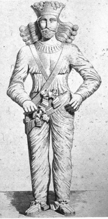
The Pāratarājas or Pāradarājas was a dynasty of Parthian kings, and ruling family from what is now Pakistan, from circa 125 CE to circa 300 CE.
Turan was a province of the Sasanian Empire located in present-day Pakistan. The province was mainly populated by Indians, and bordered Paradan in the west, Hind in the east, Sakastan in the north, and Makuran in the south. The main city and bastion of the province was Bauterna (Khuzdar/Quzdar).

Shapur I's Ka'ba-ye Zartosht inscription, also referred to as The Great Inscription of Shapur I, and Res Gestae Divi Saporis (RGDS), is a trilingual inscription made during the reign of the Sasanian king Shapur I after his victories over the Romans. The inscription is carved on the Ka'ba-ye Zartosht, a stone quadrangular and stepped structure located in Naqsh-e Rustam, an ancient necropolis located northwest of Persepolis, in today's Fars Province, Iran. The inscription dates to c. 262.

Harev, was a Sasanian province in Late Antiquity, that lay within the kust of Khorasan. The province bordered Kushanshahr in the west, Abarshahr in the east, Marv in the north, and Sakastan in the south.

Kirman was a Sasanian province in Late Antiquity, which almost corresponded to the present-day province of Kerman. The province bordered Pars in the west, Abarshahr and Sakastan in the northeast, Paradan in the east, Spahan in the north, and Mazun in the south. The capital of the province was Shiragan.
The administrative divisions of the Sasanian Empire were administrative divisions of the state organisation of the Sasanian Empire.
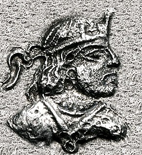
Peroz I Kushanshah was Kushanshah of the Kushano-Sasanian Kingdom from 245 to 275. He was the successor of Ardashir I Kushanshah. He was an energetic ruler, who minted coins in Balkh, Herat, and Gandhara. Under him, the Kushano-Sasanians further expanded their domains into the west, pushing the weakened Kushan Empire to Mathura in North India.

Shapur was an Iranian prince, who was the penultimate King of Persis from 207–210 to 211/2. He was succeeded by his younger brother Ardashir I, who founded the Sasanian Empire.

The Kings of Persis, also known as the Darayanids, were a series of Persian kings, who ruled the region of Persis in southwestern Iran, from the 2nd century BCE to 224 CE. They ruled as sub-kings of the Parthian Empire, until they toppled them and established the Sasanian Empire. They effectively formed some Persian dynastic continuity between the Achaemenid Empire and the Sasanian Empire.
Sasanian coinage was produced within the domains of the Iranian Sasanian Empire (224–651). Together with the Roman Empire, the Sasanian Empire was the most important money-issuing polity in Late Antiquity. Sasanian coinage had a significant influence on coinage of other polities. Sasanian coins are a pivotal primary source for the study of the Sasanian period, and of major importance in history and art history in general. The Sylloge nummorum Sasanidarum is the most important primary work of reference for Sasanian coins.
Andarzbad was a Sasanian administrative office meaning "chief advisor", "chief councillor" or "chief of staff". The andarzbads were assigned to cities within the Sasanian Empire such as Ardashir-Khwarrah or entire provinces, such as Sakastan. The main court andarzbad, known as the darandarzbad, served the Shahanshah directly and was one of the highest-ranking dignitaries within the Sasanian court. However, there were also andarzbads who served in other functions. There was the andarzbad ī aswāragān, who instructed the Sasanian knights, or according to Anahit Perikhanian the andarzbadī wāspuhragān, who exercised executive authority within the King's domain. The "andarzbad of the queens" dates back to the reign of Shapur I and is attested in his inscription at the Ka'ba-ye Zartosht. The mōgān-andarzbad was a dignitary who effectively functioned as a legal consultant and held status as "one of the highest ranking dignitaries of the priestly class". M. L. Chaumont adds that the mōgān-andarzbad office "was quite different from that of the mōbadān mōbad". Andarzgar, a less familiar Sasanian title, may have been modeled on andarzbad but this remains uncertain.
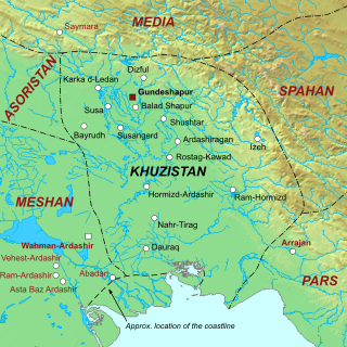
Khuzistan or Huzistan was a Sasanian province in Late Antiquity, which almost corresponded to the present-day province of Khuzestan. Its capital was Gundeshapur. During the late Sasanian era, the province was included in the southern quadrant (kust) of Nemroz.

Hind was the name of a southeastern Sasanian province lying near the Indus River. The boundaries of the province are obscure. The Austrian historian and numismatist Nikolaus Schindel has suggested that the province may have corresponded to the Sindh region, where the Sasanians notably minted unique gold coins of themselves. According to the modern historian C. J. Brunner, the province possibly included—whenever jurisdiction was established—the areas of the Indus River, including the southern part of Punjab.


