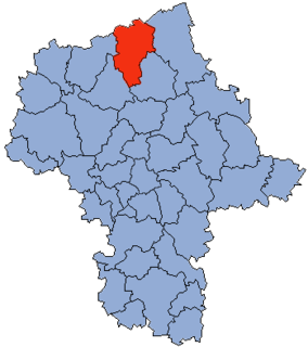
Gmina Chorzele is an urban-rural gmina in Przasnysz County, Masovian Voivodeship, in east-central Poland. Its seat is the town of Chorzele, which lies approximately 26 kilometres (16 mi) north of Przasnysz and 115 km (71 mi) north of Warsaw.

Krukowo is a village in the administrative district of Gmina Chorzele, within Przasnysz County, Masovian Voivodeship, in east-central Poland. It lies approximately 15 kilometres (9 mi) north-east of Chorzele, 35 km (22 mi) north-east of Przasnysz, and 121 km (75 mi) north of Warsaw.
Łaz is a village in the administrative district of Gmina Chorzele, within Przasnysz County, Masovian Voivodeship, in east-central Poland. It lies approximately 8 kilometres (5 mi) north-east of Chorzele, 31 km (19 mi) north of Przasnysz, and 119 km (74 mi) north of Warsaw.
Niskie Wielkie is a village in the administrative district of Gmina Chorzele, within Przasnysz County, Masovian Voivodeship, in east-central Poland. It lies approximately 4 kilometres (2 mi) north-west of Chorzele, 28 km (17 mi) north of Przasnysz, and 117 km (73 mi) north of Warsaw.
Pruskołęka is a village in the administrative district of Gmina Chorzele, within Przasnysz County, Masovian Voivodeship, in east-central Poland. It lies approximately 10 kilometres (6 mi) east of Chorzele, 30 km (19 mi) north of Przasnysz, and 117 km (73 mi) north of Warsaw.
Rzodkiewnica is a village in the administrative district of Gmina Chorzele, within Przasnysz County, Masovian Voivodeship, in the east-central area of Poland. It lies approximately 16 kilometres (10 mi) east of Chorzele, 34 km (21 mi) north-east of Przasnysz, and 119 km (74 mi) north of Warsaw.
Budy Rządowe is a village in the administrative district of Gmina Jednorożec, within Przasnysz County, Masovian Voivodeship, in east-central Poland. It lies approximately 6 kilometres (4 mi) north-east of Jednorożec, 24 km (15 mi) north-east of Przasnysz, and 106 km (66 mi) north of Warsaw.
Drążdżewo Nowe is a village in the administrative district of Gmina Jednorożec, within Przasnysz County, Masovian Voivodeship, in east-central Poland. It lies approximately 4 kilometres (2 mi) east of Jednorożec, 20 km (12 mi) north-east of Przasnysz, and 102 km (63 mi) north of Warsaw.
Dynak is a village in the administrative district of Gmina Jednorożec, within Przasnysz County, Masovian Voivodeship, in east-central Poland. It lies approximately 12 kilometres (7 mi) north-east of Jednorożec, 30 km (19 mi) north-east of Przasnysz, and 112 km (70 mi) north of Warsaw.
Małowidz is a village in the administrative district of Gmina Jednorożec, within Przasnysz County, Masovian Voivodeship, in east-central Poland. It lies approximately 10 kilometres (6 mi) north of Jednorożec, 24 km (15 mi) north of Przasnysz, and 111 km (69 mi) north of Warsaw.
Nakieł is a village in the administrative district of Gmina Jednorożec, within Przasnysz County, Masovian Voivodeship, in east-central Poland.
Obórki is a village in the administrative district of Gmina Jednorożec, within Przasnysz County, Masovian Voivodeship, in east-central Poland. It lies approximately 5 kilometres (3 mi) south-west of Jednorożec, 13 km (8 mi) north-east of Przasnysz, and 99 km (62 mi) north of Warsaw.
Olszewka is a village in the administrative district of Gmina Jednorożec, within Przasnysz County, Masovian Voivodeship, in east-central Poland. It lies approximately 10 kilometres (6 mi) north of Jednorożec, 25 km (16 mi) north-east of Przasnysz, and 111 km (69 mi) north of Warsaw.
Połoń is a village in the administrative district of Gmina Jednorożec, within Przasnysz County, Masovian Voivodeship, in east-central Poland. It lies approximately 10 kilometres (6 mi) north-west of Jednorożec, 24 km (15 mi) north of Przasnysz, and 111 km (69 mi) north of Warsaw.
Stegna is a village in the administrative district of Gmina Jednorożec, within Przasnysz County, Masovian Voivodeship, in east-central Poland.
Ulatowo-Pogorzel is a village in the administrative district of Gmina Jednorożec, within Przasnysz County, Masovian Voivodeship, in east-central Poland.
Żelazna Prywatna is a village in the administrative district of Gmina Jednorożec, within Przasnysz County, Masovian Voivodeship, in east-central Poland. It lies approximately 12 kilometres (7 mi) north-east of Jednorożec, 30 km (19 mi) north-east of Przasnysz, and 113 km (70 mi) north of Warsaw.
Żelazna Rządowa is a village in the administrative district of Gmina Jednorożec, within Przasnysz County, Masovian Voivodeship, in east-central Poland. It lies approximately 11 kilometres (7 mi) north-east of Jednorożec, 29 km (18 mi) north-east of Przasnysz, and 113 km (70 mi) north of Warsaw.
Sątrzaska is a village in the administrative district of Gmina Przasnysz, within Przasnysz County, Masovian Voivodeship, in east-central Poland. It lies approximately 9 kilometres (6 mi) north-east of Przasnysz and 93 km (58 mi) north of Warsaw.