
The Mississippi River is the primary river, and second-longest river, of the largest drainage basin in the United States. From its traditional source of Lake Itasca in northern Minnesota, it flows generally south for 2,340 miles (3,766 km) to the Mississippi River Delta in the Gulf of Mexico. With its many tributaries, the Mississippi's watershed drains all or parts of 32 U.S. states and two Canadian provinces between the Rocky and Appalachian mountains. The main stem is entirely within the United States; the total drainage basin is 1,151,000 sq mi (2,980,000 km2), of which only about one percent is in Canada. The Mississippi ranks as the thirteenth-largest river by discharge in the world. The river either borders or passes through the states of Minnesota, Wisconsin, Iowa, Illinois, Missouri, Kentucky, Tennessee, Arkansas, Mississippi, and Louisiana.

Linn County is a county located in the U.S. state of Iowa. As of the 2020 census, the population was 230,299, making it the second-most populous county in Iowa. The county seat is Cedar Rapids. Linn County is named in honor of Senator Lewis F. Linn of Missouri. Linn County is included in the Cedar Rapids, IA Metropolitan Statistical Area.

Jones County is a county in the U.S. state of Iowa. As of the 2020 census the population was 20,646. The county seat is Anamosa. The county was founded in 1837 and named after George Wallace Jones, a United States senator and member of Congress.

Independence is a city in, and the county seat of, Buchanan County, Iowa, United States. The population was 6,064 in the 2020 census, an increase from 6,014 in 2000.
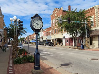
Anamosa is a city in Jones County, Iowa, United States. The population was 5,450 at the 2020 census. It is the county seat of Jones County.

The Wapsipinicon River is a tributary of the Mississippi River, approximately 300 miles (480 km) long, starting near the southeastern border of Minnesota and running through northeastern Iowa in the United States. It drains a rural farming region of rolling hills and bluffs north of Waterloo and Cedar Rapids.
Oxford Mills is an unincorporated community in Jones County, Iowa, United States. Oxford Mills is located on the Wapsipinicon River, south of Oxford Junction.

The Burlington, Cedar Rapids and Northern Railway (BCR&N) was a railroad that operated in the United States from 1876 to 1903. It was formed to take over the operations of the bankrupt Burlington, Cedar Rapids and Minnesota Railway, which was, in turn, the result of merging several predecessor lines, the construction of which began in 1869. The corporate headquarters were in Cedar Rapids, Iowa, and it had operations in Iowa and in Minnesota. It was succeeded by the Chicago, Rock Island and Pacific Railway.

The Buffalo Bill Cody Homestead is the boyhood home of Buffalo Bill Cody, a government scout and Wild West showman. The homestead is located in the broad valley of the Wapsipinicon River Valley south of McCausland, Iowa, United States, in rural Scott County. The farmhouse was built in 1847 by Isaac Cody, Buffalo Bill's father, of native limestone and contains walnut floors and trim.

U.S. Highway 161 was a U.S. Highway in Iowa that ran from Keokuk to Dubuque by way of Cedar Rapids. It was designated in 1925 and signed in 1926 along two primary highways. The route began at the Mississippi River with US 61 southwest of Keokuk ran north through Mount Pleasant and Iowa City to Cedar Rapids. There, it turned to the northeast through Anamosa and Monticello towards Dubuque. The route ended at US 61 in Key West, a few miles west of Dubuque.

Massillon is an unincorporated community in Massillon Township, Cedar County, Iowa, United States. It is south of the Wapsipinicon River on County Road Y24, west of Toronto and north of Lowden in the northeastern corner of the county, at 41.914844N, -90.922851W.
Waubeek is an unincorporated community in Linn County, Iowa, United States.
Folletts is an unincorporated community in Clinton County, Iowa, United States. It is located at the intersections of 292nd Street and County Highway Z36 on the north bank of the Wapsipinicon River. It is one mile west of Shaffton and three miles east of McCausland, at 41.750099N, -90.354990W.
Deerfield is an unincorporated community in Chickasaw County, Iowa, United States. It is located near the intersections of County Highways B28 and T76 on the east side of the Wapsipinicon River. It is five miles east of Colwell and four miles northwest of North Washington, at 43.162975N, -92.495651W.

The Upper Paris Bridge is an historic structure located near the town of Coggon in rural Linn County, Iowa, United States. The pin-connected Whipple through truss bridge was built in 1879 as a wagon bridge. It was designed by the Wrought Iron Bridge Company of Canton, Ohio. The bridge was listed on the National Register of Historic Places in 1998 as a part of the Highway Bridges of Iowa MPS.

The Wapsipinicon River Bridge is a historic structure located in Independence, Iowa, United States. It spans the Wapsipinicon River for 341 feet (104 m). The Buchanan County Board of Supervisors contracted with the Miller-Taylor Construction Company from Waterloo, Iowa, to build the new bridge on the south side of Independence for $37,680. However, high water created problems during construction, and the bridge was completed in January 1927 for $57,530. It replaced an earlier two-span iron truss bridge. This bridge is a concrete filled spandrel arch bridge with four spans. It was designed by the Iowa State Highway Commission, and continues to carry vehicle traffic. The bridge was listed on the National Register of Historic Places in 1998. There is a similar bridge upstream in Independence that was built in 1918.
Sumner Bridge is a historic structure located in Sumner, Iowa, United States. It spans the Little Wapsipinicon River for 125 feet (38 m). In June 1916 the Fayette County Board of Supervisors agreed with the supervisors in Bremer County to build this bridge on the county line. The agreement was for Bremer County to take the lead on the planning and for both counties to share the costs. Fred Boedeker was awarded a contract for $7,058 to build this concrete deck girder bridge designed by the Iowa State Highway Commission. The three span structure features concrete abutments and piers with bullnosed cutwaters. The bridge was listed on the National Register of Historic Places in 1998.

Hale Bridge is a historic structure located south of Anamosa, Iowa, United States. It spans the Wapsipinicon River for 296 feet (90 m). It is an example of a bowstring through-arch truss bridge. Perhaps thousands of these bridges were built in Iowa in the late 1860s through the 1870s. However, by 1992, fewer than twenty survive.

Wapsipinicon State Park is located south of Anamosa, Iowa, United States. The 394-acre (159 ha) park is along the sandstone and limestone bluffs of the Wapsipinicon River, from which it derives its name. It is one of the oldest state parks in Iowa, and it was listed as a historic district on the National Register of Historic Places in 2014.

The Matsell Bridge is a historic structure located northeast of Springville, Iowa, United States. It carries Matsell Park Road for 303 feet (92 m) over the Wapsipinicon River. This bridge replaced a bowstring truss bridge that had been built in stages between 1870 and 1906. E.W. Blumenschein, bridge design engineer for the Iowa State Highway Commission, recommended a plate girder bridge as a replacement. Clifford Shoemaker, District Engineer of the Federal Bureau of Public Roads, approved the plans as the new span was built by the Works Progress Administration. It was constructed by Amos Melberg for about $22,300. The bridge was listed on the National Register of Historic Places in 1998.


