
Deriringa is a Parish of Ularara County in north west New South Wales. It is between Milparinka, New South Wales and Wilcannia and west of Wanaaring. The main economic activity of the parish is agriculture, with the Ardoo and the Salisbury Downs Station. the parish is at 30°06′37″S 143°34′02″E.
Kootooloomondoo, New South Wales, located at 30.078611°S 142.956111°E is a Parish of Yantara County in north west New South Wales. It is between Milparinka, New South Wales and Wilcannia The main economic activity of the parish is agriculture, the Salisbury Downs Station is nearby.

Whyjonta is a parish of Yantara County in far north west New South Wales.

Albert Parish, New South Wales is a remote civil parish of Yantara County near Milparinka, New South Wales.
Woombup is a remote civil parish of Yantara County in far North West New South Wales, located at 30°12′49″S 142°32′44″E.
Wunawunty is a remote civil parish of Yantara County in far northwest New South Wales. located at 29°59′37″S 142°06′40″E, east of the Silver City Highway.

Yandenberry is a remote civil parish of Yantara County in far northwest New South Wales. located at 30°19′15″S 142°26′32″E, east of the Silver City Highway.
Weimbutta is a remote civil parish of Yantara County in far North West New South Wales. located at 30°04′42″S 142°45′50″E, east of the Silver City Highway.

Mount Blackwood, New South Wales located at 29°48′37″S 141°31′10″E, is a remote rural locality and civil parish of Evelyn County in far northwest New South Wales. located at 30°04′42″S 142°45′50″E, east of the Silver City Highway . The geography of the parish is mostly the flat, arid landscape of the Channel Country. The parish has a Köppen climate classification of BWh.
The Parish of Tiltabrinna is a remote civil parish of Yantara County in far North West New South Wales. The Geography, of the parish is mostly the flat, arid landscape of the Channel Country. The parish has a Köppen climate classification of BWh.
Torowoto Parish is a remote civil parish of Yantara County in far North West New South Wales. The Geography, of the parish is mostly the flat, arid landscape of the Channel Country. The parish has a Köppen climate classification of BWh.
Terrawinda is a remote civil parish of Yantara County in far North West New South Wales. The Geography, of the parish is mostly the flat, arid landscape of the Channel Country. The parish has a Köppen climate classification of BWh.
Parish of Kooltoo, New South Wales is a remote civil parish of Yantara County in far North West New South Wales. The geography of the parish is mostly the flat, arid landscape of the Channel Country. The parish has a Köppen climate classification of BWh.
Parish of Banjah, New South Wales is a remote civil parish of Yantara County in far northwest New South Wales.
Buona is a remote civil parish of Yantara County in far northwest New South Wales.

Dooran Parish, New South Wales is a rural locality of Warren Shire and a civil parish of Oxley County, New South Wales, a Cadastral divisions of New South Wales.
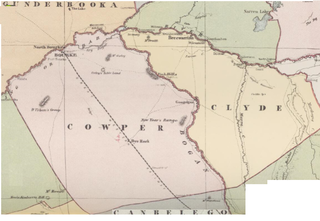
Medway Parish, New South Wales is a Bounded locality of Bogan Shire and a civil Parish of Cowper County, New South Wales, a cadasteral division of central New South Wales.
Maffra Parish, New South Wales is a Bounded locality of Bourke Shire and a civil Parish of Cowper County, New South Wales, a cadasteral division of central New South Wales.
Mulgawarrina, New South Wales is a Bounded locality of Bogan Shire and a civil Parish of Cowper County, New South Wales, a cadasteral division of central New South Wales.

Garfield Parish, New South Wales is a civil Parish of Cowper County, New South Wales, a cadasteral division of central New South Wales.
