
Cumberland is a historic county of North West England that had an administrative function from the 12th century until 1974. It was bordered by Northumberland to the east, County Durham to the southeast, Westmorland and Lancashire to the south, and the Scottish counties of Dumfriesshire and Roxburghshire to the north. It formed an administrative county from 1889 to 1974 and now forms part of Cumbria.

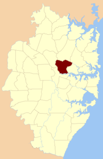
Cumberland County is a county in the State of New South Wales, Australia. Most of the Sydney metropolitan area is located within the County of Cumberland.
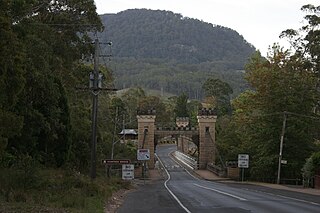
The Kangaroo River is a perennial river of the Shoalhaven catchment located in the Southern Highlands and Illawarra regions of New South Wales, Australia.

Minto Parish is one of the 57 parishes of Cumberland County, New South Wales, a cadastral unit for use on land titles. It includes Minto, Ingleburn, Glenfield and Macquarie Fields. Its eastern boundary is the Georges River, and western boundary was at the Great Southern Road.
Field of Mars Parish is one of the 57 parishes of Cumberland County, New South Wales, a cadastral unit for use on land titles. While the name is mostly forgotten as a region name today, it has given the name to the modern suburb of Marsfield and the reserve in the area. It is centred on Carlingford and also includes Epping, Telopea and Ermington. Its southern boundary is the Parramatta River.
The Parish of Sutton Forest is a parish of the County of Camden in the Southern Highlands region of New South Wales. It includes the land to the south and south-west of the small village centre presently known as Sutton Forest. The northern boundary of the parish is the Illawarra Highway and part of Canyonleigh Road. Part of Paddys River is the south-western boundary. The Southern Highlands railway line passes through the parish and is near the boundary in the east. The Hume Highway passes through a small part of the parish in the north-west. The parish includes the towns of Exeter and Bundanoon. The town of Bundanoon is at the southern edge of the Parish of Sutton Forest, with the Parish of Bundanoon just to the south.

The Parish of Bong Bong is a parish of the County of Camden in the Southern Highlands region of New South Wales. Moss Vale is the largest town in the area. The parish includes the small township of Bong Bong, which was the first village established in the Southern Highlands. The Wingecarribee River forms part of the boundary of the parish in the north and north-east. The Hume Highway passes through a small part of the parish in the north-west. Bowral is just beyond the boundary of the parish in the north-east. Berrima is located just to the north-west. The Illawarra Highway passes through the parish from east to west, and is also a small part of the boundary in the south-west.
The Parish of Berrima is a parish of the County of Camden in the Southern Highlands region of New South Wales. Berrima is the largest town in the parish, and the parish includes the land to the north and north-east of this town. The Wingecarribee River forms part of the boundary of the parish in the south, although some of the land near Berrima that is to the south of the river is also included in the parish. Both the old and new Hume Highway pass through the parish from the south-west to the north-east. Gibraltar creek is part of the boundary in the north-east. Bowral and Mittagong are located just to the east of the parish, along with the Southern Highlands railway line. Mandemar is located in the north-west of the parish.
The Parish of Mittagong is a parish of the County of Camden in the Southern Highlands region of New South Wales. It includes the town of Bowral and the southern parts of Mittagong.
The Parish of Murrimba is a parish of the County of Camden in the Southern Highlands region of New South Wales. It is located at the western end of the County of Camden, with Paddys River the boundary to the west and south. Canyonleigh road is the boundary to the north. The Hume Highway passes through near the middle of the parish, running from south-west to north-east. The parish includes Penrose State Forest, although not the town of Penrose, which is further south.
The Parish of Wingello is a parish of the County of Camden in the Southern Highlands region of New South Wales. It includes the area around the village of Wingello, and also includes the village of Tallong. The parish is located at the western end of the County of Camden, with Uringalla Creek the boundary to the west. The Southern Highlands railway line passes through the parish, including the stations of Tallong and Wingello. The Hume Highway passes through a small part of the parish in the north-west. Other roads in the area include Murrimba Road, Garbutts Road, and parts of Highland Way and Bumballa Road. Joarimma creek forms a small portion of the boundary in the south-west, with the parish including some of the land to the south of this creek.

The Parish of Colo is a parish of the County of Camden in the Southern Highlands region of New South Wales. It is centred on the town of Colo Vale, and includes Aylmerton, Willow Vale, Alpine and Yerrinbool. It also includes the northern parts of Mittagong that are north of the Old Hume Highway. The new Hume Highway runs through the parish from south-west to north-east.
The Parish of Wilton is a parish of the County of Camden in New South Wales, Australia. It is located in the area around where Picton Road crosses the Hume Highway, and the area around nearby Wilton. It is bounded by the Cataract River in the east, the Nepean River in the west and north, and the Cordeaux River in the south-west. Almost the entire boundary of the parish uses rivers, except for a small area in the south-east. The parish extends as far south as Cordeaux Dam.

St Peter Parish is one of the 57 parishes of Cumberland County, New South Wales, a cadastral unit for use on land titles. Its eastern boundary is the Georges River. It is named after St Peters Anglican church, the oldest building in Campbelltown.

Manangle Parish, Cumberland is one of the 57 parishes of Cumberland County, New South Wales, a cadastral unit for use on land titles. Its eastern boundary is the Georges River, and western boundary the Nepean River. It includes the southern Sydney suburbs of Menangle Park, Gilead, Rosemeadow and part of Glen Alpine. Major roads in the area include the South Western Freeway, Menangle Road and Appin Road.

The Wadbilliga River is a perennial stream of the Tuross River catchment that is located in the South Coast region of New South Wales, Australia.
The Little River, a perennial river that is part of the Hawkesbury-Nepean catchment, is located in the Central Tablelands region of New South Wales, Australia.
The Rush Creek, a perennial stream of the Hawkesbury-Nepean catchment, is located in the Outer Metropolitan Sydney region of New South Wales, Australia.
The Webbs Creek, a perennial stream of the Hawkesbury-Nepean catchment, is located in the Outer Metropolitan Sydney region of New South Wales, Australia.
Toongabbie Creek, an urban watercourse that is part of the Parramatta River catchment, is located in Greater Western Sydney, New South Wales, Australia.


